Region: TWA
All
Survey Types: Species & Abundance, Species Only
Dates: 1/1/93 - 5/24/26
Total Surveys: 84
#Species Reported: 129
Average Species Reported on a Survey by Expert Surveyors: 37.14
Average Species Reported on a Survey by Novice Surveyors: 33.29
Survey Type: SA = Species & Abundance; SO = Species Only - How to interpret REEF data?
Click a column header to sort by that column. Hold shift and click to sort by multiple columns
| Surveys | Bottom Time | |||||
|---|---|---|---|---|---|---|
| Expert | Novice | |||||
| Code | Name | SA | SO | SA | SO | (H:M) |
| 1 | BERMUDA | 49 | 0 | 32 | 3 | 102:35 |
| 11 | Bermuda | 49 | 0 | 32 | 3 | 102:35 |
| 1101 | Bermuda | 49 | 0 | 32 | 3 | 102:35 |
| 11012 | BREAM Sites Years 1-3 | 49 | 0 | 32 | 3 | 102:35 |
| 11012001 | BREAM 1001 Chub Head Inner | 1 | 0 | 0 | 0 | 1:30 |
| 11012002 | BREAM 1002 Exclamation | 1 | 0 | 0 | 0 | 1:00 |
| 11012003 | BREAM 1003 Gargoyle Outer | 1 | 0 | 0 | 0 | 1:00 |
| 11012004 | BREAM 1004 North Channel | 1 | 0 | 0 | 0 | 0:55 |
| 11012005 | BREAM 1005 Baileys Crescent | 2 | 0 | 4 | 0 | 6:11 |
| 11012006 | BREAM 1006 Outer Baileys Flat | 2 | 0 | 0 | 0 | 2:17 |
| 11012007 | BREAM 1007 Inner Baileys Flat | 3 | 0 | 1 | 0 | 4:35 |
| 11012008 | BREAM 1008 Hog Breaker Rim | 1 | 0 | 0 | 0 | 1:15 |
| 11012011 | BREAM 2011 Kate Rim | 1 | 0 | 0 | 0 | 0:45 |
| 11012012 | BREAM 2012 E Blue Cut | 1 | 0 | 0 | 0 | 0:55 |
| 11012014 | BREAM 2014 Watchhill Park | 5 | 0 | 2 | 1 | 8:27 |
| 11012019 | BREAM 2019 Little Head Park | 1 | 0 | 0 | 0 | 0:53 |
| 11012020 | BREAM 2020 NASA Point E | 1 | 0 | 0 | 0 | 1:00 |
| 11012021 | BREAM 2021 Marley Reef | 2 | 0 | 0 | 0 | 2:05 |
| 11012022 | BREAM 2022 Sonesta Rim | 1 | 0 | 0 | 1 | 1:30 |
| 11012025 | BREAM 2025 Devil's Rim | 1 | 0 | 0 | 0 | 1:20 |
| 11012026 | BREAM 2026 Airplane Wreck/E. of Chub Cut | 1 | 0 | 0 | 0 | 1:15 |
| 11012027 | BREAM 2027 Pompano Rim | 1 | 0 | 0 | 0 | 1:00 |
| 11012035 | BREAM 2035 Margarets Bay | 1 | 0 | 0 | 0 | 1:10 |
| 11012036 | BREAM 2036 Ely's T1 | 1 | 0 | 0 | 0 | 1:05 |
| 11012039 | BREAM 2039 Landmark | 1 | 0 | 0 | 0 | 1:30 |
| 11012040 | BREAM 2040 Hog Bay | 1 | 0 | 0 | 0 | 1:10 |
| 11012041 | BREAM 2041 Ft. St. Catherines | 1 | 0 | 4 | 0 | 4:30 |
| 11012043 | BREAM 2043 Aerial Sands | 1 | 0 | 0 | 0 | 1:20 |
| 11012044 | BREAM 2044 Aerial Sands 30 | 1 | 0 | 0 | 0 | 1:20 |
| 11012049 | BREAM 2049 Northeast Rim | 1 | 0 | 1 | 0 | 2:50 |
| 11012050 | BREAM 2050 Eastern Rim | 1 | 0 | 1 | 0 | 2:40 |
| 11012051 | BREAM 2051 Mills 30 | 0 | 0 | 1 | 0 | 1:20 |
| 11012052 | BREAM 2052 Ely's T5 | 0 | 0 | 1 | 0 | 1:20 |
| 11012053 | BREAM 2053 Ely's T4 | 0 | 0 | 1 | 0 | 1:20 |
| 11012054 | BREAM 2054 Brackish Pond | 1 | 0 | 0 | 0 | 1:00 |
| 11012055 | BREAM 2055 Brackish T3 | 1 | 0 | 0 | 0 | 1:05 |
| 11012056 | BREAM 2056 Shelly Bay Shoals | 1 | 0 | 0 | 0 | 1:30 |
| 11012057 | BREAM 2057 Brackish T2 | 1 | 0 | 0 | 0 | 1:10 |
| 11012058 | BREAM 2058 Green Flat T4 | 0 | 0 | 1 | 0 | 1:30 |
| 11012059 | BREAM 2059 Crater | 0 | 0 | 1 | 0 | 1:30 |
| 11012060 | BREAM 2060 3 Hill Shoals W | 0 | 0 | 1 | 0 | 1:30 |
| 11012061 | BREAM 2061 Drop-off | 0 | 0 | 1 | 0 | 2:00 |
| 11012062 | BREAM 2062 3 Hill Shoals E | 0 | 0 | 1 | 0 | 1:30 |
| 11012063 | BREAM 2063 Whale Bone | 0 | 0 | 1 | 0 | 1:30 |
| 11012064 | BREAM 3064North Rock (NR)MPA | 1 | 0 | 1 | 1 | 3:25 |
| 11012065 | BREAM 3065 Snake Pit (SP) MPA | 0 | 0 | 1 | 0 | 2:15 |
| 11012066 | BREAM 3066 Creole Canyon (EBC) EBC MPA | 0 | 0 | 1 | 0 | 2:30 |
| 11012067 | BREAM 3067 Eastern Blue Cut (EBC) MPA | 1 | 0 | 1 | 0 | 2:30 |
| 11012068 | BREAM 3068 Diadema Plateau (SWB) | 1 | 0 | 1 | 0 | 2:45 |
| 11012069 | BREAM 3069 SW Breaker | 2 | 0 | 1 | 0 | 5:02 |
| 11012071 | BREAM 3071 Conch Rock (NR) | 0 | 0 | 1 | 0 | 3:00 |
| 11012072 | BREAM 3072 Angelfish Pass (EBC) | 1 | 0 | 1 | 0 | 2:15 |
| 11012073 | BREAM 3073 Snapper Point (Snake Pit) | 1 | 0 | 1 | 0 | 2:25 |
| 11012074 | BREAM 2074 | 0 | 0 | 1 | 0 | 1:00 |
| 11012075 | BREAM 2075 Mini Snake Pit (SP) | 1 | 0 | 0 | 0 | 0:50 |
| 11012076 | BREAM 2076 Muck Reef | 1 | 0 | 0 | 0 | 0:55 |
| TOTALS | 49 | 0 | 32 | 3 | 102:35 | |
Species
%SF = Sighting Frequency; DEN = Density Score - How to interpret REEF data?
Bar length corresponds to sighting frequency
Color saturation corresponds to density score
Click + to display species image and additional information.
Bar length corresponds to sighting frequency
Color saturation corresponds to density score
Click + to display species image and additional information.
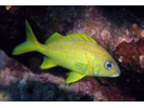
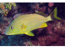
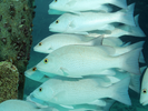
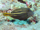
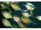
French Grunt - Grunt
(Haemulon flavolineatum)
(Haemulon flavolineatum)
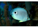
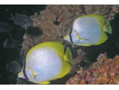
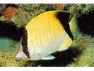
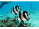
Foureye Butterflyfish - Butterflyfish
(Chaetodon capistratus)
(Chaetodon capistratus)
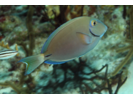
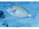
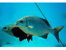
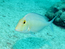
Ocean Surgeonfish - Surgeonfish
(Acanthurus tractus)
(Acanthurus tractus)
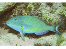
Stoplight Parrotfish - Parrotfish
(Sparisoma viride)
(Sparisoma viride)
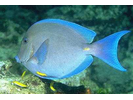
Blue Tang - Surgeonfish
(Acanthurus coeruleus)
(Acanthurus coeruleus)
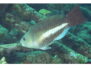
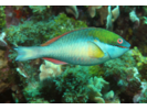
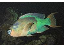
Queen Parrotfish - Parrotfish
(Scarus vetula)
(Scarus vetula)
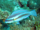
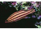
Striped Parrotfish - Parrotfish
(Scarus iseri)
(Scarus iseri)
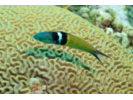
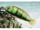
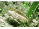
Bluehead - Wrasse
(Thalassoma bifasciatum)
(Thalassoma bifasciatum)
Sergeant Major - Damselfish
(Abudefduf saxatilis)
(Abudefduf saxatilis)
Doctorfish - Surgeonfish
(Acanthurus chirurgus)
(Acanthurus chirurgus)
Princess Parrotfish - Parrotfish
(Scarus taeniopterus)
(Scarus taeniopterus)
Puddingwife - Wrasse
(Halichoeres radiatus)
(Halichoeres radiatus)
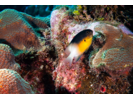
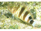
Barred Hamlet (Caribbean) - Seabass
(Hypoplectrus puella)
(Hypoplectrus puella)
Redband Parrotfish - Parrotfish
(Sparisoma aurofrenatum)
(Sparisoma aurofrenatum)
Slippery Dick - Wrasse
(Halichoeres bivittatus)
(Halichoeres bivittatus)
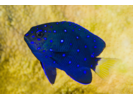
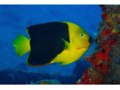
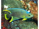
Blue Angelfish - Angelfish
(Holacanthus bermudensis)
(Holacanthus bermudensis)
Bluestriped Grunt - Grunt
(Haemulon sciurus)
(Haemulon sciurus)
Spotfin Butterflyfish - Butterflyfish
(Chaetodon ocellatus)
(Chaetodon ocellatus)
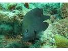
Bermuda Chub/Gray Chub - Chub
(Kyphosus sectatrix / K. bigibbus)
(Kyphosus sectatrix / K. bigibbus)
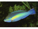
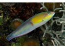
Yellowhead Wrasse - Wrasse
(Halichoeres garnoti)
(Halichoeres garnoti)
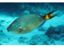
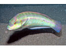
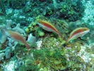
Spanish Hogfish - Wrasse
(Bodianus rufus)
(Bodianus rufus)
Bridled Goby Complex (Bridled/Sand-Canyon/Patch-Reef) - Goby
(C. glaucofraenum/C. venezuelae/C. tortugae)
(C. glaucofraenum/C. venezuelae/C. tortugae)
Clown Wrasse - Wrasse
(Halichoeres maculipinna)
(Halichoeres maculipinna)
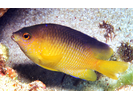
Cocoa Damselfish - Damselfish
(Stegastes xanthurus)
(Stegastes xanthurus)
Masked Goby/Glass Goby - Goby
(Coryphopterus personatus/hyalinus)
(Coryphopterus personatus/hyalinus)
Yellowtail Damselfish - Damselfish
(Microspathodon chrysurus)
(Microspathodon chrysurus)
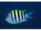
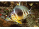
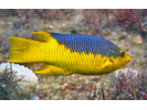
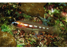
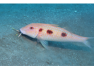
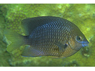
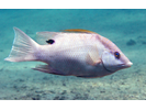
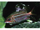
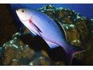
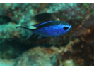
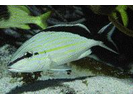
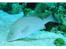
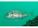
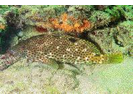
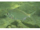
Bermuda Bream - Porgy
(Diplodus bermudensis)
(Diplodus bermudensis)
Spotted Goatfish - Goatfish
(Pseudupeneus maculatus)
(Pseudupeneus maculatus)
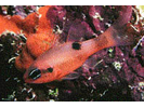
Coney - Seabass
(Cephalopholis fulva)
(Cephalopholis fulva)
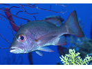
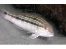
Gray Snapper - Snapper
(Lutjanus griseus)
(Lutjanus griseus)
Redtail Parrotfish - Parrotfish
(Sparisoma chrysopterum)
(Sparisoma chrysopterum)
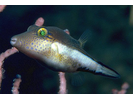
Sharpnose Puffer - Puffer
(Canthigaster rostrata)
(Canthigaster rostrata)
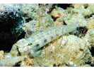
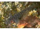
Sand Diver - Lizardfish
(Synodus intermedius)
(Synodus intermedius)

Beaugregory - Damselfish
(Stegastes leucostictus)
(Stegastes leucostictus)
Threespot Damselfish - Damselfish
(Stegastes planifrons)
(Stegastes planifrons)
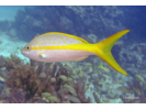
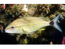
Yellowtail Snapper - Snapper
(Ocyurus chrysurus)
(Ocyurus chrysurus)
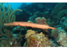
Trumpetfish - Trumpetfish
(Aulostomus maculatus)
(Aulostomus maculatus)
Blue Parrotfish - Parrotfish
(Scarus coeruleus)
(Scarus coeruleus)

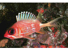
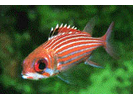
Longspine Squirrelfish - Squirrelfish
(Holocentrus rufus)
(Holocentrus rufus)
Saucereye Porgy - Porgy
(Calamus calamus)
(Calamus calamus)
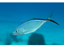
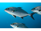
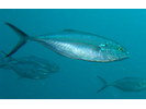
Bar Jack - Jack
(Caranx ruber)
(Caranx ruber)
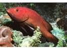
Red Hind - Seabass
(Epinephelus guttatus)
(Epinephelus guttatus)

Bandtail Puffer - Puffer
(Sphoeroides spengleri)
(Sphoeroides spengleri)
Bicolor Damselfish - Damselfish
(Stegastes partitus)
(Stegastes partitus)
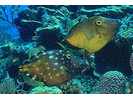
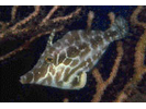
Orangespotted Filefish - Filefish
(Cantherhines pullus)
(Cantherhines pullus)
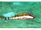
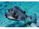
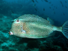
Smooth Trunkfish - Boxfish
(Lactophrys triqueter)
(Lactophrys triqueter)
Tomtate - Grunt
(Haemulon aurolineatum)
(Haemulon aurolineatum)
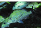
Graysby - Seabass
(Cephalopholis cruentata)
(Cephalopholis cruentata)

Reef Butterflyfish - Butterflyfish
(Chaetodon sedentarius)
(Chaetodon sedentarius)
Squirrelfish - Squirrelfish
(Holocentrus adscensionis)
(Holocentrus adscensionis)

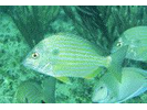
Lane Snapper - Snapper
(Lutjanus synagris)
(Lutjanus synagris)

Banded Butterflyfish - Butterflyfish
(Chaetodon striatus)
(Chaetodon striatus)
Greenblotch Parrotfish - Parrotfish
(Sparisoma atomarium)
(Sparisoma atomarium)
Rainbow Parrotfish - Parrotfish
(Scarus guacamaia)
(Scarus guacamaia)
Caesar Grunt - Grunt
(Haemulon carbonarium)
(Haemulon carbonarium)
Creole Wrasse - Wrasse
(Bodianus parrae)
(Bodianus parrae)

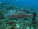
Black Grouper - Seabass
(Mycteroperca bonaci)
(Mycteroperca bonaci)
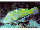
Hogfish - Wrasse
(Lachnolaimus maximus)
(Lachnolaimus maximus)
Greater Soapfish - Soapfishes
(Rypticus saponaceus)
(Rypticus saponaceus)
Goldspot Goby - Goby
(Gnatholepis thompsoni)
(Gnatholepis thompsoni)
Green Razorfish - Wrasse
(Xyrichtys splendens)
(Xyrichtys splendens)
Juvenile Grunt - Grunt
(Haemulon sp.)
(Haemulon sp.)
Seaweed Blenny - Blenny - Combtooth
(Parablennius marmoreus)
(Parablennius marmoreus)
Yellow Goatfish - Goatfish
(Mulloidichthys martinicus)
(Mulloidichthys martinicus)

Rock Beauty - Angelfish
(Holacanthus tricolor)
(Holacanthus tricolor)
Yellowtail (Redfin) Parrotfish - Parrotfish
(Sparisoma rubripinne)
(Sparisoma rubripinne)
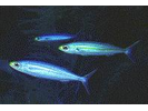
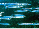
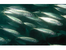
Unidentified Silvery Fish (Silversides / Anchovies / Herrings) - Silvery Fishes - Silversides, Herrings, and Anchovies
(Atheriniformes sp./ Clupeiformes sp.)
(Atheriniformes sp./ Clupeiformes sp.)

Bucktooth Parrotfish - Parrotfish
(Sparisoma radians)
(Sparisoma radians)
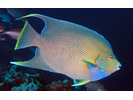
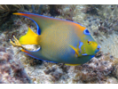
Queen Angelfish - Angelfish
(Holacanthus ciliaris)
(Holacanthus ciliaris)
Rosy Razorfish - Wrasse
(Xyrichtys martinicensis)
(Xyrichtys martinicensis)
Sand Tilefish - Tilefish
(Malacanthus plumieri)
(Malacanthus plumieri)

Townsend Angelfish (Hybrid Queen/Blue) - Angelfish
(Holacanthus sp. (Hybrid))
(Holacanthus sp. (Hybrid))
Whitespotted Filefish - Filefish
(Cantherhines macrocerus)
(Cantherhines macrocerus)
Dusky Squirrelfish - Squirrelfish
(Sargocentron vexillarium)
(Sargocentron vexillarium)
Midnight Parrotfish - Parrotfish
(Scarus coelestinus)
(Scarus coelestinus)
Slender Filefish - Filefish
(Monacanthus tuckeri)
(Monacanthus tuckeri)
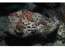
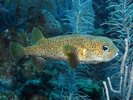
Balloonfish - Porcupinefish
(Diodon holocanthus)
(Diodon holocanthus)
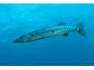
Great Barracuda - Barracuda
(Sphyraena barracuda)
(Sphyraena barracuda)
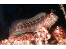
Bermuda Halfbeak - Halfbeak
(Hemiramphus bermudensis)
(Hemiramphus bermudensis)
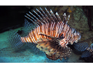
Red Lionfish (exotic) - Scorpionfish
(Pterois volitans)
(Pterois volitans)
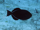
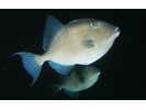
Black Durgon - Triggerfish
(Melichthys niger)
(Melichthys niger)
Creolefish (Atlantic) - Seabass
(Paranthias furcifer)
(Paranthias furcifer)
Glassy Sweeper - Sweeper
(Pempheris schomburgkii)
(Pempheris schomburgkii)
Honeycomb Cowfish - Boxfish
(Acanthostracion polygonius)
(Acanthostracion polygonius)
Reef Squirrelfish - Squirrelfish
(Holocentrus coruscus)
(Holocentrus coruscus)
Blue Chromis - Damselfish
(Azurina cyanea)
(Azurina cyanea)
Boga - Grunt
(Haemulon vittatum)
(Haemulon vittatum)
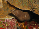
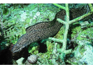
Goldentail Moray - Moray
(Gymnothorax miliaris)
(Gymnothorax miliaris)
Hairy Blenny Complex - Blenny - Labrisomids
(Labrisomus nuchipinnis/L. conditus/L.cricota)
(Labrisomus nuchipinnis/L. conditus/L.cricota)
Almaco Jack - Jack
(Seriola rivoliana)
(Seriola rivoliana)
Cottonwick - Grunt
(Haemulon melanurum)
(Haemulon melanurum)
Dusky Damselfish - Damselfish
(Stegastes adustus)
(Stegastes adustus)
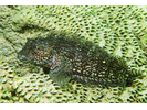
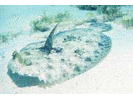
Peacock Flounder - Flounder
(Bothus lunatus)
(Bothus lunatus)
Pearl Blenny - Blenny - Combtooth
(Entomacrodus nigricans)
(Entomacrodus nigricans)
Porcupinefish - Porcupinefish
(Diodon hystrix)
(Diodon hystrix)
Brown Garden Eel - Conger
(Heteroconger longissimus)
(Heteroconger longissimus)

Eyed Flounder - Flounder
(Bothus ocellatus)
(Bothus ocellatus)
Gray Triggerfish - Triggerfish
(Balistes capriscus)
(Balistes capriscus)
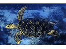
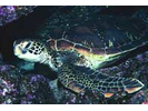
Hawksbill Sea Turtle - Sea Turtles
(Eretmochelys imbricata)
(Eretmochelys imbricata)
Horse-eye Jack - Jack
(Caranx latus)
(Caranx latus)

Mottled Mojarra - Mojarra
(Eucinostomus lefroyi)
(Eucinostomus lefroyi)
Northern / Southern Sennet - Barracuda
(Sphyraena borealis/picudilla)
(Sphyraena borealis/picudilla)
Peppermint Basslet - Basslet / Seabass
(Liopropoma rubre)
(Liopropoma rubre)
Redspotted Hawkfish - Hawkfish
(Amblycirrhitus pinos)
(Amblycirrhitus pinos)
Sharksucker - Remora
(Echeneis naucrates)
(Echeneis naucrates)
Tiger Goby - Goby
(Gobiosoma macrodon)
(Gobiosoma macrodon)
White Margate - Grunt
(Haemulon album)
(Haemulon album)
Blue Runner - Jack
(Caranx crysos)
(Caranx crysos)
Cubbyu - Drum
(Pareques umbrosus)
(Pareques umbrosus)

Flamefish - Cardinalfish
(Apogon maculatus)
(Apogon maculatus)
Fringed Filefish - Filefish
(Monacanthus ciliatus)
(Monacanthus ciliatus)
Green Sea Turtle - Sea Turtles
(Chelonia mydas)
(Chelonia mydas)
Keeltail Needlefish - Needlefish
(Platybelone argalus argalus)
(Platybelone argalus argalus)
Mahogany Snapper - Snapper
(Lutjanus mahogoni)
(Lutjanus mahogoni)
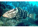
Nassau Grouper - Seabass
(Epinephelus striatus)
(Epinephelus striatus)
Ocean Triggerfish - Triggerfish
(Canthidermis sufflamen)
(Canthidermis sufflamen)
Orangespotted Goby - Goby
(Nes longus)
(Nes longus)
Pigfish - Grunt
(Orthopristis chrysoptera)
(Orthopristis chrysoptera)

Pinfish - Porgy
(Lagodon rhomboides)
(Lagodon rhomboides)
Rock Hind - Seabass
(Epinephelus adscensionis)
(Epinephelus adscensionis)
Round Scad - Jack
(Decapterus punctatus)
(Decapterus punctatus)
Sand Perch - Seabass
(Diplectrum formosum)
(Diplectrum formosum)
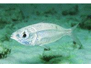
Sea Bream - Porgy
(Archosargus rhomboidalis)
(Archosargus rhomboidalis)
Silver Jenny - Mojarra
(Eucinostomus gula)
(Eucinostomus gula)
Snowy Grouper - Seabass
(Hyporthodus niveatus)
(Hyporthodus niveatus)
Spotted Moray - Moray
(Gymnothorax moringa)
(Gymnothorax moringa)
Unidentified Lizardfish - Lizardfish
(Synodus sp.)
(Synodus sp.)
White Trevally - Jack
(Pseudocaranx dentex)
(Pseudocaranx dentex)
Whitefin Sharksucker - Remora
(Echeneis neucratoides)
(Echeneis neucratoides)