Region: TWA
All
Survey Types: Species & Abundance, Species Only
Dates: 1/1/93 - 6/19/26
Total Surveys: 5
#Species Reported: 11
Average Species Reported on a Survey by Expert Surveyors: 4.20
Average Species Reported on a Survey by Novice Surveyors: 0
Survey Type: SA = Species & Abundance; SO = Species Only - How to interpret REEF data?
Click a column header to sort by that column. Hold shift and click to sort by multiple columns
| Surveys | Bottom Time | |||||
|---|---|---|---|---|---|---|
| Expert | Novice | |||||
| Code | Name | SA | SO | SA | SO | (H:M) |
| 2 | GULF OF MEXICO (Cape Sable to Yucatan Cabo Catoche | 5 | 0 | 0 | 0 | 5:41 |
| 22 | NORTH EAST (Tampa Bay to Cape San Blas) | 5 | 0 | 0 | 0 | 5:41 |
| 2204 | Hillsborough County | 5 | 0 | 0 | 0 | 5:41 |
| 22040001 | Ballast Point Park Pier | 2 | 0 | 0 | 0 | 2:34 |
| 22040002 | Seaplane Basin Pier | 1 | 0 | 0 | 0 | 1:00 |
| 22040003 | Seddon Channel | 2 | 0 | 0 | 0 | 2:07 |
| TOTALS | 5 | 0 | 0 | 0 | 5:41 | |
Species
%SF = Sighting Frequency; DEN = Density Score - How to interpret REEF data?
Bar length corresponds to sighting frequency
Color saturation corresponds to density score
Click + to display species image and additional information.
Bar length corresponds to sighting frequency
Color saturation corresponds to density score
Click + to display species image and additional information.
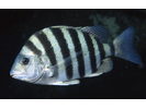
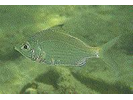
Sheepshead - Porgy
(Archosargus probatocephalus)
(Archosargus probatocephalus)
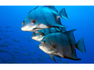
Atlantic Spadefish - Spadefish
(Chaetodipterus faber)
(Chaetodipterus faber)
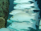
Gray Snapper - Snapper
(Lutjanus griseus)
(Lutjanus griseus)
Silver Jenny - Mojarra
(Eucinostomus gula)
(Eucinostomus gula)
Unidentified Silvery Fish (Silversides / Anchovies / Herrings) - Silvery Fishes - Silversides, Herrings, and Anchovies
(Atheriniformes sp./ Clupeiformes sp.)
(Atheriniformes sp./ Clupeiformes sp.)

Atlantic Oyster Blenny - Blenny - Combtooth
(Hypleurochilus pseudoaequipinnis)
(Hypleurochilus pseudoaequipinnis)
Common Snook - Snook
(Centropomus undecimalis)
(Centropomus undecimalis)
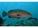
Gag - Seabass
(Mycteroperca microlepis)
(Mycteroperca microlepis)
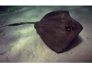
Southern Stingray - Stingray
(Hypanus americanus)
(Hypanus americanus)
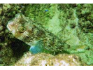
Striped Burrfish - Porcupinefish
(Chilomycterus schoepfii)
(Chilomycterus schoepfii)
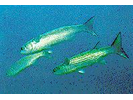
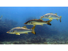
Striped Mullet - Mullet
(Mugil cephalus)
(Mugil cephalus)