Region: TWA
All
Survey Types: Species & Abundance, Species Only
Dates: 1/1/93 - 5/26/26
Total Surveys: 8
#Species Reported: 80
Average Species Reported on a Survey by Expert Surveyors: 0
Average Species Reported on a Survey by Novice Surveyors: 39.62
Survey Type: SA = Species & Abundance; SO = Species Only - How to interpret REEF data?
Click a column header to sort by that column. Hold shift and click to sort by multiple columns
| Surveys | Bottom Time | |||||
|---|---|---|---|---|---|---|
| Expert | Novice | |||||
| Code | Name | SA | SO | SA | SO | (H:M) |
| 4 | BAHAMAS, TURKS & CAICOS | 0 | 0 | 8 | 0 | 7:31 |
| 43 | SOUTH BAHAMAS (S of Crooked Is. Pass) | 0 | 0 | 8 | 0 | 7:31 |
| 4306 | Great Inagua Island | 0 | 0 | 8 | 0 | 7:31 |
| 43060029 | Loggerhead Point | 0 | 0 | 8 | 0 | 7:31 |
| TOTALS | 0 | 0 | 8 | 0 | 7:31 | |
Species
%SF = Sighting Frequency; DEN = Density Score - How to interpret REEF data?
Bar length corresponds to sighting frequency
Color saturation corresponds to density score
Click + to display species image and additional information.
Bar length corresponds to sighting frequency
Color saturation corresponds to density score
Click + to display species image and additional information.
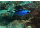
Blue Chromis - Damselfish
(Azurina cyanea)
(Azurina cyanea)
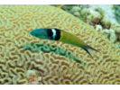
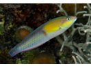
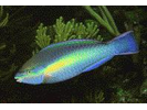
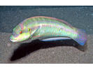
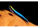
Bluehead - Wrasse
(Thalassoma bifasciatum)
(Thalassoma bifasciatum)
Coney - Seabass
(Cephalopholis fulva)
(Cephalopholis fulva)
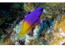
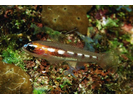
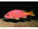
Fairy Basslet - Basslet
(Gramma loreto)
(Gramma loreto)
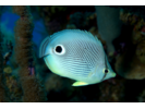
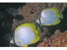
Foureye Butterflyfish - Butterflyfish
(Chaetodon capistratus)
(Chaetodon capistratus)
Longsnout Butterflyfish - Butterflyfish
(Chaetodon aculeatus)
(Chaetodon aculeatus)

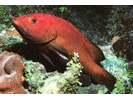
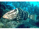
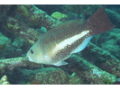
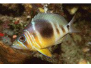
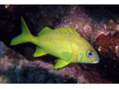
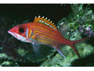
Nassau Grouper - Seabass
(Epinephelus striatus)
(Epinephelus striatus)
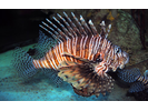
Red Lionfish (exotic) - Scorpionfish
(Pterois volitans)
(Pterois volitans)
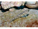
Sand Tilefish - Tilefish
(Malacanthus plumieri)
(Malacanthus plumieri)

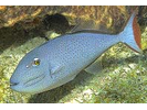
Sargassum Triggerfish - Triggerfish
(Xanthichthys ringens)
(Xanthichthys ringens)
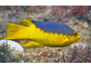
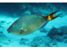
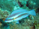
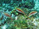
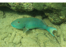
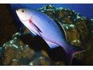
Spanish Hogfish - Wrasse
(Bodianus rufus)
(Bodianus rufus)
Spotfin Butterflyfish - Butterflyfish
(Chaetodon ocellatus)
(Chaetodon ocellatus)
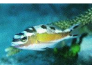
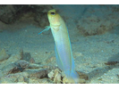
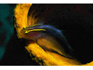
Yellowhead Jawfish - Jawfish
(Opistognathus aurifrons)
(Opistognathus aurifrons)
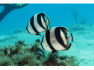
Banded Butterflyfish - Butterflyfish
(Chaetodon striatus)
(Chaetodon striatus)
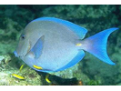
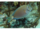
Blue Tang - Surgeonfish
(Acanthurus coeruleus)
(Acanthurus coeruleus)
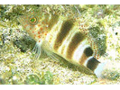
Harlequin Bass - Seabass
(Serranus tigrinus)
(Serranus tigrinus)
Stoplight Parrotfish - Parrotfish
(Sparisoma viride)
(Sparisoma viride)
Yellowhead Wrasse - Wrasse
(Halichoeres garnoti)
(Halichoeres garnoti)
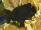
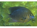
Bicolor Damselfish - Damselfish
(Stegastes partitus)
(Stegastes partitus)
Creole Wrasse - Wrasse
(Bodianus parrae)
(Bodianus parrae)

Longspine Squirrelfish - Squirrelfish
(Holocentrus rufus)
(Holocentrus rufus)
Redband Parrotfish - Parrotfish
(Sparisoma aurofrenatum)
(Sparisoma aurofrenatum)
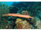
Trumpetfish - Trumpetfish
(Aulostomus maculatus)
(Aulostomus maculatus)
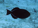
Black Durgon - Triggerfish
(Melichthys niger)
(Melichthys niger)
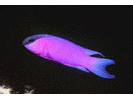
Blackcap Basslet - Basslet
(Gramma melacara)
(Gramma melacara)
Doctorfish - Surgeonfish
(Acanthurus chirurgus)
(Acanthurus chirurgus)
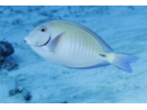
Ocean Surgeonfish - Surgeonfish
(Acanthurus tractus)
(Acanthurus tractus)
Princess Parrotfish - Parrotfish
(Scarus taeniopterus)
(Scarus taeniopterus)
Queen Parrotfish - Parrotfish
(Scarus vetula)
(Scarus vetula)
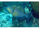
Queen Triggerfish - Triggerfish
(Balistes vetula)
(Balistes vetula)
Red Hind - Seabass
(Epinephelus guttatus)
(Epinephelus guttatus)

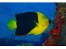
Rock Beauty - Angelfish
(Holacanthus tricolor)
(Holacanthus tricolor)
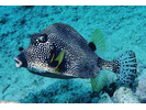
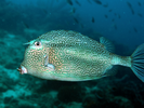
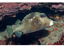
Smooth Trunkfish - Boxfish
(Lactophrys triqueter)
(Lactophrys triqueter)
Spotted Goatfish - Goatfish
(Pseudupeneus maculatus)
(Pseudupeneus maculatus)
Striped Parrotfish - Parrotfish
(Scarus iseri)
(Scarus iseri)
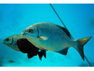
Bermuda Chub/Gray Chub - Chub
(Kyphosus sectatrix / K. bigibbus)
(Kyphosus sectatrix / K. bigibbus)
Bridled Goby Complex (Bridled/Sand-Canyon/Patch-Reef) - Goby
(C. glaucofraenum/C. venezuelae/C. tortugae)
(C. glaucofraenum/C. venezuelae/C. tortugae)
Honeycomb Cowfish - Boxfish
(Acanthostracion polygonius)
(Acanthostracion polygonius)
Longfin Damselfish - Damselfish
(Stegastes diencaeus)
(Stegastes diencaeus)
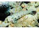
Goldspot Goby - Goby
(Gnatholepis thompsoni)
(Gnatholepis thompsoni)
Greenblotch Parrotfish - Parrotfish
(Sparisoma atomarium)
(Sparisoma atomarium)
Ocean Triggerfish - Triggerfish
(Canthidermis sufflamen)
(Canthidermis sufflamen)
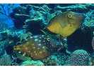
Scrawled Filefish - Filefish
(Aluterus scriptus)
(Aluterus scriptus)
Slippery Dick - Wrasse
(Halichoeres bivittatus)
(Halichoeres bivittatus)
Spotted Trunkfish - Boxfish
(Lactophrys bicaudalis)
(Lactophrys bicaudalis)
Whitespotted Filefish - Filefish
(Cantherhines macrocerus)
(Cantherhines macrocerus)
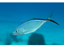
Bar Jack - Jack
(Caranx ruber)
(Caranx ruber)
Barred Hamlet (Caribbean) - Seabass
(Hypoplectrus puella)
(Hypoplectrus puella)
Black Jack - Jack
(Caranx lugubris)
(Caranx lugubris)
Black Margate - Grunt
(Anisotremus surinamensis)
(Anisotremus surinamensis)

Cero - Mackerel
(Scomberomorus regalis)
(Scomberomorus regalis)
Greater Soapfish - Soapfishes
(Rypticus saponaceus)
(Rypticus saponaceus)
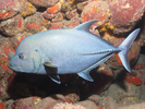
Horse-eye Jack - Jack
(Caranx latus)
(Caranx latus)

Masked Goby/Glass Goby - Goby
(Coryphopterus personatus/hyalinus)
(Coryphopterus personatus/hyalinus)
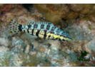
Redspotted Hawkfish - Hawkfish
(Amblycirrhitus pinos)
(Amblycirrhitus pinos)
Redtail Parrotfish - Parrotfish
(Sparisoma chrysopterum)
(Sparisoma chrysopterum)
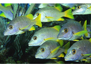
Schoolmaster - Snapper
(Lutjanus apodus)
(Lutjanus apodus)
Shortstripe Goby - Goby
(Elacatinus chancei)
(Elacatinus chancei)
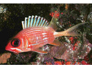
Squirrelfish - Squirrelfish
(Holocentrus adscensionis)
(Holocentrus adscensionis)

Sunshinefish - Damselfish
(Chromis insolata)
(Chromis insolata)

Threespot Damselfish - Damselfish
(Stegastes planifrons)
(Stegastes planifrons)
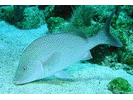
White Margate - Grunt
(Haemulon album)
(Haemulon album)
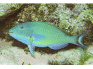
Yellowtail (Redfin) Parrotfish - Parrotfish
(Sparisoma rubripinne)
(Sparisoma rubripinne)
Blackfin Snapper - Snapper
(Lutjanus buccanella)
(Lutjanus buccanella)
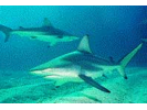
Blacktip Shark - Requiem Shark
(Carcharhinus limbatus)
(Carcharhinus limbatus)
Brown Chromis - Damselfish
(Azurina multilineata)
(Azurina multilineata)
Clown Wrasse - Wrasse
(Halichoeres maculipinna)
(Halichoeres maculipinna)
Colon Goby - Goby
(Coryphopterus dicrus)
(Coryphopterus dicrus)
Creolefish (Atlantic) - Seabass
(Paranthias furcifer)
(Paranthias furcifer)
Dusky Damselfish - Damselfish
(Stegastes adustus)
(Stegastes adustus)
French Grunt - Grunt
(Haemulon flavolineatum)
(Haemulon flavolineatum)
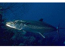
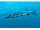
Great Barracuda - Barracuda
(Sphyraena barracuda)
(Sphyraena barracuda)
Longjaw Squirrelfish - Squirrelfish
(Neoniphon marianus)
(Neoniphon marianus)
Peppermint Goby - Goby
(Coryphopterus lipernes)
(Coryphopterus lipernes)
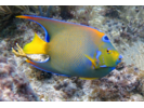
Queen Angelfish - Angelfish
(Holacanthus ciliaris)
(Holacanthus ciliaris)
Scrawled Cowfish - Boxfish
(Acanthostracion quadricornis)
(Acanthostracion quadricornis)

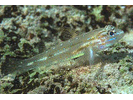
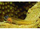
Sharknose Goby - Goby
(Elacatinus evelynae)
(Elacatinus evelynae)
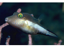
Sharpnose Puffer - Puffer
(Canthigaster rostrata)
(Canthigaster rostrata)
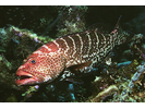
Tiger Grouper - Seabass
(Mycteroperca tigris)
(Mycteroperca tigris)
Tobaccofish - Seabass
(Serranus tabacarius)
(Serranus tabacarius)