Region: TWA
All
Survey Types: Species & Abundance, Species Only
Dates: 1/1/93 - 4/18/26
Total Surveys: 10209
#Species Reported: 503
Average Species Reported on a Survey by Expert Surveyors: 57.77
Average Species Reported on a Survey by Novice Surveyors: 38.48
Survey Type: SA = Species & Abundance; SO = Species Only - How to interpret REEF data?
Click a column header to sort by that column. Hold shift and click to sort by multiple columns
| Surveys | Bottom Time | |||||
|---|---|---|---|---|---|---|
| Expert | Novice | |||||
| Code | Name | SA | SO | SA | SO | (H:M) |
| 6 | GREATER ANTILLES & VIRGIN ISLANDS | 3957 | 41 | 5814 | 397 | 10177:10 |
| 61 | Haiti | 36 | 0 | 9 | 0 | 44:20 |
| 6101 | North (Cap a Foux to Manzanillo Bay) | 36 | 0 | 7 | 0 | 41:39 |
| 61010001 | Cormier Reef | 0 | 0 | 2 | 0 | 1:42 |
| 61010002 | Caracol Wall | 0 | 0 | 1 | 0 | 0:55 |
| 61010003 | Caracol Pass | 0 | 0 | 1 | 0 | 1:03 |
| 61010004 | Roc Sauvage | 0 | 0 | 1 | 0 | 0:39 |
| 61010005 | De Esse | 0 | 0 | 1 | 0 | 0:52 |
| 61010006 | Barefoot Beach Club (Labadee) | 1 | 0 | 1 | 0 | 2:00 |
| 61010007 | Beach under Zip Line Area, Labadee | 1 | 0 | 0 | 0 | 1:25 |
| 61010008 | Nellie's Beach, Labadee | 2 | 0 | 0 | 0 | 2:05 |
| 61010009 | CAR-02 | 1 | 0 | 0 | 0 | 0:46 |
| 61010010 | CAR-03 | 1 | 0 | 0 | 0 | 0:30 |
| 61010011 | CAR-05 | 1 | 0 | 0 | 0 | 0:30 |
| 61010012 | CAR-06 | 1 | 0 | 0 | 0 | 0:30 |
| 61010013 | CAR-07 | 1 | 0 | 0 | 0 | 0:34 |
| 61010014 | CAR-08 | 1 | 0 | 0 | 0 | 0:30 |
| 61010015 | CAR-16 | 1 | 0 | 0 | 0 | 0:35 |
| 61010016 | CAR-17 | 1 | 0 | 0 | 0 | 0:46 |
| 61010017 | CAR-18 | 1 | 0 | 0 | 0 | 0:36 |
| 61010018 | CAR-23 | 1 | 0 | 0 | 0 | 0:30 |
| 61010019 | CAR-25 | 1 | 0 | 0 | 0 | 1:10 |
| 61010020 | CAR-28 | 1 | 0 | 0 | 0 | 1:04 |
| 61010021 | FL-10 | 1 | 0 | 0 | 0 | 0:34 |
| 61010022 | FL-11 | 3 | 0 | 0 | 0 | 2:49 |
| 61010023 | FL-12 | 1 | 0 | 0 | 0 | 0:51 |
| 61010024 | FL-13 | 1 | 0 | 0 | 0 | 0:45 |
| 61010025 | FL-14 | 1 | 0 | 0 | 0 | 0:58 |
| 61010026 | FL-15 | 1 | 0 | 0 | 0 | 1:03 |
| 61010027 | PN3B-10 | 1 | 0 | 0 | 0 | 1:21 |
| 61010028 | BN3B-11 | 1 | 0 | 0 | 0 | 1:21 |
| 61010029 | PN3B-12 | 1 | 0 | 0 | 0 | 1:23 |
| 61010030 | PN3B-13 | 1 | 0 | 0 | 0 | 1:33 |
| 61010031 | PN3B-16 | 1 | 0 | 0 | 0 | 1:28 |
| 61010032 | PN3B-18 | 1 | 0 | 0 | 0 | 1:07 |
| 61010033 | PN3B-19 | 1 | 0 | 0 | 0 | 1:16 |
| 61010034 | PN3B-20 | 1 | 0 | 0 | 0 | 1:15 |
| 61010035 | PN3B-22 | 1 | 0 | 0 | 0 | 1:16 |
| 61010036 | PN3B-27 | 1 | 0 | 0 | 0 | 1:10 |
| 61010037 | PN3B-28 | 1 | 0 | 0 | 0 | 1:13 |
| 61010038 | PN3B-30 | 1 | 0 | 0 | 0 | 1:34 |
| 62 | Dominican Republic | 203 | 1 | 433 | 9 | 576:27 |
| 6201 | North (Manzanillo Bay to Cabo Engano) | 26 | 0 | 70 | 0 | 84:48 |
| 62010001 | Canyon (Sosua) | 4 | 0 | 10 | 0 | 13:42 |
| 62010002 | Three Rocks (Sosua) | 2 | 0 | 6 | 0 | 7:36 |
| 62010003 | Five Rocks (Sosua) | 2 | 0 | 5 | 0 | 6:15 |
| 62010004 | Paradise I and II (Sosua) | 2 | 0 | 8 | 0 | 7:31 |
| 62010005 | Mini Wall (Sosua) | 2 | 0 | 7 | 0 | 6:46 |
| 62010006 | Coral Gardens (Sosua) | 2 | 0 | 5 | 0 | 5:29 |
| 62010007 | Airport Wall (Sosua) | 2 | 0 | 4 | 0 | 5:03 |
| 62010008 | West Wall (Sosua) | 2 | 0 | 5 | 0 | 6:28 |
| 62010009 | Pyramids (Sosua) | 2 | 0 | 5 | 0 | 6:22 |
| 62010010 | Tres Palmas (Sosua) | 2 | 0 | 5 | 0 | 6:18 |
| 62010011 | La Pesina (Rio San Juan) | 2 | 0 | 2 | 0 | 4:25 |
| 62010012 | Cayo Levantado North Side | 1 | 0 | 0 | 0 | 1:13 |
| 62010013 | Cayo Levantado South Side | 1 | 0 | 0 | 0 | 1:00 |
| 62010014 | Playa Bonita Northeast Point | 0 | 0 | 1 | 0 | 0:30 |
| 62010016 | Punta Francisco Pancho West (Shoreline) | 0 | 0 | 1 | 0 | 0:35 |
| 62010017 | Eden Beach Bar (Shoreline) | 0 | 0 | 1 | 0 | 0:10 |
| 62010018 | Playa Las Terrenas (Small Patch Reef West of Cemetery) | 0 | 0 | 1 | 0 | 1:10 |
| 62010020 | Punta de Los Muertos (Las Terrenas Fish Market) Nearshore Reef | 0 | 0 | 1 | 0 | 1:15 |
| 62010024 | East End of Punta Popy Cove | 0 | 0 | 1 | 0 | 1:47 |
| 62010026 | Patch Reef West of Balcones del Atlantico | 0 | 0 | 1 | 0 | 0:43 |
| 62010028 | La Playita (Las Galeras) | 0 | 0 | 1 | 0 | 0:30 |
| 6202 | South (Cabo Engano to Pedernales not incl P/Este a | 40 | 1 | 89 | 3 | 124:35 |
| 62020001 | Isla Catalina Canyon | 1 | 0 | 14 | 0 | 11:07 |
| 62020002 | Catalina Wall / Pared de Catalina | 11 | 0 | 16 | 1 | 27:27 |
| 62020003 | Isla Catalina Punta Cana | 0 | 0 | 9 | 0 | 10:15 |
| 62020004 | Coral Garden (Punta Cana Reef) | 2 | 0 | 7 | 0 | 7:10 |
| 62020005 | La Pescera (Punta Cana Reef) | 0 | 0 | 7 | 0 | 5:45 |
| 62020006 | La Marina (Punta Cana Reef) | 0 | 0 | 3 | 0 | 2:34 |
| 62020007 | La Tortuga (Punta Cana Reef) | 0 | 0 | 3 | 0 | 2:26 |
| 62020008 | Entrada de Las Cuevas (Punta Cana Reef) | 3 | 0 | 4 | 0 | 5:41 |
| 62020009 | Acquaria (Aquarium, Catalina Island) | 9 | 0 | 4 | 0 | 11:45 |
| 62020010 | Paradise Reef | 2 | 0 | 1 | 0 | 2:15 |
| 62020011 | Rondana | 5 | 0 | 2 | 0 | 5:25 |
| 62020012 | Channel Caves | 1 | 0 | 0 | 0 | 0:37 |
| 62020013 | Panocha Reef | 1 | 0 | 0 | 0 | 0:46 |
| 62020014 | Coral Caves | 1 | 0 | 0 | 0 | 0:46 |
| 62020015 | Astron Wreck | 3 | 0 | 3 | 0 | 4:51 |
| 62020016 | Pork Reef | 0 | 0 | 1 | 0 | 0:49 |
| 62020017 | Cuevitas | 0 | 0 | 1 | 0 | 0:50 |
| 62020018 | Barracuda | 0 | 0 | 1 | 0 | 0:21 |
| 62020019 | Stingray Point | 1 | 0 | 2 | 0 | 2:39 |
| 62020020 | Coral Garden 1 (Dominican Republic) | 0 | 0 | 1 | 0 | 0:42 |
| 62020021 | Coral Garden 2 (Dominican Republic) | 0 | 0 | 1 | 0 | 0:43 |
| 62020023 | Reef Explorer Snorkeling Platform | 0 | 0 | 1 | 0 | 2:00 |
| 62020024 | El Abanico (near Bahia de Las Calderas) | 0 | 0 | 5 | 0 | 10:30 |
| 62020025 | Cabo Rojo | 0 | 0 | 1 | 0 | 2:00 |
| 62020027 | Playa Punta Salinas | 0 | 0 | 1 | 0 | 1:00 |
| 62020028 | Playa Juan Dolio Beach | 0 | 1 | 0 | 0 | 1:00 |
| 62020030 | Potato / Patato (Punta Cana) | 0 | 0 | 1 | 0 | 0:51 |
| 6203 | Cotubanama and Parque Nacional del Este (incl Los Melones and Dominicus) | 92 | 0 | 272 | 5 | 328:23 |
| 62030001 | El Penon | 8 | 0 | 21 | 1 | 27:02 |
| 62030002 | Arrecife los Cocos | 15 | 0 | 7 | 1 | 22:46 |
| 62030003 | Acantilado del Catuano | 3 | 0 | 1 | 0 | 5:20 |
| 62030004 | Arrecife de Ruben | 5 | 0 | 19 | 0 | 17:26 |
| 62030005 | Puerto Catuano | 4 | 0 | 1 | 0 | 6:15 |
| 62030006 | El Toro | 4 | 0 | 14 | 0 | 15:40 |
| 62030007 | El Faro I | 2 | 0 | 2 | 0 | 3:40 |
| 62030008 | El Faro II | 3 | 0 | 4 | 0 | 6:28 |
| 62030009 | Dominicus / Playa Dominicus | 3 | 0 | 31 | 0 | 26:43 |
| 62030010 | Please use site in 6202 area (was Catalina) | 2 | 0 | 3 | 0 | 4:22 |
| 62030011 | Please use 62020002 (was Pared de Catalina) | 2 | 0 | 2 | 0 | 3:08 |
| 62030012 | Arrecife de la Raya | 0 | 0 | 21 | 0 | 15:56 |
| 62030013 | Acuario 1 | 1 | 0 | 17 | 0 | 17:33 |
| 62030014 | Acuario 2 | 1 | 0 | 14 | 0 | 15:20 |
| 62030015 | Acuario 3 | 1 | 0 | 16 | 0 | 15:48 |
| 62030016 | Acuario Middle | 1 | 0 | 13 | 0 | 11:10 |
| 62030017 | Coca Wreck | 3 | 0 | 16 | 0 | 15:34 |
| 62030018 | Pargo | 1 | 0 | 15 | 0 | 12:23 |
| 62030019 | Dominica Nite | 2 | 0 | 21 | 0 | 22:34 |
| 62030020 | Saona Channel | 1 | 0 | 12 | 1 | 10:29 |
| 62030021 | Pepe's Reef | 0 | 0 | 2 | 0 | 1:45 |
| 62030022 | El Penon 2 | 2 | 0 | 0 | 0 | 1:58 |
| 62030023 | Guaraguao | 2 | 0 | 4 | 0 | 5:48 |
| 62030024 | La Parguera | 1 | 0 | 0 | 0 | 0:39 |
| 62030025 | St. George Wreck | 3 | 0 | 2 | 0 | 3:22 |
| 62030026 | Champagne Reef | 0 | 0 | 0 | 1 | 1:00 |
| 62030027 | Bayahibe (Ollos de Maria) | 0 | 0 | 1 | 0 | 1:03 |
| 62030028 | Guadalupe Underwater Archeological Reserve | 0 | 0 | 1 | 0 | 0:49 |
| 62030029 | Morales (Guaraguoa Reef) | 0 | 0 | 1 | 1 | 1:44 |
| 62030030 | Pinki Reef | 1 | 0 | 0 | 0 | 0:52 |
| 62030031 | Tortuga | 1 | 0 | 2 | 0 | 3:01 |
| 62030032 | Mama Reef | 1 | 0 | 0 | 0 | 1:05 |
| 62030033 | Penon 3 | 1 | 0 | 0 | 0 | 1:07 |
| 62030034 | Guaraguao Deep | 1 | 0 | 0 | 0 | 0:50 |
| 62030035 | Playa Magallanes | 0 | 0 | 2 | 0 | 3:30 |
| 62030036 | Atlantic Princess Wreck | 3 | 0 | 3 | 0 | 5:32 |
| 62030037 | Victoria Reef | 2 | 0 | 0 | 0 | 2:09 |
| 62030038 | Viva Wyndham Dominicus Beach Resort | 2 | 0 | 0 | 0 | 1:55 |
| 62030040 | Viva Wyndham Dominicus Palace Resort / House Reef / Ancora | 3 | 0 | 0 | 0 | 3:41 |
| 62030043 | El Bajon / Pinnacle | 2 | 0 | 0 | 0 | 2:05 |
| 62030044 | Cotubanama National Park I | 3 | 0 | 0 | 0 | 2:51 |
| 62030045 | Cotubanama National Park II | 2 | 0 | 0 | 0 | 2:00 |
| 6204 | La Caleta Submarine Park | 17 | 0 | 2 | 0 | 15:06 |
| 62040001 | Bajos de Afuera | 3 | 0 | 0 | 0 | 2:06 |
| 62040002 | El Peaje | 3 | 0 | 0 | 0 | 2:43 |
| 62040003 | Punta Picua | 3 | 0 | 0 | 0 | 2:35 |
| 62040004 | La Bomba | 2 | 0 | 0 | 0 | 1:46 |
| 62040005 | Hickory Wreck | 2 | 0 | 2 | 0 | 2:39 |
| 62040006 | Los Pargos | 2 | 0 | 0 | 0 | 1:36 |
| 62040007 | Las Golondrinas | 2 | 0 | 0 | 0 | 1:41 |
| 6205 | Monte Cristi | 28 | 0 | 0 | 0 | 18:05 |
| 62050001 | AIB1 | 1 | 0 | 0 | 0 | 0:23 |
| 62050002 | AIB2 | 1 | 0 | 0 | 0 | 0:30 |
| 62050003 | AIB7 | 1 | 0 | 0 | 0 | 0:35 |
| 62050004 | AIIBI | 1 | 0 | 0 | 0 | 0:30 |
| 62050005 | AIIB5 | 1 | 0 | 0 | 0 | 0:53 |
| 62050006 | AIIIB1 | 1 | 0 | 0 | 0 | 0:24 |
| 62050007 | AIIIB2 | 1 | 0 | 0 | 0 | 0:37 |
| 62050008 | BIB4 | 1 | 0 | 0 | 0 | 0:58 |
| 62050009 | BIIB7 | 1 | 0 | 0 | 0 | 0:34 |
| 62050010 | BIIIB1 | 1 | 0 | 0 | 0 | 1:03 |
| 62050011 | BIIIB3A | 1 | 0 | 0 | 0 | 0:34 |
| 62050012 | CIBI | 1 | 0 | 0 | 0 | 0:30 |
| 62050013 | CIIBI | 1 | 0 | 0 | 0 | 0:14 |
| 62050014 | CIIB2 | 1 | 0 | 0 | 0 | 0:56 |
| 62050015 | CIIB10 | 1 | 0 | 0 | 0 | 0:48 |
| 62050016 | CIIIB4 | 1 | 0 | 0 | 0 | 0:51 |
| 62050017 | Grand Grossier | 1 | 0 | 0 | 0 | 0:42 |
| 62050018 | Cayo Toruru | 1 | 0 | 0 | 0 | 0:25 |
| 62050019 | Frontera | 1 | 0 | 0 | 0 | 0:45 |
| 62050020 | Cayo Monte Grande | 1 | 0 | 0 | 0 | 0:35 |
| 62050021 | Cayo Monte Chico | 1 | 0 | 0 | 0 | 0:35 |
| 62050022 | Cayo Ahogado | 1 | 0 | 0 | 0 | 0:35 |
| 62050023 | Isla Cabra | 1 | 0 | 0 | 0 | 0:55 |
| 62050024 | Cayo Muerto | 1 | 0 | 0 | 0 | 0:40 |
| 62050025 | Cayo Arenas | 1 | 0 | 0 | 0 | 0:45 |
| 62050026 | Campamento Las Ratas | 1 | 0 | 0 | 0 | 0:35 |
| 62050027 | Cayo Las Ratas | 1 | 0 | 0 | 0 | 0:35 |
| 62050028 | Cayo Tercero | 1 | 0 | 0 | 0 | 0:38 |
| 63 | Puerto Rico | 565 | 3 | 749 | 34 | 1239:58 |
| 6301 | North PR (Pt. Borinquen - Fajardo Beach) | 17 | 0 | 72 | 19 | 113:47 |
| 63010002 | Bajuras Beach, Isabela | 0 | 0 | 1 | 0 | 0:42 |
| 63010004 | Cayo Diablo West, Cayo Diablo Island | 6 | 0 | 7 | 0 | 12:07 |
| 63010006 | Las Cuevas de Baiura, Isabela | 0 | 0 | 2 | 1 | 11:10 |
| 63010007 | Quike Bravo Beach, Isabela | 0 | 0 | 1 | 0 | 0:40 |
| 63010013 | Buccaneer Reef | 1 | 0 | 9 | 0 | 7:19 |
| 63010014 | South Point of Palominitos Island | 2 | 0 | 7 | 2 | 10:33 |
| 63010015 | Palomino Island | 0 | 0 | 12 | 0 | 10:36 |
| 63010016 | Vega Baja | 0 | 0 | 3 | 0 | 2:35 |
| 63010017 | Carolina (Pinones) | 0 | 0 | 0 | 1 | 5:15 |
| 63010018 | Eagle Point | 1 | 0 | 1 | 0 | 2:59 |
| 63010019 | Cayo Lobo | 1 | 0 | 7 | 0 | 7:42 |
| 63010020 | Southwest Cayo Lobo | 0 | 0 | 4 | 0 | 3:25 |
| 63010021 | Blake Reef | 0 | 0 | 1 | 0 | 1:04 |
| 63010022 | Condado Lagoon, L Playita by Condado Plaza Hotel | 0 | 0 | 1 | 0 | 0:30 |
| 63010023 | Arecibos (Penon de Merra) | 0 | 0 | 0 | 8 | 7:06 |
| 63010024 | Isabela, The Shacks | 0 | 0 | 0 | 3 | 2:52 |
| 63010025 | Arecibo, The Indian Caves | 0 | 0 | 0 | 3 | 2:30 |
| 63010026 | Susoni Hospital (Arecibos) | 0 | 0 | 0 | 1 | 1:00 |
| 63010027 | Escambron Beach | 0 | 0 | 13 | 0 | 12:38 |
| 63010029 | Cayo Icacos | 2 | 0 | 1 | 0 | 4:43 |
| 63010030 | Tortugas | 0 | 0 | 1 | 0 | 0:45 |
| 63010031 | Lobitto | 2 | 0 | 0 | 0 | 2:17 |
| 63010032 | North Coast Palomino Island | 2 | 0 | 0 | 0 | 2:10 |
| 6302 | South/East PR (S. Fajardo Beach - Cabo Rojo Lighth | 228 | 0 | 288 | 4 | 428:38 |
| 63020003 | The Cracks, Humacao | 0 | 0 | 4 | 0 | 3:20 |
| 63020004 | The Reserve, Palmas del Mar, Humacao | 0 | 0 | 7 | 0 | 4:43 |
| 63020007 | El Plato, Coffin Island, Ponce | 0 | 0 | 3 | 0 | 2:41 |
| 63020008 | La Parguera - unknown location | 1 | 0 | 2 | 2 | 6:55 |
| 63020009 | Gilligan's Trenches | 0 | 0 | 1 | 0 | 0:40 |
| 63020011 | Black Wall, La Parguera | 12 | 0 | 11 | 0 | 18:54 |
| 63020012 | Old Buoy, La Parguera | 8 | 0 | 2 | 0 | 8:45 |
| 63020013 | Efra's Wall, La Parguera | 8 | 0 | 7 | 0 | 12:42 |
| 63020014 | Canyons, La Parguera | 6 | 0 | 0 | 0 | 4:15 |
| 63020015 | Coral Gardens, La Parguera | 11 | 0 | 2 | 0 | 10:41 |
| 63020016 | Cylinders, La Parguera | 7 | 0 | 1 | 0 | 6:10 |
| 63020017 | Hole in the Wall, La Parguera | 6 | 0 | 6 | 0 | 10:13 |
| 63020018 | Trenches, La Parguera | 10 | 0 | 3 | 0 | 12:15 |
| 63020019 | Forest, La Parguera | 25 | 0 | 10 | 0 | 30:26 |
| 63020020 | West Forest, La Parguera | 4 | 0 | 0 | 0 | 3:23 |
| 63020021 | Star, La Parguera | 6 | 0 | 0 | 1 | 5:26 |
| 63020022 | El Mario Caye, La Parguera | 16 | 0 | 1 | 0 | 16:45 |
| 63020023 | Enrique, La Parguera | 28 | 0 | 11 | 0 | 32:14 |
| 63020024 | Media Luna, La Parguera | 12 | 0 | 1 | 0 | 12:23 |
| 63020026 | Turrumote, La Parguera | 9 | 0 | 2 | 0 | 8:48 |
| 63020027 | Pinnacles, La Parguera | 12 | 0 | 4 | 0 | 14:21 |
| 63020028 | Angel's Forray, La Parguera | 8 | 0 | 2 | 0 | 8:16 |
| 63020029 | P1, La Parguera | 0 | 0 | 2 | 0 | 1:23 |
| 63020030 | P2, La Parguera | 0 | 0 | 1 | 0 | 0:40 |
| 63020031 | Caracoles, La Parguera | 3 | 0 | 0 | 0 | 3:09 |
| 63020032 | Hatchery, Guanica | 4 | 0 | 19 | 0 | 19:55 |
| 63020033 | Fallen Rock, Guanica | 4 | 0 | 22 | 0 | 23:11 |
| 63020034 | Pozas, Guanica | 5 | 0 | 20 | 0 | 24:57 |
| 63020035 | Labyrinth, Guanica | 1 | 0 | 15 | 0 | 13:22 |
| 63020036 | Mushroom, Guanica | 2 | 0 | 1 | 0 | 3:04 |
| 63020037 | Andrea Reef | 2 | 0 | 25 | 0 | 25:51 |
| 63020038 | Hole in the Wall, Guanica | 1 | 0 | 9 | 0 | 8:26 |
| 63020039 | The Wall, Guanica | 2 | 0 | 1 | 0 | 2:12 |
| 63020040 | Moray Ledge, Palmas del Mar, Humacao | 0 | 0 | 2 | 0 | 1:24 |
| 63020041 | Retreat, Palmas del Mar, Humacao | 0 | 0 | 2 | 0 | 1:30 |
| 63020042 | Minerva, Palmas del Mar, Humacao | 0 | 0 | 2 | 0 | 1:30 |
| 63020043 | The Room, Palmas del Mar, Humacao | 0 | 0 | 4 | 0 | 3:26 |
| 63020044 | Roosevelt Roads EFH 1 | 1 | 0 | 0 | 0 | 0:30 |
| 63020045 | Roosevelt Roads EFH 2 | 1 | 0 | 0 | 0 | 0:30 |
| 63020046 | Roosevelt Roads EFH 3 | 3 | 0 | 0 | 0 | 1:30 |
| 63020047 | Roosevelt Roads EFH 4 | 3 | 0 | 0 | 0 | 1:30 |
| 63020048 | Roosevelt Roads EFH 5 | 3 | 0 | 0 | 0 | 1:30 |
| 63020049 | Bajo de Cico | 0 | 0 | 1 | 0 | 0:25 |
| 63020050 | Islands in the Sand, Humacao | 0 | 0 | 4 | 0 | 2:55 |
| 63020051 | 24U, La Parguera | 0 | 0 | 1 | 0 | 0:49 |
| 63020052 | Trails End, Humacao | 0 | 0 | 2 | 0 | 1:46 |
| 63020053 | Superbowl | 0 | 0 | 1 | 0 | 0:52 |
| 63020054 | La Conga, Humacao | 0 | 0 | 1 | 0 | 0:42 |
| 63020055 | San Crisotbal 176, La Parguera | 0 | 0 | 5 | 0 | 3:00 |
| 63020056 | San Crisotbal 177, La Parguera | 0 | 0 | 2 | 0 | 1:00 |
| 63020057 | Laurel 178, La Parguera | 0 | 0 | 2 | 0 | 0:58 |
| 63020058 | Laurel 179, La Parguera | 0 | 0 | 4 | 0 | 1:56 |
| 63020059 | Laurel 180, La Parguera | 0 | 0 | 3 | 0 | 1:30 |
| 63020060 | Laurel 182, La Parguera | 0 | 0 | 4 | 0 | 1:58 |
| 63020061 | Media Luna 183, La Parguera | 0 | 0 | 4 | 0 | 1:50 |
| 63020062 | Media Luna 184, La Parguera | 0 | 0 | 4 | 0 | 2:10 |
| 63020063 | Media Luna 185, La Parguera | 0 | 0 | 6 | 0 | 3:29 |
| 63020064 | Media Luna 186, La Parguera | 0 | 0 | 7 | 0 | 4:24 |
| 63020065 | Turromote 188, La Parguera | 0 | 0 | 4 | 0 | 2:25 |
| 63020066 | Turromote 190, La Parguera | 0 | 0 | 8 | 0 | 4:56 |
| 63020067 | Corral 191, La Parguera | 0 | 0 | 1 | 0 | 0:36 |
| 63020068 | Corral 192, La Parguera | 0 | 0 | 5 | 0 | 3:08 |
| 63020069 | Corral 193, La Parguera | 0 | 0 | 7 | 0 | 3:59 |
| 63020070 | Corral 194, La Parguera | 0 | 0 | 7 | 0 | 4:13 |
| 63020071 | Isla Pinero | 1 | 0 | 0 | 0 | 1:00 |
| 63020072 | Cayo Santiago | 1 | 0 | 0 | 0 | 1:35 |
| 63020073 | Coffin Island (Isla Caja de Muertos) | 1 | 0 | 0 | 0 | 1:36 |
| 63020074 | Gilligans Island / Isla Guilligan | 1 | 0 | 0 | 0 | 1:00 |
| 6303 | West PR (Cabo Rojo Lighthouse - Pt. Borinquen) | 67 | 0 | 88 | 8 | 137:46 |
| 63030001 | Pena Blanca, Aguadilla | 0 | 0 | 1 | 0 | 0:48 |
| 63030002 | El Natural, Aguadilla | 0 | 0 | 20 | 2 | 17:19 |
| 63030003 | Crashboat Beach, Aguadilla | 1 | 0 | 14 | 1 | 16:56 |
| 63030004 | Bajo Gallardo, Boqueron | 1 | 0 | 2 | 0 | 2:20 |
| 63030005 | Tres Palmas Reef, Rincon | 0 | 0 | 2 | 0 | 1:30 |
| 63030006 | Pools Caverns, Rincon | 0 | 0 | 1 | 0 | 0:45 |
| 63030007 | Steps Beach, Rincon | 3 | 0 | 1 | 0 | 1:53 |
| 63030008 | The Hump | 0 | 0 | 1 | 0 | 0:27 |
| 63030009 | Second Rivermouth, Rincon | 0 | 0 | 6 | 0 | 4:40 |
| 63030010 | Lighthouse, Rincon | 0 | 0 | 3 | 0 | 2:00 |
| 63030011 | Rivermouth South | 0 | 0 | 2 | 0 | 1:35 |
| 63030012 | Porkfish Caves | 0 | 0 | 1 | 0 | 0:30 |
| 63030013 | Pinch Ledge | 0 | 0 | 1 | 0 | 0:30 |
| 63030014 | Cayo Negro Inside Buoy, Joyuda/Puerto Real | 2 | 0 | 3 | 0 | 3:58 |
| 63030015 | Cayo Negro North Buoy, Joyuda/Puerto Real | 13 | 0 | 7 | 0 | 18:15 |
| 63030016 | Cayo Negro East Buoy, Joyuda/Puerto Real | 3 | 0 | 5 | 0 | 6:37 |
| 63030017 | Rum Cay Center, Rum Cay, Joyuda/Puerto Real | 5 | 0 | 4 | 0 | 8:05 |
| 63030018 | Nice Site, Joyuda/Puerto Real | 6 | 0 | 1 | 0 | 7:05 |
| 63030019 | Engine Trouble, Joyuda/Puerto Real | 4 | 0 | 1 | 0 | 4:21 |
| 63030020 | Rum Point, Rum Cay, Joyuda/Puerto Real | 6 | 0 | 1 | 0 | 6:24 |
| 63030021 | Rum Cay West, Rum Cay, Joyuda/Puerto Real | 7 | 0 | 5 | 0 | 9:52 |
| 63030022 | The Gardens, Boqueron | 7 | 0 | 0 | 0 | 6:23 |
| 63030023 | Jim's Wall, Boqueron | 7 | 0 | 1 | 0 | 4:41 |
| 63030024 | Isthmus (Boqueron) | 1 | 0 | 3 | 0 | 3:24 |
| 63030025 | Aguadillas (The Wilderness) | 0 | 0 | 0 | 4 | 3:03 |
| 63030026 | Coffin Reef (Rincon) | 0 | 0 | 1 | 0 | 0:52 |
| 63030027 | Little Desecheo (Rincon) | 0 | 0 | 1 | 0 | 1:03 |
| 63030028 | Playa Jobos | 0 | 0 | 0 | 1 | 2:00 |
| 63030029 | Whaling Station | 1 | 0 | 0 | 0 | 0:30 |
| 6304 | Culebra Island | 78 | 1 | 143 | 1 | 239:46 |
| 63040001 | Luis Pena SW | 0 | 0 | 5 | 0 | 6:35 |
| 63040002 | Luis Pena SW 18 | 2 | 0 | 9 | 0 | 11:49 |
| 63040003 | Melones Beach | 1 | 0 | 5 | 0 | 10:49 |
| 63040004 | Punta Soldado (Soldier's Point) | 8 | 0 | 7 | 0 | 17:20 |
| 63040005 | Culebrita | 5 | 0 | 5 | 0 | 11:39 |
| 63040006 | Luis Pena E | 0 | 0 | 2 | 0 | 3:05 |
| 63040007 | Grand Tamarindo | 6 | 0 | 3 | 0 | 12:40 |
| 63040008 | Cable Beach | 0 | 0 | 1 | 0 | 1:05 |
| 63040009 | Carlos Rosario | 2 | 0 | 8 | 0 | 12:05 |
| 63040010 | Flamenco Beach | 1 | 0 | 8 | 1 | 11:08 |
| 63040011 | Lana's Cove | 2 | 0 | 6 | 0 | 9:13 |
| 63040013 | Cayo Raton | 2 | 0 | 2 | 0 | 3:50 |
| 63040014 | Los Corchos South | 2 | 0 | 7 | 0 | 8:38 |
| 63040015 | Los Corchos North | 0 | 0 | 2 | 0 | 1:45 |
| 63040016 | Cayo Norte West | 1 | 0 | 2 | 0 | 3:24 |
| 63040017 | Cayo Norte East | 0 | 0 | 2 | 0 | 2:35 |
| 63040018 | Luis Pena SE | 2 | 0 | 13 | 0 | 14:53 |
| 63040019 | Carlos Rosario North | 2 | 0 | 7 | 0 | 8:53 |
| 63040020 | Cayo Agua | 4 | 0 | 5 | 0 | 7:44 |
| 63040021 | Zoni Beach | 3 | 0 | 2 | 0 | 3:55 |
| 63040022 | El Mono | 2 | 0 | 6 | 0 | 8:29 |
| 63040023 | Cayo Yerba | 2 | 0 | 9 | 0 | 11:23 |
| 63040024 | El Faro (Culebrita) | 2 | 0 | 4 | 0 | 6:04 |
| 63040025 | Cayos Gunique | 4 | 0 | 7 | 0 | 10:03 |
| 63040026 | Marta's Mountain | 2 | 0 | 4 | 0 | 6:24 |
| 63040027 | Cable Beach Rock | 2 | 0 | 4 | 0 | 6:30 |
| 63040028 | CRT1 | 1 | 1 | 0 | 0 | 2:33 |
| 63040029 | CC2 | 2 | 0 | 0 | 0 | 1:20 |
| 63040030 | CT1 | 3 | 0 | 0 | 0 | 1:15 |
| 63040031 | CT2 | 2 | 0 | 0 | 0 | 1:20 |
| 63040032 | CRT2 | 1 | 0 | 0 | 0 | 0:40 |
| 63040033 | CS1 | 2 | 0 | 0 | 0 | 1:00 |
| 63040034 | CS2 | 2 | 0 | 0 | 0 | 1:10 |
| 63040035 | Yellow Reef | 0 | 0 | 4 | 0 | 3:47 |
| 63040036 | Tortuga Bay (Culebrita) | 3 | 0 | 1 | 0 | 5:28 |
| 63040037 | Punta Marc (Culebrita) | 2 | 0 | 0 | 0 | 2:47 |
| 63040038 | Ensenada Dakity | 1 | 0 | 0 | 0 | 1:07 |
| 63040039 | Cayo Bellena | 1 | 0 | 0 | 0 | 0:51 |
| 63040040 | Punta Colorado | 0 | 0 | 1 | 0 | 1:00 |
| 63040041 | Cano Quebrado North | 0 | 0 | 1 | 0 | 1:00 |
| 63040042 | Bahia Flamenco East Side | 0 | 0 | 1 | 0 | 1:00 |
| 63040043 | Cayo Luis Pena (SW in bay) | 1 | 0 | 0 | 0 | 1:30 |
| 6305 | Vieques Island | 47 | 2 | 34 | 0 | 76:30 |
| 63050001 | Vieques Deep | 0 | 0 | 2 | 0 | 1:52 |
| 63050002 | Vieques Shallow | 0 | 0 | 3 | 0 | 2:50 |
| 63050003 | Little cove | 2 | 0 | 1 | 0 | 3:00 |
| 63050004 | Vieques VT1 | 2 | 1 | 0 | 0 | 3:10 |
| 63050005 | Vieques VS3 | 1 | 0 | 0 | 0 | 0:30 |
| 63050006 | Vieques VT2 | 1 | 0 | 0 | 0 | 0:30 |
| 63050007 | Vieques VRT2 | 1 | 0 | 0 | 0 | 0:30 |
| 63050008 | Vieques VRT1 | 2 | 0 | 0 | 0 | 1:00 |
| 63050009 | Vieques The Killen | 2 | 0 | 0 | 0 | 1:10 |
| 63050010 | Vieques VC1 | 1 | 0 | 0 | 0 | 0:30 |
| 63050011 | Vieques VC2 | 1 | 0 | 0 | 0 | 0:30 |
| 63050012 | Vieques VS1 | 2 | 1 | 0 | 0 | 2:55 |
| 63050013 | Vieques VS2 | 2 | 0 | 0 | 0 | 1:00 |
| 63050014 | Vieques VS4 | 2 | 0 | 0 | 0 | 1:00 |
| 63050015 | Vieques VS5 | 2 | 0 | 0 | 0 | 1:00 |
| 63050016 | Mosquito Reef | 0 | 0 | 1 | 0 | 0:45 |
| 63050017 | Los Canones | 0 | 0 | 1 | 0 | 0:35 |
| 63050018 | 3 Rocks | 0 | 0 | 1 | 0 | 0:35 |
| 63050019 | Esperanza Pier | 0 | 0 | 2 | 0 | 2:40 |
| 63050020 | Cayo Afueria | 0 | 0 | 2 | 0 | 4:00 |
| 63050021 | Mosquito Bay | 0 | 0 | 2 | 0 | 2:45 |
| 63050022 | Sun Bay (outside and closer to Media Luna Beach) | 0 | 0 | 1 | 0 | 1:45 |
| 63050023 | Bahia de Chiva | 0 | 0 | 3 | 0 | 4:40 |
| 63050024 | Isla de Chiva West side | 0 | 0 | 1 | 0 | 2:00 |
| 63050025 | Ensenada Honda (Turtles) | 0 | 0 | 1 | 0 | 0:30 |
| 63050026 | Bahia Salina | 0 | 0 | 2 | 0 | 3:30 |
| 63050027 | Mosquito Pier | 8 | 0 | 6 | 0 | 11:33 |
| 63050028 | Arena Reef | 1 | 0 | 0 | 0 | 0:42 |
| 63050030 | Green Beach / Punta Arenas | 11 | 0 | 1 | 0 | 8:34 |
| 63050031 | Boulders | 1 | 0 | 0 | 0 | 1:28 |
| 63050033 | Cayo Real East Side | 0 | 0 | 1 | 0 | 1:30 |
| 63050034 | Sun Bay East Side (Vieques) | 2 | 0 | 1 | 0 | 2:36 |
| 63050035 | Reef off Puerto Real (Vieques) | 1 | 0 | 0 | 0 | 1:14 |
| 63050036 | K&K's Haven (Vieques) | 1 | 0 | 1 | 0 | 2:16 |
| 63050037 | Cayo de Tierra West side | 1 | 0 | 0 | 0 | 0:30 |
| 6306 | Mona Island | 65 | 0 | 44 | 1 | 106:50 |
| 63060001 | Mujeras Wall / Norma's Garden / Aquarium | 5 | 0 | 6 | 0 | 9:41 |
| 63060002 | Pearl Drop | 8 | 0 | 1 | 0 | 9:03 |
| 63060003 | Diablo's Grotto / Bubbles & Blossom | 9 | 0 | 6 | 0 | 16:42 |
| 63060004 | Dos Piedras | 6 | 0 | 1 | 0 | 6:35 |
| 63060005 | Pinnacle | 5 | 0 | 0 | 0 | 4:46 |
| 63060006 | Playa Mujeres | 5 | 0 | 1 | 0 | 5:19 |
| 63060007 | Playa Sardinera Campground | 6 | 0 | 2 | 0 | 7:42 |
| 63060008 | DRN Buoy Sardinera / One Particular Harbor | 12 | 0 | 6 | 0 | 19:50 |
| 63060009 | Yule Tide | 1 | 0 | 4 | 0 | 5:31 |
| 63060010 | Mushroom Rocks | 1 | 0 | 2 | 0 | 2:46 |
| 63060011 | Sanctuary Point (Monita Isl) | 1 | 0 | 3 | 0 | 3:09 |
| 63060012 | Rainbow Wall (Monita Isl) | 1 | 0 | 3 | 0 | 3:00 |
| 63060013 | Captains Point | 0 | 0 | 1 | 0 | 0:55 |
| 63060014 | Caigo no Caigo (off Mona Island) | 2 | 0 | 2 | 0 | 2:53 |
| 63060015 | Coco (Off Mona Island) | 0 | 0 | 1 | 0 | 0:45 |
| 63060016 | Mona Island (SW of Playa De Pajaros, Candilones) | 0 | 0 | 5 | 0 | 4:34 |
| 63060017 | John's Playground (Monita Island) | 3 | 0 | 0 | 0 | 1:54 |
| 6307 | Desecheo Island | 63 | 0 | 71 | 0 | 126:48 |
| 63070001 | D1 | 0 | 0 | 1 | 0 | 0:40 |
| 63070002 | Las Cuevas | 17 | 0 | 13 | 0 | 28:56 |
| 63070003 | Inside Pinnacle | 0 | 0 | 1 | 0 | 0:45 |
| 63070004 | D2 | 0 | 0 | 1 | 0 | 0:45 |
| 63070005 | Las Cueves 2 (East Caves) | 6 | 0 | 2 | 0 | 8:58 |
| 63070006 | North Ledge | 6 | 0 | 1 | 0 | 4:43 |
| 63070007 | Yellow Reef | 8 | 0 | 7 | 0 | 13:09 |
| 63070008 | Aquarium | 4 | 0 | 8 | 0 | 11:47 |
| 63070009 | Candyland/Monkeys Pass/Devils Grotto | 18 | 0 | 28 | 0 | 42:57 |
| 63070010 | Bomber Anchor Valley | 2 | 0 | 5 | 0 | 8:11 |
| 63070011 | Pesones | 1 | 0 | 2 | 0 | 2:54 |
| 63070012 | Two Step Junction | 1 | 0 | 2 | 0 | 3:03 |
| 64 | US Virgin Islands | 1788 | 1 | 1914 | 198 | 4151:42 |
| 6401 | St Croix | 691 | 0 | 770 | 66 | 1683:24 |
| 64010001 | Long Reef | 1 | 0 | 3 | 0 | 4:47 |
| 64010002 | Frederiksted Pier | 51 | 0 | 68 | 4 | 163:52 |
| 64010003 | Northstar Reef | 20 | 0 | 22 | 0 | 40:16 |
| 64010004 | Butler Bay | 0 | 0 | 10 | 0 | 10:25 |
| 64010005 | Salt River Canyon | 2 | 0 | 7 | 3 | 10:55 |
| 64010006 | Buck Island | 2 | 0 | 33 | 1 | 26:15 |
| 64010007 | Rainbow Reef | 0 | 0 | 3 | 1 | 3:41 |
| 64010008 | Gentle Winds | 12 | 0 | 19 | 1 | 30:18 |
| 64010009 | West Wall / Salt River Canyon | 18 | 0 | 20 | 0 | 38:13 |
| 64010010 | Love Shack | 23 | 0 | 23 | 0 | 45:52 |
| 64010011 | Pavillion | 21 | 0 | 24 | 2 | 45:46 |
| 64010012 | Rust Op Twist | 11 | 0 | 21 | 1 | 33:46 |
| 64010013 | Cane Bay 'Oh The Wall' / Cane Bay Wall | 23 | 0 | 34 | 6 | 92:57 |
| 64010014 | Scotch Bank | 25 | 0 | 24 | 2 | 54:57 |
| 64010015 | Eagle Ray Pass / Russ's Rock / The Cliffs | 50 | 0 | 55 | 5 | 122:06 |
| 64010016 | Russ Rock / Salt River Canyon East Wall | 23 | 0 | 25 | 0 | 46:46 |
| 64010017 | Wapa Garden | 17 | 0 | 33 | 0 | 49:53 |
| 64010018 | Blue Hole | 47 | 0 | 31 | 1 | 81:35 |
| 64010019 | Cane Bay | 22 | 0 | 55 | 1 | 78:14 |
| 64010020 | Caravelle Dock | 1 | 0 | 0 | 0 | 0:55 |
| 64010021 | Cormorant | 9 | 0 | 10 | 0 | 19:23 |
| 64010022 | Davis Bay | 5 | 0 | 1 | 0 | 5:47 |
| 64010023 | Green Cay Slope | 11 | 0 | 2 | 0 | 14:17 |
| 64010026 | Jason's Anchors | 0 | 0 | 0 | 1 | 0:55 |
| 64010028 | Little Cozumel | 10 | 0 | 17 | 0 | 25:18 |
| 64010029 | Rosa Maria Wreck | 4 | 0 | 2 | 0 | 4:36 |
| 64010030 | St.C.Wall (Pelican Cove) | 0 | 0 | 1 | 0 | 1:20 |
| 64010031 | Sugar Mill (near Christiansted) | 0 | 0 | 3 | 0 | 2:23 |
| 64010032 | White Horse | 1 | 0 | 1 | 0 | 2:14 |
| 64010033 | Butler Bay Deep Wrecks (Rosa Maria and Coakley Bay Tug) | 5 | 0 | 8 | 0 | 9:36 |
| 64010034 | Paul's Anchor | 0 | 0 | 1 | 0 | 0:50 |
| 64010035 | 19th Hole | 7 | 0 | 6 | 0 | 14:54 |
| 64010036 | Turner Hole | 0 | 0 | 1 | 0 | 2:00 |
| 64010037 | Isaac's Bay | 0 | 0 | 1 | 17 | 17:50 |
| 64010038 | Hotel on the Cay Beach | 7 | 0 | 19 | 1 | 31:50 |
| 64010039 | Day's Reef | 1 | 0 | 0 | 0 | 0:54 |
| 64010040 | Mooring #7 | 1 | 0 | 0 | 0 | 0:52 |
| 64010041 | Swirling Ring of Death (Dan's Reef) | 4 | 0 | 11 | 0 | 15:51 |
| 64010042 | Cruzan Comfort | 4 | 0 | 0 | 0 | 4:34 |
| 64010043 | Stingray Sted | 20 | 0 | 4 | 0 | 23:43 |
| 64010044 | Torquoise Bay | 25 | 0 | 13 | 0 | 39:41 |
| 64010045 | Sleeping Shark Hole | 12 | 0 | 9 | 0 | 20:04 |
| 64010046 | Salt River (Inner East Wall) | 32 | 0 | 18 | 0 | 48:31 |
| 64010047 | Salt River (Inner West Wall) | 7 | 0 | 5 | 0 | 11:15 |
| 64010048 | Judith's Fancy | 11 | 0 | 2 | 0 | 14:38 |
| 64010049 | Sugar Beach | 15 | 0 | 6 | 0 | 21:54 |
| 64010050 | Shooters | 21 | 0 | 18 | 0 | 39:08 |
| 64010052 | Protestant Cay West | 8 | 0 | 4 | 0 | 16:01 |
| 64010053 | Buck Island - E corner, underwater trail and Moorings | 10 | 0 | 6 | 0 | 18:46 |
| 64010054 | Cameron TB Beach | 3 | 0 | 0 | 0 | 4:10 |
| 64010056 | Slippery Fingers | 2 | 0 | 0 | 0 | 1:45 |
| 64010057 | Superbowl | 1 | 0 | 0 | 0 | 0:55 |
| 64010058 | Kings Cross Alley / Eelectric Avenue (off Westend Saltpond) | 5 | 0 | 4 | 0 | 9:47 |
| 64010059 | Buoy No 1 Christiansted Harbour | 6 | 0 | 2 | 0 | 6:41 |
| 64010060 | Red Cliff | 0 | 0 | 2 | 0 | 1:21 |
| 64010061 | Pelicans | 1 | 0 | 0 | 0 | 0:30 |
| 64010062 | Captain Morgans | 1 | 0 | 4 | 0 | 4:07 |
| 64010063 | White Chair | 2 | 0 | 0 | 0 | 1:01 |
| 64010064 | Sugar Mill (Cane Bay) | 1 | 0 | 1 | 0 | 1:16 |
| 64010065 | On The Rocks | 2 | 0 | 0 | 0 | 1:00 |
| 64010068 | Black Durgon Alley | 2 | 0 | 1 | 0 | 1:36 |
| 64010069 | Sandchute | 2 | 0 | 2 | 0 | 2:21 |
| 64010070 | Pole on the Wall | 4 | 0 | 0 | 0 | 2:00 |
| 64010071 | Surge City | 0 | 0 | 2 | 0 | 1:02 |
| 64010074 | Senators Reef | 2 | 0 | 0 | 0 | 1:00 |
| 64010075 | Alien Nation | 4 | 0 | 4 | 0 | 8:34 |
| 64010076 | Armegeddon | 3 | 0 | 8 | 0 | 9:32 |
| 64010077 | Butler Bay Shallow Wrecks / Suffolk Maid / Northwind / Virgin Islander | 5 | 0 | 15 | 0 | 15:08 |
| 64010078 | Sprat Hole / Horseshoe Reef (St. Croix) | 0 | 0 | 1 | 0 | 1:04 |
| 64010079 | Buck Island South | 1 | 0 | 1 | 0 | 1:18 |
| 64010081 | Three Amigos (tip of Fredriksted Pier) | 1 | 0 | 2 | 0 | 4:20 |
| 64010083 | Aquarium | 4 | 0 | 7 | 0 | 11:48 |
| 64010085 | USV2P | 1 | 0 | 0 | 0 | 0:33 |
| 64010086 | USP1P | 1 | 0 | 0 | 0 | 0:41 |
| 64010087 | USV3P | 1 | 0 | 0 | 0 | 0:29 |
| 64010088 | BDS2P | 1 | 0 | 0 | 0 | 0:31 |
| 64010089 | SDV16P | 1 | 0 | 0 | 0 | 0:29 |
| 64010090 | SSV16P | 1 | 0 | 0 | 0 | 0:28 |
| 64010091 | UDV19P | 1 | 0 | 0 | 0 | 0:32 |
| 64010092 | UDR3P | 1 | 0 | 0 | 0 | 0:34 |
| 64010093 | UDV22P | 1 | 0 | 0 | 0 | 0:39 |
| 64010094 | 8DV1P | 1 | 0 | 0 | 0 | 0:37 |
| 64010095 | BSP2P | 1 | 0 | 0 | 0 | 0:25 |
| 64010096 | WDV2P | 1 | 0 | 0 | 0 | 0:33 |
| 64010097 | SDV8P | 1 | 0 | 0 | 0 | 0:33 |
| 64010098 | SSV3P | 1 | 0 | 0 | 0 | 0:25 |
| 64010099 | SDS1P | 1 | 0 | 0 | 0 | 0:29 |
| 64010100 | SSV7P | 1 | 0 | 0 | 0 | 0:30 |
| 64010101 | SSV2P | 1 | 0 | 0 | 0 | 0:31 |
| 64010102 | UDP3P | 1 | 0 | 0 | 0 | 0:40 |
| 64010103 | SSV11P | 1 | 0 | 0 | 0 | 0:35 |
| 64010104 | SDV9P | 1 | 0 | 0 | 0 | 0:31 |
| 64010105 | SSP6A | 1 | 0 | 0 | 0 | 0:27 |
| 64010106 | SSV6P | 1 | 0 | 0 | 0 | 0:30 |
| 64010107 | SDR3P | 1 | 0 | 0 | 0 | 0:37 |
| 64010108 | NPK02 | 1 | 0 | 0 | 0 | 0:43 |
| 64010109 | NPK04 | 1 | 0 | 0 | 0 | 0:49 |
| 64010118 | Buck P1 | 0 | 0 | 1 | 0 | 0:30 |
| 64010126 | Little Mill Point (north of pier) | 0 | 0 | 4 | 0 | 4:18 |
| 64010127 | Chubs (north of pier) | 0 | 0 | 2 | 0 | 2:18 |
| 64010128 | Rum Barrel (south of pier) | 0 | 0 | 2 | 0 | 2:22 |
| 64010129 | Nooks and Crannies / Cables | 0 | 0 | 3 | 0 | 3:33 |
| 64010130 | Sandy Point | 0 | 0 | 4 | 0 | 3:22 |
| 64010131 | Cane Bay Shallow | 1 | 0 | 1 | 0 | 0:45 |
| 64010132 | Princess | 3 | 0 | 0 | 0 | 3:01 |
| 64010133 | Firing Range | 1 | 0 | 0 | 0 | 1:10 |
| 64010134 | Emerald Garden | 1 | 0 | 1 | 0 | 1:52 |
| 64010135 | Gentle Winds Condos Beach | 0 | 0 | 0 | 3 | 1:20 |
| 64010136 | Mermaid Beach (Buccaneer) | 0 | 0 | 0 | 1 | 0:25 |
| 64010137 | Whistle Beach (Buccaneer) | 0 | 0 | 0 | 1 | 0:25 |
| 64010138 | Blue Chute (West of Blue Hole) | 3 | 0 | 8 | 0 | 11:21 |
| 64010139 | Turtle Beach (Buck Island SW side off St Croix) | 2 | 0 | 0 | 0 | 1:50 |
| 64010140 | Mill Point | 0 | 0 | 1 | 0 | 0:55 |
| 64010141 | King's Reef | 0 | 0 | 2 | 0 | 1:59 |
| 64010142 | Spanish Anchor | 1 | 0 | 1 | 0 | 1:27 |
| 64010143 | Salt River East Outer | 1 | 0 | 0 | 0 | 0:55 |
| 64010144 | Wiz Bang | 1 | 0 | 0 | 0 | 0:54 |
| 64010145 | Juliette Sprat | 1 | 0 | 0 | 0 | 1:00 |
| 64010146 | Wapa | 0 | 0 | 1 | 0 | 0:53 |
| 6402 | St Thomas | 701 | 0 | 509 | 15 | 1249:38 |
| 64020001 | Pinnacles at Frenchcap Cay | 16 | 0 | 4 | 0 | 16:44 |
| 64020002 | East End Capella Point | 10 | 0 | 0 | 0 | 10:45 |
| 64020003 | Saba Island | 2 | 0 | 11 | 0 | 12:38 |
| 64020004 | Coki Beach | 8 | 0 | 14 | 4 | 27:46 |
| 64020005 | Cartanza Senor Wreck (Buck Island) | 12 | 0 | 10 | 1 | 19:48 |
| 64020006 | Calf Rock | 24 | 0 | 15 | 0 | 35:06 |
| 64020007 | Buck Island Point | 11 | 0 | 9 | 0 | 18:09 |
| 64020008 | Ledges of Little Saint James | 50 | 0 | 31 | 0 | 78:47 |
| 64020009 | Cow Rock | 58 | 0 | 28 | 0 | 79:53 |
| 64020010 | The Barges | 11 | 0 | 16 | 0 | 26:31 |
| 64020011 | Grassy Key | 11 | 0 | 5 | 0 | 13:11 |
| 64020012 | General Rogers Wreck | 11 | 0 | 8 | 0 | 13:13 |
| 64020013 | Christmas Cove | 18 | 0 | 12 | 1 | 42:03 |
| 64020014 | Dog Rock | 27 | 0 | 13 | 0 | 41:19 |
| 64020015 | Arches and Tunnels (off Thatch Island) | 11 | 0 | 15 | 0 | 24:15 |
| 64020016 | Flat Cay | 7 | 0 | 17 | 0 | 21:33 |
| 64020017 | Black Point | 0 | 0 | 2 | 0 | 1:50 |
| 64020018 | Andre's Reef (Buck Island) | 10 | 0 | 4 | 0 | 13:15 |
| 64020019 | V Luck Point (Caret Bay) | 4 | 0 | 1 | 0 | 4:15 |
| 64020020 | Sprat Bay (Water Island) | 2 | 0 | 2 | 1 | 4:29 |
| 64020021 | Wreck of the Miss Opportunity | 1 | 0 | 9 | 1 | 8:00 |
| 64020022 | Barracuda Point (Buck Island) | 2 | 0 | 1 | 0 | 3:12 |
| 64020023 | Stragglers | 25 | 0 | 10 | 0 | 36:36 |
| 64020024 | Sprat Point (Water Island) | 12 | 0 | 11 | 0 | 21:48 |
| 64020025 | Packet Rock | 21 | 0 | 7 | 0 | 28:49 |
| 64020027 | Joe's Jam/Coral Bowl | 15 | 0 | 6 | 0 | 17:44 |
| 64020028 | Bolongo Bay | 15 | 0 | 9 | 0 | 20:59 |
| 64020029 | Erin's Reef | 10 | 0 | 1 | 0 | 10:58 |
| 64020031 | Supermarket / Limestone Reef (Water Island) | 11 | 0 | 3 | 0 | 12:35 |
| 64020032 | Armando's Paradise | 15 | 0 | 5 | 0 | 19:41 |
| 64020033 | Rye Reef in Wreck Bay (Buck Island) | 18 | 0 | 6 | 0 | 22:36 |
| 64020034 | Dive Flag Rock | 22 | 0 | 9 | 0 | 30:54 |
| 64020035 | Pokie's Pleasure | 11 | 0 | 0 | 0 | 11:38 |
| 64020036 | Deck Point (Beverhout Pt) | 12 | 0 | 6 | 0 | 26:05 |
| 64020037 | Water Point | 4 | 0 | 4 | 0 | 12:03 |
| 64020038 | Veti Bay (Thatch Cay) | 2 | 0 | 4 | 0 | 4:53 |
| 64020042 | Whistling Cay | 2 | 0 | 12 | 0 | 15:48 |
| 64020043 | Nazareth Bay | 19 | 0 | 8 | 1 | 41:27 |
| 64020044 | Brewers Bay | 3 | 0 | 6 | 0 | 11:49 |
| 64020045 | Coculus Rocks (Jersey Bay) | 2 | 0 | 3 | 0 | 8:04 |
| 64020046 | Hull Bay | 1 | 0 | 7 | 0 | 12:46 |
| 64020047 | Cabrita Point | 14 | 0 | 6 | 0 | 24:38 |
| 64020048 | Ray's rise (btw Big & Little St James) | 7 | 0 | 3 | 0 | 10:48 |
| 64020049 | Rotto Cay (Jersey Bay) | 2 | 0 | 1 | 0 | 3:52 |
| 64020050 | Shark Island | 1 | 0 | 1 | 0 | 2:44 |
| 64020051 | Bull Point (Thatch Cay) | 3 | 0 | 2 | 0 | 4:08 |
| 64020052 | Smith Bay | 0 | 0 | 1 | 0 | 0:30 |
| 64020053 | Great Bay | 15 | 0 | 5 | 0 | 24:46 |
| 64020054 | Rough Point (Outer Brass Isl) | 2 | 0 | 3 | 0 | 5:10 |
| 64020055 | Stumpy Point | 0 | 0 | 2 | 0 | 1:45 |
| 64020056 | Dorthea Bay | 0 | 0 | 2 | 0 | 3:00 |
| 64020057 | Spring Bay | 0 | 0 | 2 | 0 | 1:30 |
| 64020058 | Tropaco Point | 0 | 0 | 1 | 0 | 2:00 |
| 64020059 | Western Bay (Outer Brass Isl) | 3 | 0 | 1 | 0 | 4:00 |
| 64020060 | Lizard Rocks | 3 | 0 | 1 | 0 | 3:35 |
| 64020061 | Water Bay | 1 | 0 | 3 | 0 | 5:10 |
| 64020062 | Santa Maria Bay | 0 | 0 | 2 | 0 | 2:01 |
| 64020063 | Pelican Cay | 2 | 0 | 2 | 0 | 3:40 |
| 64020064 | Western Point (Thatch Cay) | 1 | 0 | 1 | 0 | 1:30 |
| 64020065 | Redhook Bay | 8 | 0 | 4 | 0 | 16:35 |
| 64020066 | Botany Bay | 2 | 0 | 1 | 0 | 3:20 |
| 64020067 | Sail Rock | 0 | 0 | 9 | 0 | 6:49 |
| 64020068 | Savana Island | 1 | 0 | 3 | 0 | 3:39 |
| 64020069 | Mandal Point | 0 | 0 | 2 | 0 | 2:12 |
| 64020070 | Tutu Bay | 0 | 0 | 1 | 1 | 15:20 |
| 64020071 | Cockroach Island | 3 | 0 | 1 | 0 | 3:45 |
| 64020072 | Dutchcap Cay | 2 | 0 | 2 | 0 | 3:55 |
| 64020073 | Pretty K Lip Point | 0 | 0 | 1 | 0 | 1:30 |
| 64020074 | Cowpet Bay | 3 | 0 | 3 | 0 | 8:05 |
| 64020075 | Fortuna Bay | 0 | 0 | 2 | 0 | 2:55 |
| 64020076 | Frenchcap Northside | 4 | 0 | 4 | 0 | 7:06 |
| 64020077 | Westside (Salt Cay) | 0 | 0 | 1 | 0 | 0:55 |
| 64020078 | Wreck WIT Concrete | 1 | 0 | 7 | 0 | 5:18 |
| 64020079 | Cricket Rock | 4 | 0 | 0 | 0 | 3:37 |
| 64020080 | Dry Rocks | 1 | 0 | 1 | 0 | 2:03 |
| 64020081 | St. John Bay | 3 | 0 | 2 | 2 | 5:20 |
| 64020082 | Bareass Bay | 0 | 0 | 1 | 0 | 0:45 |
| 64020083 | Welk Rocks | 2 | 0 | 0 | 0 | 2:05 |
| 64020084 | Central Fingers (Jersey Bay) | 7 | 0 | 1 | 0 | 10:23 |
| 64020085 | Green Cay | 1 | 0 | 0 | 0 | 1:30 |
| 64020086 | East Bank at Hans Lollick Isl. | 2 | 0 | 0 | 0 | 1:50 |
| 64020087 | Mother Lode | 0 | 0 | 4 | 0 | 3:21 |
| 64020088 | Frenchy Pinnacle | 3 | 0 | 1 | 0 | 2:54 |
| 64020089 | Creaking Rock | 1 | 0 | 1 | 0 | 1:10 |
| 64020090 | Creaking Gardens | 0 | 0 | 1 | 0 | 0:19 |
| 64020091 | Coculus Point | 1 | 0 | 0 | 0 | 1:25 |
| 64020092 | East Jersey Bay | 2 | 0 | 0 | 0 | 2:45 |
| 64020093 | Boat Hook Reef | 2 | 0 | 2 | 0 | 2:45 |
| 64020094 | South Deck Reef | 3 | 0 | 0 | 0 | 3:05 |
| 64020095 | Dog Island East | 5 | 0 | 1 | 0 | 6:20 |
| 64020096 | Jim's Spot | 0 | 0 | 1 | 0 | 0:32 |
| 64020097 | Lobster Bowl | 3 | 0 | 2 | 0 | 3:49 |
| 64020098 | Claiborne Wreck - St. Thomas | 0 | 0 | 3 | 0 | 1:46 |
| 64020099 | Hidden Valley - St. Thomas | 0 | 0 | 3 | 0 | 2:33 |
| 64020100 | Grassey Key - Charly's Reef | 1 | 0 | 0 | 0 | 0:49 |
| 64020101 | Grass Cay - Creature Cove | 2 | 0 | 0 | 0 | 2:19 |
| 64020102 | Grass Cay - Grassco Junction | 2 | 0 | 0 | 0 | 1:31 |
| 64020103 | Grass Cay - Al's cut | 1 | 0 | 0 | 0 | 0:47 |
| 64020104 | East French Rise | 1 | 0 | 0 | 0 | 1:15 |
| 64020105 | Wreck of the Kennedy | 0 | 0 | 6 | 1 | 5:26 |
| 64020106 | Long Point | 1 | 0 | 0 | 0 | 1:40 |
| 64020107 | Jimmy's Reef | 0 | 0 | 3 | 0 | 3:01 |
| 64020108 | Wit Shoals | 1 | 0 | 11 | 0 | 7:53 |
| 64020109 | Lonely Fingers | 1 | 0 | 0 | 0 | 0:50 |
| 64020110 | Cas Cay (Red Point) | 1 | 0 | 4 | 0 | 5:15 |
| 64020111 | Capella Island (Bigeye Deep) | 4 | 0 | 1 | 0 | 4:53 |
| 64020112 | WIT Power wreck | 0 | 0 | 2 | 0 | 1:00 |
| 64020113 | Ornen Rock | 3 | 0 | 1 | 0 | 4:40 |
| 64020114 | Little Hans Lollik Island (NE Pt.) | 1 | 0 | 1 | 0 | 2:20 |
| 64020115 | Inner Brass Island (NW Steep Reef) | 4 | 0 | 0 | 0 | 4:30 |
| 64020116 | Stephen's Kay | 2 | 0 | 0 | 0 | 1:58 |
| 64020118 | South Buck Deep | 2 | 0 | 0 | 0 | 2:20 |
| 64020119 | Current Rock | 1 | 0 | 0 | 0 | 1:00 |
| 64020120 | Rock Pile | 0 | 0 | 2 | 0 | 1:43 |
| 64020121 | The Castle or Castle Rock | 0 | 0 | 3 | 0 | 2:44 |
| 64020123 | Bluebeard Club East | 4 | 0 | 0 | 0 | 2:05 |
| 64020124 | Bluebeard Club West | 3 | 0 | 0 | 0 | 2:20 |
| 64020125 | Fish Bowl | 5 | 0 | 1 | 0 | 6:08 |
| 64020128 | Secret Harbor Beach (Nazareth Bay) | 0 | 0 | 5 | 0 | 7:00 |
| 64020129 | Sapphire Beach (St. John Bay) | 0 | 0 | 4 | 0 | 4:40 |
| 64020130 | Tejo's Treasure (Buck Island Cove) | 1 | 0 | 0 | 0 | 0:47 |
| 64020131 | Shipwreck Cove snorkel (Buck Island) | 0 | 0 | 2 | 0 | 2:10 |
| 64020132 | Dolphin Rocks | 1 | 0 | 0 | 0 | 1:29 |
| 64020133 | Muhlenfels Point (Frenchman's Reef) | 2 | 0 | 0 | 0 | 2:58 |
| 64020134 | Morningstar Bay | 1 | 0 | 0 | 0 | 1:22 |
| 64020135 | Magens Bay | 1 | 0 | 0 | 0 | 1:15 |
| 64020136 | Turtle Cove (Buck Island) | 1 | 0 | 0 | 0 | 1:00 |
| 64020137 | West Cay | 1 | 0 | 0 | 0 | 1:11 |
| 64020138 | West Side Story | 0 | 0 | 1 | 0 | 0:59 |
| 64020139 | Two Rays | 0 | 0 | 1 | 0 | 0:48 |
| 64020140 | Snapper Valley / Submarine Alley | 0 | 0 | 1 | 0 | 0:31 |
| 64020141 | Turtle West | 0 | 0 | 1 | 0 | 0:52 |
| 64020142 | Haulover Cove - NW Hassell Island | 0 | 0 | 1 | 0 | 2:00 |
| 64020143 | Mermaid's Chair (North side) | 0 | 0 | 1 | 0 | 0:50 |
| 64020146 | Deep Grass Cay | 0 | 0 | 1 | 0 | 0:42 |
| 64020147 | Flag Pole (Little St. James) | 9 | 0 | 3 | 0 | 12:44 |
| 6403 | St John | 396 | 1 | 633 | 112 | 1179:41 |
| 64030001 | Congo Cave | 2 | 0 | 2 | 0 | 3:42 |
| 64030002 | Carval Rock | 17 | 0 | 17 | 0 | 30:56 |
| 64030003 | Fishbowl Reef | 0 | 0 | 1 | 0 | 0:54 |
| 64030004 | Trunk Bay Underwater Trail | 15 | 0 | 37 | 1 | 57:18 |
| 64030005 | Salt Pond Bay | 9 | 0 | 31 | 7 | 49:29 |
| 64030006 | The Caves | 1 | 0 | 1 | 1 | 3:57 |
| 64030007 | Francis Bay | 17 | 0 | 74 | 8 | 89:06 |
| 64030008 | Grass Cay | 11 | 0 | 8 | 0 | 15:21 |
| 64030009 | Steven Cay | 10 | 0 | 9 | 2 | 17:30 |
| 64030010 | Lavango Cay (south side bay) | 9 | 0 | 5 | 4 | 13:52 |
| 64030011 | Mingo Cay | 18 | 0 | 18 | 5 | 35:20 |
| 64030012 | Congo Cay | 12 | 0 | 15 | 2 | 24:30 |
| 64030013 | Hawksnest Bay | 20 | 0 | 7 | 5 | 25:00 |
| 64030014 | Honeymoon Bay | 13 | 0 | 24 | 3 | 53:05 |
| 64030015 | Two Brothers | 6 | 0 | 3 | 0 | 10:52 |
| 64030016 | Peter Bay | 2 | 0 | 0 | 0 | 2:00 |
| 64030017 | Devers Bay | 3 | 0 | 1 | 0 | 2:33 |
| 64030018 | Haulover Bay | 10 | 0 | 48 | 11 | 140:06 |
| 64030019 | Cinnamon Bay | 3 | 0 | 13 | 1 | 16:25 |
| 64030020 | Waterlemon Cay | 19 | 0 | 74 | 1 | 91:39 |
| 64030021 | May Point (Steven Cay) | 3 | 0 | 0 | 0 | 2:50 |
| 64030022 | Caneel Bay South | 14 | 0 | 15 | 0 | 22:30 |
| 64030023 | Al's Cut/Jaws (Grass Cay) | 11 | 0 | 9 | 0 | 19:44 |
| 64030024 | Lavango Cay North Bay | 1 | 0 | 0 | 2 | 3:03 |
| 64030025 | Maple Leaf/White Point | 10 | 0 | 8 | 0 | 14:52 |
| 64030026 | Booby Rock | 8 | 0 | 15 | 0 | 26:54 |
| 64030027 | Brown Bay | 0 | 0 | 5 | 0 | 5:30 |
| 64030028 | Cocolobo Cay (Fish Bay) | 2 | 0 | 1 | 0 | 2:39 |
| 64030029 | Ed's Head | 2 | 0 | 1 | 0 | 2:27 |
| 64030030 | Westin shore (Great Cruz Bay) | 31 | 0 | 2 | 0 | 21:04 |
| 64030031 | Leinster Bay | 3 | 0 | 8 | 1 | 12:48 |
| 64030032 | Maho Bay | 13 | 0 | 8 | 2 | 25:12 |
| 64030033 | West Outer Reef in Fish Bay | 0 | 0 | 2 | 0 | 1:30 |
| 64030034 | East Outer Reef in Fish Bay | 0 | 0 | 1 | 0 | 0:30 |
| 64030035 | East Inner Reef in Fish Bay | 0 | 0 | 2 | 0 | 1:00 |
| 64030036 | Donkey Bight Reef (Lameshure Bay) | 0 | 0 | 4 | 1 | 6:45 |
| 64030037 | Yawzi Point Reef (Lameshure Bay) | 3 | 0 | 8 | 2 | 15:48 |
| 64030038 | Tektite Reef (Lameshure Bay) | 3 | 0 | 12 | 0 | 15:24 |
| 64030039 | Angelfish Reef | 2 | 0 | 2 | 1 | 6:30 |
| 64030040 | Coral Gardens (Grass Cay) | 0 | 0 | 3 | 0 | 2:45 |
| 64030041 | School Room (Grass Cay) | 0 | 0 | 4 | 0 | 3:15 |
| 64030043 | Eagle Shoal | 2 | 0 | 5 | 1 | 7:48 |
| 64030044 | Princess Bay | 1 | 0 | 7 | 2 | 7:31 |
| 64030045 | Hurricane Hole | 0 | 0 | 29 | 33 | 71:40 |
| 64030046 | Witches | 6 | 0 | 1 | 0 | 5:49 |
| 64030048 | Mary Creek (Leinster Bay) | 5 | 0 | 0 | 0 | 3:15 |
| 64030049 | Lind Point | 3 | 0 | 1 | 0 | 3:25 |
| 64030050 | Dittlif Point | 1 | 0 | 4 | 0 | 5:04 |
| 64030051 | Newfound Bay - Outside Reef -Nside | 2 | 0 | 2 | 0 | 5:06 |
| 64030052 | Green Cay - South side moorings | 0 | 0 | 1 | 0 | 0:53 |
| 64030053 | Henley Cay | 2 | 0 | 9 | 1 | 10:25 |
| 64030054 | Leduck Island | 2 | 0 | 0 | 0 | 2:45 |
| 64030055 | Maria Bluff | 2 | 0 | 0 | 0 | 2:10 |
| 64030056 | Window Drop | 2 | 0 | 0 | 0 | 1:22 |
| 64030057 | Congo East | 1 | 0 | 1 | 0 | 1:29 |
| 64030058 | Ram's Head Point - St. John | 1 | 0 | 5 | 1 | 7:06 |
| 64030059 | Flanagan Island | 1 | 0 | 1 | 0 | 2:00 |
| 64030060 | Lesser Lameshur Bay | 1 | 0 | 8 | 0 | 6:04 |
| 64030061 | Kiddel Bay | 0 | 0 | 5 | 2 | 7:35 |
| 64030062 | Dennis Bay (St. John) | 0 | 0 | 1 | 0 | 0:35 |
| 64030063 | Coral Bay | 0 | 0 | 2 | 2 | 4:20 |
| 64030064 | Jumbie Bay | 0 | 0 | 5 | 0 | 3:20 |
| 64030065 | Johnson Bay Reef | 0 | 0 | 1 | 0 | 0:30 |
| 64030066 | Europa Bay - East Side | 0 | 0 | 1 | 0 | 1:40 |
| 64030067 | Europa Bay - West Side | 0 | 0 | 1 | 0 | 1:45 |
| 64030068 | Reef Bay | 0 | 0 | 10 | 0 | 8:15 |
| 64030069 | Haulover Bay South Side | 10 | 0 | 9 | 5 | 20:50 |
| 64030071 | Princess Bay Mangroves, North side of bay | 0 | 0 | 3 | 0 | 2:25 |
| 64030072 | Pelican Rock, Hansen Bay, East End | 1 | 0 | 0 | 3 | 6:33 |
| 64030073 | Hansen Bay | 3 | 0 | 1 | 1 | 5:52 |
| 64030074 | Scott Beach North Side | 1 | 0 | 1 | 0 | 1:15 |
| 64030075 | Klein Bay Snorkel | 2 | 0 | 0 | 0 | 1:23 |
| 64030076 | Cinnamon Bay snorkel | 3 | 0 | 2 | 0 | 3:29 |
| 64030077 | Jumbie Bay snorkel | 8 | 0 | 0 | 0 | 6:25 |
| 64030078 | Lameshur Bay Shore snorkel | 1 | 0 | 0 | 0 | 1:06 |
| 64030079 | E1 | 1 | 0 | 0 | 0 | 0:42 |
| 64030080 | J44 | 1 | 0 | 0 | 0 | 0:43 |
| 64030081 | J62 | 1 | 0 | 0 | 0 | 0:36 |
| 64030082 | J66 | 1 | 0 | 0 | 0 | 0:28 |
| 64030083 | M69 | 1 | 0 | 0 | 0 | 0:35 |
| 64030084 | MJ109 | 1 | 0 | 0 | 0 | 0:45 |
| 64030085 | MJ117 | 1 | 0 | 0 | 0 | 0:36 |
| 64030086 | MJ118 | 1 | 0 | 0 | 0 | 0:26 |
| 64030087 | MM145 | 1 | 0 | 0 | 0 | 0:51 |
| 64030088 | MM146 | 1 | 0 | 0 | 0 | 0:47 |
| 64030089 | MM148 | 1 | 0 | 0 | 0 | 0:53 |
| 64030090 | MM161 | 1 | 0 | 0 | 0 | 0:40 |
| 64030091 | MM167 | 1 | 0 | 0 | 0 | 0:41 |
| 64030092 | P194 | 1 | 0 | 0 | 0 | 0:46 |
| 64030093 | Mary Point | 2 | 0 | 0 | 0 | 2:32 |
| 64030094 | Monte Bay | 1 | 0 | 0 | 0 | 0:25 |
| 64030095 | Rendezvous Bay | 1 | 0 | 0 | 0 | 0:20 |
| 64030096 | Salomon Bay | 3 | 0 | 2 | 1 | 6:18 |
| 64030097 | Maho Bay North Side | 8 | 0 | 0 | 0 | 4:30 |
| 64030098 | Gibney Beach (Hawksnest Bay) | 3 | 0 | 0 | 0 | 1:40 |
| 65 | British Virgin Islands | 1365 | 36 | 2709 | 155 | 4164:43 |
| 6501 | Tortola (inc. Buck Is. & Frenchmans Cay) | 1198 | 31 | 2163 | 139 | 3477:58 |
| 65010001 | Santa Monica Rock (Norman Island) | 19 | 0 | 25 | 0 | 40:09 |
| 65010002 | Angelfish Reef (Norman Island) | 71 | 3 | 78 | 5 | 151:55 |
| 65010003 | Blonde Rock (Salt Island) | 51 | 2 | 36 | 3 | 89:36 |
| 65010004 | Dead Chest North (aka Coral Gardens) | 48 | 3 | 50 | 6 | 112:46 |
| 65010005 | Rhone Reef (Salt Island) | 61 | 1 | 37 | 4 | 103:52 |
| 65010006 | Painted Walls (Dead Chest Isle) | 74 | 6 | 62 | 8 | 146:01 |
| 65010007 | RMS Rhone Wreck (Salt Island) | 155 | 1 | 200 | 7 | 296:55 |
| 65010008 | Wreck Alley/Marie L (Cooper Island) | 37 | 0 | 60 | 1 | 79:07 |
| 65010009 | Vanishing Rocks (Cooper Island) | 40 | 1 | 78 | 2 | 119:43 |
| 65010010 | Manchioneel Bay (Cooper Island) | 4 | 2 | 29 | 3 | 50:27 |
| 65010011 | Chikuzen | 11 | 0 | 9 | 0 | 12:42 |
| 65010013 | Brewer's Bay Pinnacles | 7 | 0 | 31 | 1 | 27:22 |
| 65010015 | Twin Towers | 1 | 0 | 1 | 0 | 1:45 |
| 65010016 | The Playground (Jost Van Dyke) | 1 | 0 | 12 | 0 | 8:53 |
| 65010017 | Ginger Steps (Ginger Island) | 26 | 0 | 46 | 1 | 67:12 |
| 65010019 | Alice in Wonderland (Ginger Island) | 17 | 0 | 23 | 0 | 36:58 |
| 65010022 | Spy Glass (Norman Island) | 10 | 0 | 28 | 1 | 36:15 |
| 65010023 | Ring Dove Rock (Water Point Cove) | 31 | 0 | 48 | 2 | 69:22 |
| 65010024 | The Caves (Norman Island) | 7 | 0 | 56 | 1 | 55:52 |
| 65010025 | Rainbow Canyon (Norman Island) | 30 | 1 | 32 | 7 | 67:33 |
| 65010026 | Brown Pants (Norman Island) | 10 | 0 | 9 | 1 | 19:44 |
| 65010027 | The Bight (Norman Island) | 3 | 0 | 16 | 1 | 22:04 |
| 65010029 | Cistern Point (Cooper Island) | 21 | 3 | 64 | 3 | 105:16 |
| 65010030 | Dry Rocks (Cooper Island) | 23 | 0 | 21 | 1 | 45:19 |
| 65010031 | Red Bluff Point (Cooper Island) | 1 | 0 | 0 | 0 | 0:37 |
| 65010032 | Carvel Rock (Cooper Island) | 19 | 0 | 19 | 0 | 35:49 |
| 65010033 | Markoe Point (Cooper Island) | 6 | 0 | 2 | 0 | 6:52 |
| 65010034 | Please use 65010807 - WAS Chromis Reef (Cooper Island) | 8 | 0 | 23 | 0 | 33:03 |
| 65010035 | Marina Cay (Camanos Island) | 12 | 0 | 21 | 1 | 36:04 |
| 65010036 | Diamond Reef (Camanos Island) | 4 | 0 | 85 | 0 | 72:15 |
| 65010037 | Pelican Reef (Norman Isl) | 17 | 1 | 25 | 0 | 37:46 |
| 65010038 | Treasure Point Reef (Norman Island) | 0 | 0 | 8 | 0 | 7:27 |
| 65010040 | The Aquarium or Nursery (Thatch Island) | 1 | 0 | 4 | 0 | 4:35 |
| 65010041 | Alice's Back Door/Ginger Patches/Ginger's Backside (Ginger Island) | 22 | 0 | 23 | 0 | 47:28 |
| 65010042 | Dead Chest West (Dead Chest Island) | 25 | 0 | 13 | 1 | 34:08 |
| 65010043 | Inganess Bay Wreck, Cooper Island | 6 | 0 | 16 | 3 | 17:00 |
| 65010044 | Thumb Rock (Cooper Island) | 26 | 0 | 24 | 3 | 50:17 |
| 65010045 | Gunn Point | 1 | 0 | 1 | 0 | 2:54 |
| 65010048 | Devils Kitchen (Cooper Island) | 11 | 0 | 7 | 0 | 18:47 |
| 65010049 | Sandy Ledges (Norman Island) | 5 | 0 | 10 | 0 | 15:03 |
| 65010050 | Joasiaha Bay (East End) | 4 | 0 | 2 | 0 | 4:15 |
| 65010051 | Benures Bay (Norman Island) | 1 | 0 | 13 | 0 | 4:50 |
| 65010052 | Splash Rocks (Long Bay Beach) | 0 | 0 | 2 | 0 | 2:59 |
| 65010053 | Wreck of the Beata (Cooper Isl) | 6 | 0 | 2 | 0 | 7:33 |
| 65010054 | Soldier Bay/Squid Reef (Norman Isl) | 2 | 0 | 2 | 0 | 3:15 |
| 65010055 | Kelly's Cove (Norman Isl) | 4 | 0 | 15 | 2 | 25:02 |
| 65010056 | Round Rock | 5 | 0 | 0 | 0 | 5:11 |
| 65010057 | Please use 64010002 (duplicate) | 3 | 0 | 3 | 0 | 7:44 |
| 65010058 | Alice's Netherland | 6 | 0 | 8 | 1 | 15:23 |
| 65010059 | Great Camanoe Catacombs in Lee Bay, Salt Island) | 0 | 0 | 24 | 0 | 14:35 |
| 65010060 | Banana Wharf | 1 | 0 | 0 | 0 | 1:05 |
| 65010061 | Ridge in Sir Francis Drake Channel outside Road Ha | 1 | 0 | 0 | 0 | 1:03 |
| 65010062 | Brewer's Bay East / Rocky Mountain Low | 1 | 0 | 27 | 1 | 34:25 |
| 65010063 | Squid Reef (Norman Island) | 2 | 0 | 0 | 0 | 1:50 |
| 65010064 | Vagabond, Round Rock | 0 | 0 | 2 | 0 | 1:27 |
| 65010065 | Soldier Bay (Norman Island) | 1 | 0 | 4 | 0 | 6:30 |
| 65010066 | Privateer Bay | 0 | 0 | 2 | 0 | 4:00 |
| 65010067 | Cane Garden Bay | 0 | 0 | 0 | 1 | 16:20 |
| 65010068 | Smuggler's Cove (Lower Belmont Bay - Tortola) | 0 | 0 | 1 | 0 | 1:00 |
| 65010069 | Bombie Bay (Norman Island) | 0 | 0 | 1 | 0 | 1:00 |
| 65010100 | Tabago Islands (Gt. Tabago & Little Tabago) | 3 | 0 | 3 | 0 | 5:28 |
| 65010101 | West Tabago Bay (Gt Tabago) | 0 | 0 | 1 | 1 | 2:30 |
| 65010102 | Mercurius Rock (Tabago Isl) | 1 | 1 | 0 | 1 | 1:40 |
| 65010104 | Cable Rock (Watson Rock) | 1 | 0 | 0 | 0 | 1:21 |
| 650102 | Jost Van Dyke (incl Little Jost Van Dyke, Green Ca | 9 | 0 | 35 | 2 | 64:56 |
| 65010201 | Sandy Spit | 1 | 0 | 4 | 0 | 3:15 |
| 65010202 | Mound off East End Jost Van Dyke | 0 | 0 | 4 | 0 | 1:24 |
| 65010203 | Diamond Cay (East end Jost Van Dyke) | 0 | 0 | 5 | 0 | 4:24 |
| 65010204 | White Bay (Jost Van Dyke) | 1 | 0 | 3 | 1 | 20:14 |
| 65010205 | The Horseshoe (Jost Van Dyke) | 0 | 0 | 1 | 0 | 0:31 |
| 65010206 | Changes Point (West White Bay) | 2 | 0 | 2 | 0 | 5:38 |
| 65010207 | Green Cay west | 1 | 0 | 1 | 0 | 3:28 |
| 650103 | Thatch Islands (Gt. & Little Thatch) | 1 | 0 | 3 | 1 | 5:22 |
| 65010301 | Holiday Inn (Great Thatch) | 0 | 0 | 1 | 1 | 3:25 |
| 650104 | Guana Island | 23 | 1 | 66 | 2 | 90:16 |
| 65010401 | Iguana Head | 0 | 0 | 1 | 0 | 0:30 |
| 65010402 | Grand Central Station | 4 | 0 | 2 | 1 | 6:20 |
| 65010403 | Monkey Point | 6 | 0 | 52 | 1 | 59:57 |
| 65010404 | Time Square (Guana Island) | 5 | 0 | 1 | 0 | 5:45 |
| 65010405 | Muskmellon Bay (Guana Island) | 4 | 1 | 2 | 0 | 7:24 |
| 65010406 | White Bay (Guana Island) | 0 | 0 | 1 | 0 | 1:10 |
| 650105 | Camanoe Islands (incl Gt. & Little Camanoe & Scrub | 26 | 1 | 68 | 11 | 91:45 |
| 65010501 | No Name Site - W coast Great Camanoe | 1 | 0 | 0 | 0 | 0:56 |
| 65010502 | Cam Bay (Great Camanoe Island) | 0 | 0 | 2 | 0 | 2:42 |
| 65010504 | Heave Rock (Camanoe Isl) | 5 | 1 | 2 | 0 | 7:08 |
| 65010505 | Merry Ground (Great Camanoe Isl) | 0 | 0 | 1 | 0 | 1:24 |
| 65010506 | Scrub Island | 2 | 0 | 1 | 11 | 12:33 |
| 65010507 | West Coast ( Great Camanoe Isl) | 0 | 0 | 2 | 0 | 1:20 |
| 65010508 | Shove Rock (Camanoe Isl) | 1 | 0 | 0 | 0 | 1:00 |
| 65010509 | Northwest Coast (Great Camanoe Isl) | 1 | 0 | 0 | 0 | 1:24 |
| 65010510 | Rinse Bolux Point - Great Camanoe Island | 4 | 0 | 1 | 0 | 5:07 |
| 65010511 | The Maze (Camanoe) | 7 | 0 | 4 | 0 | 12:01 |
| 65010512 | Lee Bay | 1 | 0 | 22 | 0 | 19:26 |
| 65010513 | Tow In Point, Great Camanoe | 2 | 0 | 0 | 0 | 2:06 |
| 65010514 | East Side, Little Camanoe Island | 0 | 0 | 10 | 0 | 6:05 |
| 65010600 | Beef Island | 6 | 0 | 11 | 3 | 33:22 |
| 650107 | Ginger Island | 3 | 0 | 6 | 0 | 6:04 |
| 65010701 | Mystery Anchor | 1 | 0 | 0 | 0 | 1:10 |
| 65010702 | Marios, Ginger Island | 0 | 0 | 3 | 0 | 1:28 |
| 650108 | Cooper Island | 22 | 0 | 53 | 2 | 65:17 |
| 65010801 | Cooper Island Beach Club Harbor | 2 | 0 | 1 | 0 | 3:28 |
| 65010802 | Wreck Alley | 15 | 0 | 5 | 2 | 18:19 |
| 65010804 | Cooper Saddle | 1 | 0 | 24 | 0 | 22:28 |
| 65010805 | Carvel Bay (Cooper Island) | 0 | 0 | 1 | 0 | 0:45 |
| 65010806 | Haulover / Hallover's Bay | 0 | 0 | 2 | 0 | 1:00 |
| 65010807 | Chromis Reef (Cooper Island) | 3 | 0 | 7 | 0 | 10:24 |
| 65010808 | Ollie's Wreck | 0 | 0 | 1 | 0 | 1:00 |
| 650109 | Salt Island | 3 | 0 | 21 | 0 | 18:58 |
| 65010901 | What's the Point (Near Devil's Kitchen) | 0 | 0 | 1 | 0 | 1:00 |
| 65010902 | Salt Pond Bay | 2 | 0 | 16 | 0 | 13:40 |
| 650110 | Peter Island (incl Deadchest Isle) | 136 | 3 | 439 | 22 | 614:54 |
| 65011001 | Little Harbor | 7 | 0 | 24 | 1 | 31:09 |
| 65011002 | Rhone Anchor | 3 | 0 | 7 | 0 | 8:35 |
| 65011003 | Great Harbor | 1 | 0 | 33 | 0 | 24:58 |
| 65011004 | Truck Reef | 1 | 0 | 1 | 1 | 2:26 |
| 65011005 | White Bay | 1 | 0 | 7 | 11 | 122:39 |
| 65011006 | Shark Point | 23 | 0 | 6 | 1 | 26:52 |
| 65011007 | Wreck of the Fearless | 7 | 0 | 6 | 1 | 9:16 |
| 65011008 | Randy's Reef | 3 | 0 | 13 | 1 | 16:12 |
| 65011009 | Carrot Shoal | 23 | 0 | 25 | 0 | 42:36 |
| 65011010 | Black Forest | 15 | 0 | 28 | 0 | 38:02 |
| 65011011 | The Indians / Indian Rocks | 45 | 3 | 192 | 6 | 218:31 |
| 65011012 | Cathedral | 0 | 0 | 2 | 0 | 1:47 |
| 65011013 | Pirates Purchase | 1 | 0 | 3 | 0 | 2:24 |
| 65011014 | Rogue Point | 1 | 0 | 2 | 0 | 2:00 |
| 65011015 | Key Bay | 0 | 0 | 19 | 0 | 18:18 |
| 65011016 | JC's Blue Sugar Bowl | 0 | 0 | 2 | 0 | 1:10 |
| 65011017 | The Barracks (Peter Island BVI) | 0 | 0 | 2 | 0 | 1:47 |
| 65011018 | Jeff Rocks / Jeff Rox | 0 | 0 | 2 | 0 | 1:53 |
| 65011019 | Willie T Wreck (Peter Island) | 1 | 0 | 2 | 0 | 2:28 |
| 65011020 | Matt's Rock | 0 | 0 | 1 | 0 | 0:52 |
| 6502 | Anegada | 3 | 0 | 22 | 2 | 17:48 |
| 65020003 | Horseshoe Reef (Anegada) | 2 | 0 | 8 | 1 | 5:48 |
| 65020004 | West Cow Wreck Bay | 0 | 0 | 1 | 1 | 1:45 |
| 65020005 | Jack Bay | 0 | 0 | 1 | 0 | 0:30 |
| 65020006 | Hawksbill Bank | 0 | 0 | 1 | 0 | 0:30 |
| 65020007 | Herman Reef | 0 | 0 | 1 | 0 | 0:30 |
| 65020008 | Flash of Beauty Reef | 0 | 0 | 2 | 0 | 2:00 |
| 65020009 | Loblolly Bay | 1 | 0 | 3 | 0 | 3:21 |
| 6503 | Virgin Gorda | 164 | 5 | 518 | 9 | 623:09 |
| 65030001 | Bronco Billy's (Dog Island) | 2 | 0 | 12 | 0 | 10:13 |
| 65030002 | Chimney (Great Dog Island) | 19 | 0 | 67 | 2 | 80:34 |
| 65030004 | Rocus / Rokus Wreck Anegada (S end Horseshoe Reef) | 1 | 0 | 3 | 0 | 3:18 |
| 65030006 | Joe's Cave (Dog Island) | 0 | 0 | 8 | 2 | 6:25 |
| 65030008 | Invisibles (near Necker Island) | 12 | 0 | 13 | 0 | 21:48 |
| 65030011 | The Baths | 9 | 2 | 24 | 0 | 32:31 |
| 65030012 | Mountain Point | 16 | 1 | 75 | 2 | 81:23 |
| 65030013 | The Flintstones (Dog Island) | 7 | 0 | 24 | 0 | 26:50 |
| 65030014 | The Visibles / Project Ocean Survey / POS (Cockroach Island) | 21 | 0 | 31 | 0 | 51:12 |
| 65030015 | Oil Nut Bay (N.Sound) | 3 | 0 | 13 | 0 | 10:42 |
| 65030016 | Eustatia Reef | 6 | 0 | 29 | 0 | 29:58 |
| 65030017 | Bitter End Pier | 0 | 2 | 0 | 0 | 1:30 |
| 65030018 | Seal Dog Island | 3 | 0 | 17 | 0 | 13:24 |
| 65030019 | The Blinders | 4 | 0 | 1 | 0 | 5:35 |
| 65030020 | Leverick Bay Marina Dock | 5 | 0 | 5 | 0 | 4:43 |
| 65030021 | Long Bay | 0 | 0 | 3 | 0 | 3:10 |
| 65030022 | Valley Trunk Bay | 2 | 0 | 2 | 0 | 4:31 |
| 65030023 | The Swimming Pool (Long Bay) | 1 | 0 | 0 | 0 | 1:15 |
| 65030024 | Seal Dog Rock / Seal Rock | 3 | 0 | 10 | 0 | 27:30 |
| 65030025 | Spring Bay, Virgin Gorda | 0 | 0 | 2 | 0 | 1:05 |
| 65030026 | Savannah Bay | 0 | 0 | 15 | 0 | 13:48 |
| 65030027 | Fort Point | 0 | 0 | 7 | 0 | 8:04 |
| 65030028 | Leverick Bay Resort Dock, Bay, and Little Bay | 0 | 0 | 2 | 0 | 1:15 |
| 65030029 | Eustatia Sound (near Eustatia Island) | 3 | 0 | 7 | 0 | 9:03 |
| 65030030 | Fallen Jerusalem Island, Virgin Gorda | 2 | 0 | 6 | 0 | 8:15 |
| 65030031 | Mountain Point SE (Virgin Gorda) | 0 | 0 | 3 | 0 | 1:50 |
| 65030032 | Biras Creek | 2 | 0 | 0 | 0 | 3:02 |
| 65030033 | West Seal Dog | 0 | 0 | 3 | 0 | 3:04 |
| 65030034 | Cannons inside Eustatia Reef | 1 | 0 | 0 | 0 | 0:38 |
| 65030035 | Kodiak Queen Wreck | 2 | 0 | 3 | 0 | 3:45 |
| 65030037 | Cow's Mouth (Virgin Gorda) | 1 | 0 | 1 | 0 | 1:45 |
| 65030100 | Mosquito Island | 0 | 0 | 4 | 0 | 4:55 |
| 65030200 | Necker Island | 1 | 0 | 3 | 0 | 5:21 |
| 65030300 | Dog Islands off Virgin Gorda | 1 | 0 | 8 | 0 | 0:45 |
| 65030301 | Kitchen Point (George Dog) | 0 | 0 | 3 | 0 | 2:00 |
| 65030303 | Sharkplaneo / Coral Gardens (Great Dog Isl) | 17 | 0 | 39 | 0 | 51:18 |
| 65030304 | Tow Rock (Dog Isl) | 2 | 0 | 1 | 0 | 3:13 |
| 65030305 | Wall-to-Wall (Dog Isl) | 4 | 0 | 11 | 1 | 11:43 |
| 65030306 | George Dog | 1 | 0 | 31 | 0 | 23:25 |
| 65030307 | Aquarium - Virgin Gorda | 11 | 0 | 25 | 0 | 34:57 |
| 65030308 | Jacuzzi, Virgin Gorda | 0 | 0 | 1 | 0 | 0:53 |
| 65030309 | Ledges (George Dog) | 0 | 0 | 1 | 0 | 1:00 |
| 65030400 | Saba Rock (small island next Virgin Gorda) | 2 | 0 | 2 | 0 | 3:13 |
| TOTALS | 3957 | 41 | 5814 | 397 | 10177:10 | |
Species
%SF = Sighting Frequency; DEN = Density Score - How to interpret REEF data?
Bar length corresponds to sighting frequency
Color saturation corresponds to density score
Click + to display species image and additional information.
Bar length corresponds to sighting frequency
Color saturation corresponds to density score
Click + to display species image and additional information.
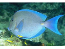
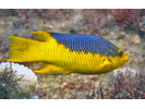
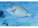
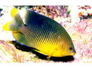
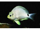
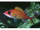
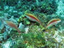
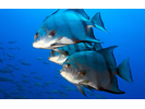
Blue Tang - Surgeonfish
(Acanthurus coeruleus)
(Acanthurus coeruleus)
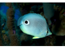
Foureye Butterflyfish - Butterflyfish
(Chaetodon capistratus)
(Chaetodon capistratus)
Bluehead - Wrasse
(Thalassoma bifasciatum)
(Thalassoma bifasciatum)
Stoplight Parrotfish - Parrotfish
(Sparisoma viride)
(Sparisoma viride)
French Grunt - Grunt
(Haemulon flavolineatum)
(Haemulon flavolineatum)
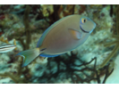
Ocean Surgeonfish - Surgeonfish
(Acanthurus tractus)
(Acanthurus tractus)
Bicolor Damselfish - Damselfish
(Stegastes partitus)
(Stegastes partitus)
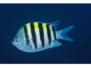
Sergeant Major - Damselfish
(Abudefduf saxatilis)
(Abudefduf saxatilis)
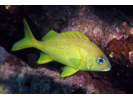
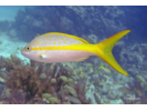
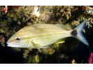
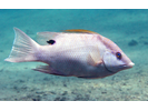
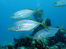
Yellowtail Snapper - Snapper
(Ocyurus chrysurus)
(Ocyurus chrysurus)
Redband Parrotfish - Parrotfish
(Sparisoma aurofrenatum)
(Sparisoma aurofrenatum)
Bar Jack - Jack
(Caranx ruber)
(Caranx ruber)
Blue Chromis - Damselfish
(Azurina cyanea)
(Azurina cyanea)
Yellowtail Damselfish - Damselfish
(Microspathodon chrysurus)
(Microspathodon chrysurus)
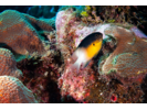
Yellowhead Wrasse - Wrasse
(Halichoeres garnoti)
(Halichoeres garnoti)
Fairy Basslet - Basslet
(Gramma loreto)
(Gramma loreto)
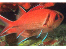
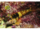
Longspine Squirrelfish - Squirrelfish
(Holocentrus rufus)
(Holocentrus rufus)
Yellow Goatfish - Goatfish
(Mulloidichthys martinicus)
(Mulloidichthys martinicus)

Princess Parrotfish - Parrotfish
(Scarus taeniopterus)
(Scarus taeniopterus)
Trumpetfish - Trumpetfish
(Aulostomus maculatus)
(Aulostomus maculatus)
Spotted Goatfish - Goatfish
(Pseudupeneus maculatus)
(Pseudupeneus maculatus)
Brown Chromis - Damselfish
(Azurina multilineata)
(Azurina multilineata)
Graysby - Seabass
(Cephalopholis cruentata)
(Cephalopholis cruentata)

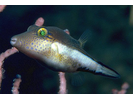
Sharpnose Puffer - Puffer
(Canthigaster rostrata)
(Canthigaster rostrata)
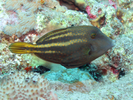
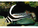
Striped Parrotfish - Parrotfish
(Scarus iseri)
(Scarus iseri)
Bluestriped Grunt - Grunt
(Haemulon sciurus)
(Haemulon sciurus)
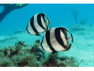
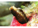
Banded Butterflyfish - Butterflyfish
(Chaetodon striatus)
(Chaetodon striatus)
Spanish Hogfish - Wrasse
(Bodianus rufus)
(Bodianus rufus)
Blackbar Soldierfish - Squirrelfish
(Myripristis jacobus)
(Myripristis jacobus)
Schoolmaster - Snapper
(Lutjanus apodus)
(Lutjanus apodus)
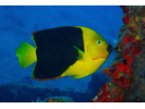
Rock Beauty - Angelfish
(Holacanthus tricolor)
(Holacanthus tricolor)
Harlequin Bass - Seabass
(Serranus tigrinus)
(Serranus tigrinus)
Beaugregory - Damselfish
(Stegastes leucostictus)
(Stegastes leucostictus)
Masked Goby/Glass Goby - Goby
(Coryphopterus personatus/hyalinus)
(Coryphopterus personatus/hyalinus)
Coney - Seabass
(Cephalopholis fulva)
(Cephalopholis fulva)
Smooth Trunkfish - Boxfish
(Lactophrys triqueter)
(Lactophrys triqueter)
Barred Hamlet (Caribbean) - Seabass
(Hypoplectrus puella)
(Hypoplectrus puella)
Queen Parrotfish - Parrotfish
(Scarus vetula)
(Scarus vetula)
Threespot Damselfish - Damselfish
(Stegastes planifrons)
(Stegastes planifrons)
Longfin Damselfish - Damselfish
(Stegastes diencaeus)
(Stegastes diencaeus)
Slippery Dick - Wrasse
(Halichoeres bivittatus)
(Halichoeres bivittatus)
Mahogany Snapper - Snapper
(Lutjanus mahogoni)
(Lutjanus mahogoni)
Creole Wrasse - Wrasse
(Bodianus parrae)
(Bodianus parrae)

Squirrelfish - Squirrelfish
(Holocentrus adscensionis)
(Holocentrus adscensionis)

Bridled Goby Complex (Bridled/Sand-Canyon/Patch-Reef) - Goby
(C. glaucofraenum/C. venezuelae/C. tortugae)
(C. glaucofraenum/C. venezuelae/C. tortugae)
Doctorfish - Surgeonfish
(Acanthurus chirurgus)
(Acanthurus chirurgus)
Orangespotted Filefish - Filefish
(Cantherhines pullus)
(Cantherhines pullus)
Puddingwife - Wrasse
(Halichoeres radiatus)
(Halichoeres radiatus)
Yellowtail (Redfin) Parrotfish - Parrotfish
(Sparisoma rubripinne)
(Sparisoma rubripinne)
Caesar Grunt - Grunt
(Haemulon carbonarium)
(Haemulon carbonarium)
White Grunt - Grunt
(Haemulon plumierii)
(Haemulon plumierii)
Sand Diver - Lizardfish
(Synodus intermedius)
(Synodus intermedius)

Clown Wrasse - Wrasse
(Halichoeres maculipinna)
(Halichoeres maculipinna)
Dusky Damselfish - Damselfish
(Stegastes adustus)
(Stegastes adustus)
Saucereye Porgy - Porgy
(Calamus calamus)
(Calamus calamus)
Black Durgon - Triggerfish
(Melichthys niger)
(Melichthys niger)
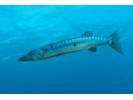
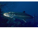
Great Barracuda - Barracuda
(Sphyraena barracuda)
(Sphyraena barracuda)
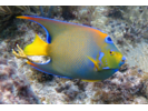
Queen Angelfish - Angelfish
(Holacanthus ciliaris)
(Holacanthus ciliaris)
Red Hind - Seabass
(Epinephelus guttatus)
(Epinephelus guttatus)

Gray Angelfish - Angelfish
(Pomacanthus arcuatus)
(Pomacanthus arcuatus)

Cocoa Damselfish - Damselfish
(Stegastes xanthurus)
(Stegastes xanthurus)
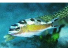
Saddled Blenny - Blenny - Labrisomids
(Malacoctenus triangulatus)
(Malacoctenus triangulatus)
Yellowhead Jawfish - Jawfish
(Opistognathus aurifrons)
(Opistognathus aurifrons)
Sand Tilefish - Tilefish
(Malacanthus plumieri)
(Malacanthus plumieri)

Tomtate - Grunt
(Haemulon aurolineatum)
(Haemulon aurolineatum)
French Angelfish - Angelfish
(Pomacanthus paru)
(Pomacanthus paru)
Redlip Blenny - Blenny - Combtooth
(Ophioblennius macclurei)
(Ophioblennius macclurei)
Goldspot Goby - Goby
(Gnatholepis thompsoni)
(Gnatholepis thompsoni)
Glasseye Snapper (Atlantic) - Bigeye
(Heteropriacanthus cruentatus)
(Heteropriacanthus cruentatus)
Butter Hamlet - Seabass
(Hypoplectrus unicolor)
(Hypoplectrus unicolor)
Tobaccofish - Seabass
(Serranus tabacarius)
(Serranus tabacarius)
Redtail Parrotfish - Parrotfish
(Sparisoma chrysopterum)
(Sparisoma chrysopterum)
Spotted Drum - Drum
(Eques punctatus)
(Eques punctatus)
Smallmouth Grunt - Grunt
(Haemulon chrysargyreum)
(Haemulon chrysargyreum)
Yellowtail Hamlet - Seabass
(Hypoplectrus chlorurus)
(Hypoplectrus chlorurus)

Whitespotted Filefish - Filefish
(Cantherhines macrocerus)
(Cantherhines macrocerus)
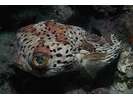
Porcupinefish - Porcupinefish
(Diodon hystrix)
(Diodon hystrix)
Cleaning Goby - Goby
(Elacatinus genie)
(Elacatinus genie)
Longjaw Squirrelfish - Squirrelfish
(Neoniphon marianus)
(Neoniphon marianus)
Bermuda Chub/Gray Chub - Chub
(Kyphosus sectatrix / K. bigibbus)
(Kyphosus sectatrix / K. bigibbus)
Redspotted Hawkfish - Hawkfish
(Amblycirrhitus pinos)
(Amblycirrhitus pinos)
Sharknose Goby - Goby
(Elacatinus evelynae)
(Elacatinus evelynae)
Black Hamlet - Seabass
(Hypoplectrus nigricans)
(Hypoplectrus nigricans)
Yellowfin Mojarra - Mojarra
(Gerres cinereus)
(Gerres cinereus)
Spinyhead Blenny - Blenny - Pike, tube, and flag
(Acanthemblemaria spinosa)
(Acanthemblemaria spinosa)
Colon Goby - Goby
(Coryphopterus dicrus)
(Coryphopterus dicrus)
Lane Snapper - Snapper
(Lutjanus synagris)
(Lutjanus synagris)

Unidentified Silvery Fish (Silversides / Anchovies / Herrings) - Silvery Fishes - Silversides, Herrings, and Anchovies
(Atheriniformes sp./ Clupeiformes sp.)
(Atheriniformes sp./ Clupeiformes sp.)

Gray Snapper - Snapper
(Lutjanus griseus)
(Lutjanus griseus)
Spanish Grunt - Grunt
(Haemulon macrostoma)
(Haemulon macrostoma)
Reef Butterflyfish - Butterflyfish
(Chaetodon sedentarius)
(Chaetodon sedentarius)
Spotted Trunkfish - Boxfish
(Lactophrys bicaudalis)
(Lactophrys bicaudalis)
Cero - Mackerel
(Scomberomorus regalis)
(Scomberomorus regalis)
Queen Triggerfish - Triggerfish
(Balistes vetula)
(Balistes vetula)
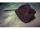
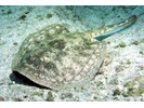
Southern Stingray - Stingray
(Hypanus americanus)
(Hypanus americanus)
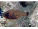
Belted Cardinalfish - Cardinalfish
(Apogon townsendi)
(Apogon townsendi)
Rainbow Wrasse - Wrasse
(Halichoeres pictus)
(Halichoeres pictus)
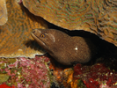
Spotted Moray - Moray
(Gymnothorax moringa)
(Gymnothorax moringa)
Mutton Snapper - Snapper
(Lutjanus analis)
(Lutjanus analis)
Dog Snapper - Snapper
(Lutjanus jocu)
(Lutjanus jocu)
Dusky Squirrelfish - Squirrelfish
(Sargocentron vexillarium)
(Sargocentron vexillarium)
Shortstripe Goby - Goby
(Elacatinus chancei)
(Elacatinus chancei)
Honeycomb Cowfish - Boxfish
(Acanthostracion polygonius)
(Acanthostracion polygonius)
Porkfish - Grunt
(Anisotremus virginicus)
(Anisotremus virginicus)
Spotfin Butterflyfish - Butterflyfish
(Chaetodon ocellatus)
(Chaetodon ocellatus)
Flamefish - Cardinalfish
(Apogon maculatus)
(Apogon maculatus)
Horse-eye Jack - Jack
(Caranx latus)
(Caranx latus)

Pallid Goby - Goby
(Coryphopterus eidolon)
(Coryphopterus eidolon)
Peppermint Goby - Goby
(Coryphopterus lipernes)
(Coryphopterus lipernes)
Barred Cardinalfish - Cardinalfish
(Apogon binotatus)
(Apogon binotatus)
Peacock Flounder - Flounder
(Bothus lunatus)
(Bothus lunatus)
Brown Garden Eel - Conger
(Heteroconger longissimus)
(Heteroconger longissimus)

Longsnout Butterflyfish - Butterflyfish
(Chaetodon aculeatus)
(Chaetodon aculeatus)

Scrawled Filefish - Filefish
(Aluterus scriptus)
(Aluterus scriptus)
Glassy Sweeper - Sweeper
(Pempheris schomburgkii)
(Pempheris schomburgkii)
Black Margate - Grunt
(Anisotremus surinamensis)
(Anisotremus surinamensis)

Tan Hamlet - Seabass
(Hypoplectrus randallorum)
(Hypoplectrus randallorum)
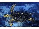
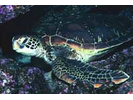
Hawksbill Sea Turtle - Sea Turtles
(Eretmochelys imbricata)
(Eretmochelys imbricata)
Bandtail Puffer - Puffer
(Sphoeroides spengleri)
(Sphoeroides spengleri)
Goldentail Moray - Moray
(Gymnothorax miliaris)
(Gymnothorax miliaris)
Chalk Bass - Seabass
(Serranus tortugarum)
(Serranus tortugarum)
Scrawled Cowfish - Boxfish
(Acanthostracion quadricornis)
(Acanthostracion quadricornis)

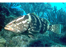
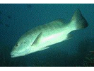
Nassau Grouper - Seabass
(Epinephelus striatus)
(Epinephelus striatus)
Pluma - Porgy
(Calamus pennatula)
(Calamus pennatula)
Yellowbelly Hamlet - Seabass
(Hypoplectrus aberrans)
(Hypoplectrus aberrans)
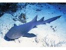
Nurse Shark - Carpet Shark
(Ginglymostoma cirratum)
(Ginglymostoma cirratum)
Greater Soapfish - Soapfishes
(Rypticus saponaceus)
(Rypticus saponaceus)
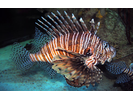
Red Lionfish (exotic) - Scorpionfish
(Pterois volitans)
(Pterois volitans)
Sailors Choice - Grunt
(Haemulon parra)
(Haemulon parra)
Rainbow Parrotfish - Parrotfish
(Scarus guacamaia)
(Scarus guacamaia)
Greenblotch Parrotfish - Parrotfish
(Sparisoma atomarium)
(Sparisoma atomarium)
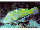
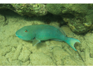
Hogfish - Wrasse
(Lachnolaimus maximus)
(Lachnolaimus maximus)
Blackear Wrasse - Wrasse
(Halichoeres poeyi)
(Halichoeres poeyi)
Rock Hind - Seabass
(Epinephelus adscensionis)
(Epinephelus adscensionis)
Diamond Blenny - Blenny - Labrisomids
(Malacoctenus boehlkei)
(Malacoctenus boehlkei)
Jolthead Porgy - Porgy
(Calamus bajonado)
(Calamus bajonado)
Highhat - Drum
(Pareques acuminatus / Pareques lineatus)
(Pareques acuminatus / Pareques lineatus)
Green Moray - Moray
(Gymnothorax funebris)
(Gymnothorax funebris)

Creolefish (Atlantic) - Seabass
(Paranthias furcifer)
(Paranthias furcifer)
Balloonfish - Porcupinefish
(Diodon holocanthus)
(Diodon holocanthus)
Sailfin Blenny - Blenny - Pike, tube, and flag
(Emblemaria pandionis)
(Emblemaria pandionis)
Boga - Grunt
(Haemulon vittatum)
(Haemulon vittatum)
Mackerel Scad - Jack
(Decapterus macarellus)
(Decapterus macarellus)

Peppermint Basslet - Basslet / Seabass
(Liopropoma rubre)
(Liopropoma rubre)
White Margate - Grunt
(Haemulon album)
(Haemulon album)
Slender Filefish - Filefish
(Monacanthus tuckeri)
(Monacanthus tuckeri)
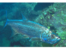
Tarpon - Tarpon
(Megalops atlanticus)
(Megalops atlanticus)
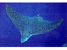
Spotted Eagle Ray - Eagle Ray
(Aetobatus narinari)
(Aetobatus narinari)
Hybrid Hamlet - Seabass
(Hypoplectrus (Hybrid))
(Hypoplectrus (Hybrid))
Sharksucker - Remora
(Echeneis naucrates)
(Echeneis naucrates)
Shy Hamlet - Seabass
(Hypoplectrus guttavarius)
(Hypoplectrus guttavarius)
Blue Runner - Jack
(Caranx crysos)
(Caranx crysos)
Juvenile Grunt - Grunt
(Haemulon sp.)
(Haemulon sp.)
Reef Squirrelfish - Squirrelfish
(Holocentrus coruscus)
(Holocentrus coruscus)
Whitestar Cardinalfish - Cardinalfish
(Apogon lachneri)
(Apogon lachneri)
Houndfish - Needlefish
(Tylosurus crocodilus crocodilus)
(Tylosurus crocodilus crocodilus)
Green Razorfish - Wrasse
(Xyrichtys splendens)
(Xyrichtys splendens)
Bluelip Parrotfish - Parrotfish
(Cryptotomus roseus)
(Cryptotomus roseus)
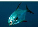
Permit - Jack
(Trachinotus falcatus)
(Trachinotus falcatus)
Rosy Blenny - Blenny - Labrisomids
(Malacoctenus macropus)
(Malacoctenus macropus)
Indigo Hamlet - Seabass
(Hypoplectrus indigo)
(Hypoplectrus indigo)
Rosy Razorfish - Wrasse
(Xyrichtys martinicensis)
(Xyrichtys martinicensis)
Lantern Bass - Seabass
(Serranus baldwini)
(Serranus baldwini)
Spotted Scorpionfish - Scorpionfish
(Scorpaena plumieri plumieri)
(Scorpaena plumieri plumieri)
Hovering Dartfish (Hovering Goby) - Dartfish
(Ptereleotris helenae)
(Ptereleotris helenae)
Night Sergeant - Damselfish
(Abudefduf taurus)
(Abudefduf taurus)
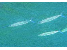
Northern / Southern Sennet - Barracuda
(Sphyraena borealis/picudilla)
(Sphyraena borealis/picudilla)
Reef Shark (Caribbean) - Requiem Shark
(Carcharhinus perezii)
(Carcharhinus perezii)

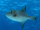
Atlantic Spadefish - Spadefish
(Chaetodipterus faber)
(Chaetodipterus faber)
Cubera Snapper - Snapper
(Lutjanus cyanopterus)
(Lutjanus cyanopterus)
Dusky Cardinalfish - Cardinalfish
(Phaeoptyx pigmentaria)
(Phaeoptyx pigmentaria)
Ballyhoo - Halfbeak
(Hemiramphus brasiliensis)
(Hemiramphus brasiliensis)
Green Sea Turtle - Sea Turtles
(Chelonia mydas)
(Chelonia mydas)
Sponge Cardinalfish - Cardinalfish
(Phaeoptyx xenus)
(Phaeoptyx xenus)
Tiger Grouper - Seabass
(Mycteroperca tigris)
(Mycteroperca tigris)
Ocean Triggerfish - Triggerfish
(Canthidermis sufflamen)
(Canthidermis sufflamen)
Eyed Flounder - Flounder
(Bothus ocellatus)
(Bothus ocellatus)
Bucktooth Parrotfish - Parrotfish
(Sparisoma radians)
(Sparisoma radians)
Goldline Blenny - Blenny - Labrisomids
(Malacoctenus aurolineatus)
(Malacoctenus aurolineatus)
Yellow Jack - Jack
(Caranx bartholomaei)
(Caranx bartholomaei)
Roughhead Blenny - Blenny - Pike, tube, and flag
(Acanthemblemaria aspera)
(Acanthemblemaria aspera)
Broadstripe Goby - Goby
(Elacatinus prochilos)
(Elacatinus prochilos)
Tusked Goby - Goby
(Risor ruber)
(Risor ruber)
Yellow Stingray - Round Stingrays
(Urobatis jamaicensis)
(Urobatis jamaicensis)
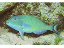
Blue Parrotfish - Parrotfish
(Scarus coeruleus)
(Scarus coeruleus)

Rusty Goby - Goby
(Priolepis hipoliti)
(Priolepis hipoliti)
Sunshinefish - Damselfish
(Chromis insolata)
(Chromis insolata)

Lancer Dragonet - Dragonet
(Paradiplogrammus bairdi)
(Paradiplogrammus bairdi)
Bigeye - Bigeye
(Priacanthus arenatus)
(Priacanthus arenatus)
Seaweed Blenny - Blenny - Combtooth
(Parablennius marmoreus)
(Parablennius marmoreus)
Orangespotted Goby - Goby
(Nes longus)
(Nes longus)
Reef Croaker - Drum
(Odontoscion dentex)
(Odontoscion dentex)
Cottonwick - Grunt
(Haemulon melanurum)
(Haemulon melanurum)
Jackknife-Fish - Drum
(Eques lanceolatus)
(Eques lanceolatus)

Unidentified Darkheaded Blenny Emblemariopsis sp. B - Blenny - Pike, tube, and flag
(Emblemariopsis sp. B (Darkheaded))
(Emblemariopsis sp. B (Darkheaded))
Yellowfin Grouper - Seabass
(Mycteroperca venenosa)
(Mycteroperca venenosa)
Yellowface Pikeblenny - Blenny - Pike, tube, and flag
(Chaenopsis limbaughi)
(Chaenopsis limbaughi)
Cardinal Soldierfish - Squirrelfish
(Plectrypops retrospinis)
(Plectrypops retrospinis)
Hamlet - Juvenile - Seabass
(Hypoplectrus sp.)
(Hypoplectrus sp.)
Palometa - Jack
(Trachinotus goodei)
(Trachinotus goodei)
Blackfin Snapper - Snapper
(Lutjanus buccanella)
(Lutjanus buccanella)
Mottled Mojarra - Mojarra
(Eucinostomus lefroyi)
(Eucinostomus lefroyi)
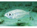
Chain Moray - Moray
(Echidna catenata)
(Echidna catenata)
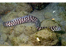
Black Jack - Jack
(Caranx lugubris)
(Caranx lugubris)
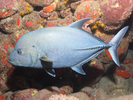
Longsnout Seahorse - Pipefish and Seahorse
(Hippocampus reidi)
(Hippocampus reidi)
Sheepshead Porgy - Porgy
(Calamus penna)
(Calamus penna)
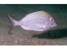
Sargassum Triggerfish - Triggerfish
(Xanthichthys ringens)
(Xanthichthys ringens)
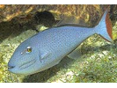
Orangesided Goby - Goby
(Tigrigobius dilepis)
(Tigrigobius dilepis)
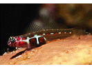
Arrow Blenny - Blenny - Pike, tube, and flag
(Lucayablennius zingaro)
(Lucayablennius zingaro)
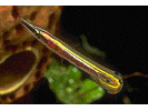
Secretary Blenny - Blenny - Pike, tube, and flag
(Acanthemblemaria maria)
(Acanthemblemaria maria)
Flat Needlefish - Needlefish
(Ablennes hians)
(Ablennes hians)
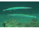
Rainbow Runner - Jack
(Elagatis bipinnulata)
(Elagatis bipinnulata)
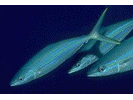
Blue Dartfish (Blue Goby) - Dartfish
(Ptereleotris calliurus)
(Ptereleotris calliurus)
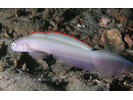
Sea Turtle sp. (unidentified) - Sea Turtles
()
()
Trunkfish - Boxfish
(Lactophrys trigonus)
(Lactophrys trigonus)
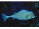
Yellowline Goby - Goby
(Elacatinus horsti)
(Elacatinus horsti)
Almaco Jack - Jack
(Seriola rivoliana)
(Seriola rivoliana)
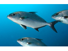
Twospot Cardinalfish - Cardinalfish
(Apogon pseudomaculatus)
(Apogon pseudomaculatus)
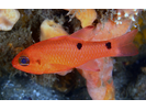
Flagfin Mojarra - Mojarra
(Eucinostomus melanopterus)
(Eucinostomus melanopterus)
Leopard Goby - Goby
(Tigrigobius saucras)
(Tigrigobius saucras)
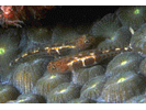
Hairy Blenny Complex - Blenny - Labrisomids
(Labrisomus nuchipinnis/L. conditus/L.cricota)
(Labrisomus nuchipinnis/L. conditus/L.cricota)
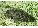
Black Grouper - Seabass
(Mycteroperca bonaci)
(Mycteroperca bonaci)
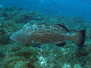
Midnight Parrotfish - Parrotfish
(Scarus coelestinus)
(Scarus coelestinus)
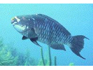
Silver Porgy - Porgy
(Diplodus caudimacula)
(Diplodus caudimacula)
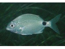
Mutton Hamlet - Seabass
(Alphestes afer)
(Alphestes afer)
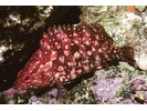
Striped Grunt - Grunt
(Haemulon striatum)
(Haemulon striatum)
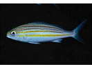
Pearl Blenny - Blenny - Combtooth
(Entomacrodus nigricans)
(Entomacrodus nigricans)
Greenbanded Goby - Goby
(Tigrigobius multifasciatus)
(Tigrigobius multifasciatus)
Seminole Goby - Goby
(Microgobius carri)
(Microgobius carri)
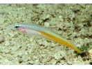
Unidentified Triplefin species - Triplefin (Blenny)
(Enneanectes sp.)
(Enneanectes sp.)
Bluestriped Lizardfish - Lizardfish
(Synodus saurus)
(Synodus saurus)
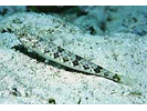
Sawcheek Cardinalfish - Cardinalfish
(Apogon quadrisquamatus)
(Apogon quadrisquamatus)
Keeltail Needlefish - Needlefish
(Platybelone argalus argalus)
(Platybelone argalus argalus)
Redbelly (pka Redeye) Triplefin - Triplefin (Blenny)
(Enneanectes jordani (pka E. pectoralis))
(Enneanectes jordani (pka E. pectoralis))
Banded Jawfish - Jawfish
(Opistognathus macrognathus)
(Opistognathus macrognathus)
Sharptail Eel - Snake Eel
(Myrichthys breviceps)
(Myrichthys breviceps)
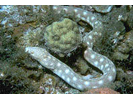
Pearly Razorfish - Wrasse
(Xyrichtys novacula)
(Xyrichtys novacula)
Cherubfish - Angelfish
(Centropyge argi)
(Centropyge argi)
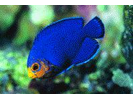
Mimic Cardinalfish - Cardinalfish
(Apogon phenax)
(Apogon phenax)
Blue Angelfish - Angelfish
(Holacanthus bermudensis)
(Holacanthus bermudensis)
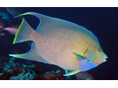
Freckled Soapfish - Soapfishes
(Rypticus bistrispinus)
(Rypticus bistrispinus)
African Pompano - Jack
(Alectis ciliaris)
(Alectis ciliaris)
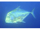
Purplemouth Moray - Moray
(Gymnothorax vicinus)
(Gymnothorax vicinus)
Red Grouper - Seabass
(Epinephelus morio)
(Epinephelus morio)
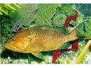
Sand-Canyon Goby (part of Bridled Goby Complex) - Goby
(Coryphopterus venezuelae (was C. bol))
(Coryphopterus venezuelae (was C. bol))
Bigeye Scad - Jack
(Selar crumenophthalmus)
(Selar crumenophthalmus)
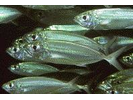
Remora - Remora
(Remora remora)
(Remora remora)
Sea Bream - Porgy
(Archosargus rhomboidalis)
(Archosargus rhomboidalis)
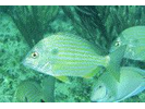
Neon Goby - Goby
(Elacatinus oceanops)
(Elacatinus oceanops)
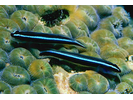
Blackcap Basslet - Basslet
(Gramma melacara)
(Gramma melacara)
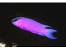
Dash Goby - Goby
(Ctenogobius saepepallens)
(Ctenogobius saepepallens)
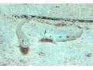
Greater Amberjack - Jack
(Seriola dumerili)
(Seriola dumerili)
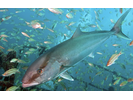
King Mackerel - Mackerel
(Scomberomorus cavalla)
(Scomberomorus cavalla)
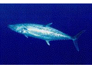
Blacktip Shark - Requiem Shark
(Carcharhinus limbatus)
(Carcharhinus limbatus)
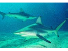
Lofty Triplefin - Triplefin (Blenny)
(Enneanectes altivelis)
(Enneanectes altivelis)
Yellowmouth Grouper - Seabass
(Mycteroperca interstitialis)
(Mycteroperca interstitialis)
Yellowcheek Wrasse - Wrasse
(Halichoeres cyanocephalus)
(Halichoeres cyanocephalus)
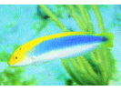
White Mullet - Mullet
(Mugil curema)
(Mugil curema)
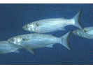
Bridle Cardinalfish - Cardinalfish
(Apogon aurolineatus)
(Apogon aurolineatus)
Web Burrfish - Porcupinefish
(Chilomycterus antillarum)
(Chilomycterus antillarum)
Checkered Puffer - Puffer
(Sphoeroides testudineus)
(Sphoeroides testudineus)
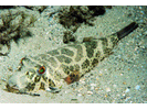
Dwarf Sand Perch - Seabass
(Diplectrum bivittatum)
(Diplectrum bivittatum)
Bluelip Hamlet - Seabass
(Hypoplectrus affinis)
(Hypoplectrus affinis)
Brassy Chub - Chub
(Kyphosus vaigiensis)
(Kyphosus vaigiensis)
Crevalle Jack - Jack
(Caranx hippos)
(Caranx hippos)
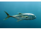
Longlure Frogfish - Frogfish
(Antennarius multiocellatus)
(Antennarius multiocellatus)
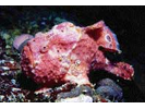
Pale Cardinalfish - Cardinalfish
(Apogon planifrons)
(Apogon planifrons)
Flying Gurnard - Flying Gurnard
(Dactylopterus volitans)
(Dactylopterus volitans)
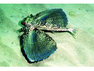
Pirate Blenny - Blenny - Pike, tube, and flag
(Emblemaria piratula)
(Emblemaria piratula)
Spotted Soapfish - Soapfishes
(Rypticus subbifrenatus)
(Rypticus subbifrenatus)
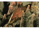
Wall Goby (aka Semiscaled Goby) - Goby
(Tigrigobius pallens)
(Tigrigobius pallens)
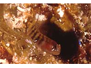
Quillfin Blenny - Blenny - Labrisomids
(Gobioclinus filamentosus)
(Gobioclinus filamentosus)
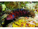
Silver Jenny - Mojarra
(Eucinostomus gula)
(Eucinostomus gula)
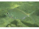
Bonnetmouth - Grunt
(Emmelichthyops atlanticus)
(Emmelichthyops atlanticus)
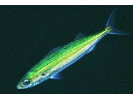
Bluespotted Cornetfish - Cornetfish
(Fistularia tabacaria)
(Fistularia tabacaria)
Bluethroat Pikeblenny - Blenny - Pike, tube, and flag
(Chaenopsis ocellata)
(Chaenopsis ocellata)
Emerald Parrotfish - Parrotfish
(Nicholsina usta usta)
(Nicholsina usta usta)
Goliath Grouper - Seabass
(Epinephelus itajara)
(Epinephelus itajara)
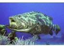
Red Lizardfish - Lizardfish
(Synodus synodus)
(Synodus synodus)
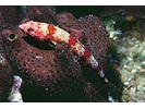
Reef Scorpionfish - Scorpionfish
(Scorpaenodes caribbaeus)
(Scorpaenodes caribbaeus)
Bigtooth Cardinalfish - Cardinalfish
(Apogon affinis)
(Apogon affinis)
Chestnut Moray - Moray
(Enchelycore carychroa)
(Enchelycore carychroa)
Shortnose Batfish - Batfish
(Ogcocephalus nasutus)
(Ogcocephalus nasutus)
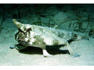
Spotlight Goby - Goby
(Elacatinus louisae)
(Elacatinus louisae)

Orange Filefish - Filefish
(Aluterus schoepfii)
(Aluterus schoepfii)
Redear Sardine (Redear Herring) - Silvery Fishes - Silversides, Herrings, and Anchovies
(Harengula humeralis)
(Harengula humeralis)
Round Scad - Jack
(Decapterus punctatus)
(Decapterus punctatus)
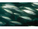
Bridled Burrfish - Porcupinefish
(Chilomycterus antennatus)
(Chilomycterus antennatus)
Tessellated Blenny - Blenny - Combtooth
(Hypsoblennius invemar)
(Hypsoblennius invemar)
Dusky Jawfish - Jawfish
(Opistognathus whitehurstii)
(Opistognathus whitehurstii)
Dusky Blenny - Blenny - Labrisomids
(Malacoctenus gilli)
(Malacoctenus gilli)
Gray Triggerfish - Triggerfish
(Balistes capriscus)
(Balistes capriscus)
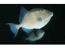
Molly Miller - Blenny - Combtooth
(Scartella cristata)
(Scartella cristata)
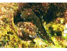
Shortfin Sweeper - Sweeper
(Pempheris poeyi)
(Pempheris poeyi)
Spanish Mackerel - Mackerel
(Scomberomorus maculatus)
(Scomberomorus maculatus)

Palehead Blenny - Blenny - Labrisomids
(Labrisomus gobio)
(Labrisomus gobio)
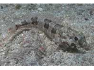
Goldspotted Eel - Snake Eel
(Myrichthys ocellatus)
(Myrichthys ocellatus)
School Bass - Seabass
(Schultzea beta)
(Schultzea beta)
Whitefin Sharksucker - Remora
(Echeneis neucratoides)
(Echeneis neucratoides)
Atlantic Silverside - Neotropical Silversides
(Menidia menidia)
(Menidia menidia)
Shortfin Pipefish - Pipefish and Seahorse
(Cosmocampus elucens)
(Cosmocampus elucens)
Slender Mojarra - Mojarra
(Eucinostomus jonesii)
(Eucinostomus jonesii)
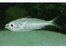
Nineline Goby - Goby
(Ginsburgellus novemlineatus)
(Ginsburgellus novemlineatus)
Topsail Chub - Chub
(Kyphosus cinerascens)
(Kyphosus cinerascens)
Bridled Goby (true species; not complex) - Goby
(Coryphopterus glaucofraenum)
(Coryphopterus glaucofraenum)
Sand Perch - Seabass
(Diplectrum formosum)
(Diplectrum formosum)
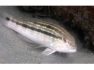
Barfin Blenny - Blenny - Labrisomids
(Malacoctenus versicolor)
(Malacoctenus versicolor)
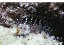
Fringed Filefish - Filefish
(Monacanthus ciliatus)
(Monacanthus ciliatus)
Unidentified Needlefish - Needlefish
()
()
Yellowtail Reeffish - Damselfish
(Chromis enchrysura)
(Chromis enchrysura)

Bantam Bass - Seabass
(Parasphyraenops incisus)
(Parasphyraenops incisus)
Little Tunny - Mackerel
(Euthynnus alletteratus)
(Euthynnus alletteratus)
Wrasse Blenny - Blenny - Pike, tube, and flag
(Hemiemblemaria simulus)
(Hemiemblemaria simulus)
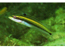
Cobia - Cobia
(Rachycentron canadum)
(Rachycentron canadum)
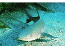
Papillose Blenny - Blenny - Pike, tube, and flag
(Acanthemblemaria chaplini)
(Acanthemblemaria chaplini)
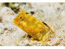
Spotfin Hogfish - Wrasse
(Bodianus pulchellus)
(Bodianus pulchellus)
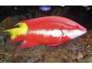
Twinhorn Blenny - Blenny - Pike, tube, and flag
(Coralliozetus cardonae)
(Coralliozetus cardonae)
Atlantic Leatherjack - Jack
(Oligoplites saurus)
(Oligoplites saurus)
Balao - Halfbeak
(Hemiramphus balao)
(Hemiramphus balao)

Golden Hamlet - Seabass
(Hypoplectrus gummigutta)
(Hypoplectrus gummigutta)
Harlequin / Banded Pipefish - Pipefish and Seahorse
(Micrognathus crinitus)
(Micrognathus crinitus)
Spotfin Goby - Goby
(Oxyurichthys stigmalophius)
(Oxyurichthys stigmalophius)
Whitespotted Soapfish - Soapfishes
(Rypticus maculatus)
(Rypticus maculatus)
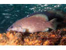
Atlantic Needlefish - Needlefish
(Strongylura marina)
(Strongylura marina)
Blackfin Cardinalfish - Cardinalfish
(Astrapogon puncticulatus)
(Astrapogon puncticulatus)

Oddscale Cardinalfish - Cardinalfish
(Apogon evermanni)
(Apogon evermanni)
Roughhead Triplefin - Triplefin (Blenny)
(Enneanectes boehlkei)
(Enneanectes boehlkei)
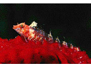
Viper Moray - Moray
(Enchelycore nigricans)
(Enchelycore nigricans)
Inshore Lizardfish - Lizardfish
(Synodus foetens)
(Synodus foetens)
Lined Seahorse - Pipefish and Seahorse
(Hippocampus erectus)
(Hippocampus erectus)
Purple Reeffish - Damselfish
(Chromis scotti)
(Chromis scotti)
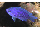
Orangespotted Blenny - Blenny - Combtooth
(Hypleurochilus springeri)
(Hypleurochilus springeri)
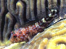
Red Clingfish - Clingfish
(Acyrtus rubiginosus)
(Acyrtus rubiginosus)
Redtail Scad - Jack
(Decapterus tabl)
(Decapterus tabl)
Atlantic Bumper - Jack
(Chloroscombrus chrysurus)
(Chloroscombrus chrysurus)
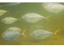
Blue Hamlet - Seabass
(Hypoplectrus gemma)
(Hypoplectrus gemma)
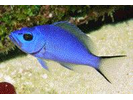
Bonefish - Bonefish
(Albula vulpes)
(Albula vulpes)
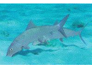
Candy Basslet - Basslet / Seabass
(Liopropoma carmabi)
(Liopropoma carmabi)
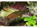
Cave Basslet - Basslet / Seabass
(Liopropoma mowbrayi)
(Liopropoma mowbrayi)
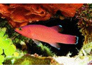
Hamlet sp C (Black USVI) - Seabass
(Hypoplectrus sp. (spC))
(Hypoplectrus sp. (spC))
Littlehead Porgy - Porgy
(Calamus proridens)
(Calamus proridens)
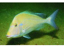
Timucu - Needlefish
(Strongylura timucu)
(Strongylura timucu)
Downy Blenny - Blenny - Labrisomids
(Labrisomus kalisherae)
(Labrisomus kalisherae)
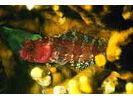
Mirrorwing Flyingfish - Flyingfish
(Hirundichthys speculiger)
(Hirundichthys speculiger)
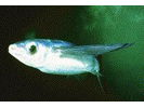
Spotted Snake Eel - Snake Eel
(Ophichthus ophis)
(Ophichthus ophis)
Twinspot Bass - Seabass
(Serranus flaviventris)
(Serranus flaviventris)
Wahoo - Mackerel
(Acanthocybium solandri)
(Acanthocybium solandri)
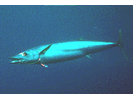
Barred Blenny - Blenny - Combtooth
(Hypleurochilus bermudensis)
(Hypleurochilus bermudensis)
Caribbean Whiptail Stingray - Stingray
(Himantura schmardae)
(Himantura schmardae)
Common Snook - Snook
(Centropomus undecimalis)
(Centropomus undecimalis)
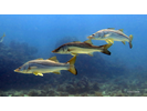
Conchfish - Cardinalfish
(Astrapogon stellatus)
(Astrapogon stellatus)
Gag - Seabass
(Mycteroperca microlepis)
(Mycteroperca microlepis)
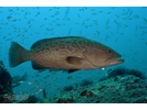
Guaguanche - Barracuda
(Sphyraena guachancho)
(Sphyraena guachancho)
Loggerhead Sea Turtle - Sea Turtles
(Caretta caretta)
(Caretta caretta)
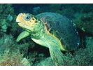
Masked Hamlet - Seabass
(Hypoplectrus providencianus)
(Hypoplectrus providencianus)
Mimic Blenny - Blenny - Labrisomids
(Labrisomus guppyi)
(Labrisomus guppyi)
Oceanic Manta Ray - Manta
(Mobula birostris)
(Mobula birostris)
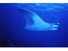
Redfin Needlefish - Needlefish
(Strongylura notata notata)
(Strongylura notata notata)
Sheepshead - Porgy
(Archosargus probatocephalus)
(Archosargus probatocephalus)
Snakefish - Lizardfish
(Trachinocephalus myops)
(Trachinocephalus myops)
Spottail Pinfish - Porgy
(Diplodus holbrookii)
(Diplodus holbrookii)

Unidentified Lizardfish - Lizardfish
(Synodus sp.)
(Synodus sp.)
Whitenose Pipefish - Pipefish and Seahorse
(Cosmocampus albirostris)
(Cosmocampus albirostris)
Crested Goby - Goby
(Lophogobius cyprinoides)
(Lophogobius cyprinoides)
Cubbyu - Drum
(Pareques umbrosus)
(Pareques umbrosus)

Dwarf Shy Blenny Complex - Blenny - Labrisomids
(Starksia nanodes complex)
(Starksia nanodes complex)
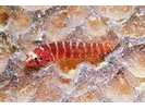
Spotted Spoon-nose Eel - Snake Eel
(Echiophis intertinctus)
(Echiophis intertinctus)
Threeline Basslet - Basslet
(Lipogramma trilineatum)
(Lipogramma trilineatum)
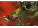
Bigeye Mojarra - Mojarra
(Eucinostomus havana)
(Eucinostomus havana)
Bull Shark - Requiem Shark
(Carcharhinus leucas)
(Carcharhinus leucas)
Dwarf Herring - Silvery Fishes - Silversides, Herrings, and Anchovies
(Jenkinsia lamprotaenia)
(Jenkinsia lamprotaenia)
Matador Triplefin - Triplefin (Blenny)
(Enneanectes matador)
(Enneanectes matador)
Mushroom Scorpionfish - Scorpionfish
(Scorpaena inermis)
(Scorpaena inermis)
Pipehorse - Pipefish and Seahorse
(Amphelikturus dendriticus)
(Amphelikturus dendriticus)
Roughtail Stingray - Stingray
(Dasyatis centroura)
(Dasyatis centroura)
Striped Croaker - Drum
(Bairdiella sanctaeluciae)
(Bairdiella sanctaeluciae)
Unidentified Pipefish sp. - Pipefish and Seahorse
()
()
Unidentified Shy Blenny Starksia - Blenny - Labrisomids
(Starksia sp.)
(Starksia sp.)
Bahamas (Red Banner) Blenny (pka Redspine Glass Blenny) - Blenny - Pike, tube, and flag
(Emblemariopsis occidentalis)
(Emblemariopsis occidentalis)
Barred Clingfish - Clingfish
(Tomicodon fasciatus)
(Tomicodon fasciatus)
Blackedge Triplefin - Triplefin (Blenny)
(Enneanectes atrorus)
(Enneanectes atrorus)
Freckled Cardinalfish - Cardinalfish
(Phaeoptyx conklini)
(Phaeoptyx conklini)
Lemon Shark - Requiem Shark
(Negaprion brevirostris)
(Negaprion brevirostris)
Lesser Devil Ray (aka Atlantic Devil Ray) - Manta
(Mobula hypostoma)
(Mobula hypostoma)
Patch-Reef Goby (part of Bridled Goby Complex) - Goby
(Coryphopterus tortugae)
(Coryphopterus tortugae)
Puffcheek Blenny - Blenny - Labrisomids
(Labrisomus bucciferus)
(Labrisomus bucciferus)
Pygmy Filefish - Filefish
(Stephanolepis setifer)
(Stephanolepis setifer)
Roughlip Cardinalfish - Cardinalfish
(Apogon robinsi)
(Apogon robinsi)
Slaty Goby - Goby
(Elacatinus tenox)
(Elacatinus tenox)
Spotcheek Blenny - Blenny - Labrisomids
(Labrisomus nigricinctus)
(Labrisomus nigricinctus)
Spotfin Burrfish - Porcupinefish
(Chilomycterus reticulatus)
(Chilomycterus reticulatus)
Spotfin Mojarra - Mojarra
(Eucinostomus argenteus)
(Eucinostomus argenteus)
Spotted Dragonet - Dragonet
(Diplogrammus pauciradiatus)
(Diplogrammus pauciradiatus)
Stippled Clingfish - Clingfish
(Gobiesox punctulatus)
(Gobiesox punctulatus)
Vermillion Snapper - Snapper
(Rhomboplites aurorubens)
(Rhomboplites aurorubens)
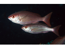
Western Smoothhead Glass Blenny (pka Seafan Blenny) - Blenny - Pike, tube, and flag
(Emblemariopsis pricei)
(Emblemariopsis pricei)
Yellownose Goby - Goby
(Elacatinus randalli)
(Elacatinus randalli)
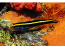
Yellowprow Goby - Goby
(Elacatinus xanthiprora)
(Elacatinus xanthiprora)
Banded Puffer - Puffer
(Colomesus psittacus)
(Colomesus psittacus)
Barbfish - Scorpionfish
(Scorpaena brasiliensis)
(Scorpaena brasiliensis)
Black Snapper - Snapper
(Apsilus dentatus)
(Apsilus dentatus)
Blackspotted Snake Eel - Snake Eel
(Quassiremus ascensionis)
(Quassiremus ascensionis)
Broadsaddle Cardinalfish - Cardinalfish
(Apogon pillionatus)
(Apogon pillionatus)
Channel Flounder - Flounder
(Syacium micrurum)
(Syacium micrurum)
Conger Eel - Conger
(Conger oceanicus)
(Conger oceanicus)
Cottonmouth Jack - Jack
(Uraspis secunda)
(Uraspis secunda)
Dwarf Frogfish - Frogfish
(Antennarius pauciradiatus)
(Antennarius pauciradiatus)
Green Sea Turtle w/ FP Tumor - Sea Turtles
(Chelonia mydas)
(Chelonia mydas)
Hardhead Silverside - Silvery Fishes - Silversides, Herrings, and Anchovies
(Atherinomorus stipes)
(Atherinomorus stipes)
Imitator Blenny - Blenny - Labrisomids
(Malacoctenus erdmani)
(Malacoctenus erdmani)
Key Worm Eel - Snake Eel
(Ahlia egmontis)
(Ahlia egmontis)
Latin Grunt - Grunt
(Haemulon steindachneri)
(Haemulon steindachneri)
Linesnout Goby - Goby
(Elacatinus lori)
(Elacatinus lori)
Longhorn Blenny - Blenny - Combtooth
(Hypsoblennius exstochilus)
(Hypsoblennius exstochilus)
Maculated Flounder - Flounder
(Bothus maculiferus)
(Bothus maculiferus)
Manytooth Conger - Conger
(Conger triporiceps)
(Conger triporiceps)
Plumed Scorpionfish - Scorpionfish
(Scorpaena grandicornis)
(Scorpaena grandicornis)
Pygmy Sea Bass - Seabass
(Serraniculus pumilio)
(Serraniculus pumilio)
Striped Hamlet (restricted to Fort Liberte Haiti) - Seabass
(Hypoplectrus liberte)
(Hypoplectrus liberte)
Tiger Goby - Goby
(Gobiosoma macrodon)
(Gobiosoma macrodon)
Tropical Flounder - Flounder
(Paralichthys tropicus)
(Paralichthys tropicus)
Unidentified Scad - Jack
()
()
Yellowcheek Basslet - Basslet
(Gramma linki)
(Gramma linki)

Bandtail Searobin - Searobin
(Prionotus ophryas)
(Prionotus ophryas)
Barsnout Goby - Goby
(Elacatinus illecebrosum)
(Elacatinus illecebrosum)
Belted Sandfish - Seabass
(Serranus subligarius)
(Serranus subligarius)
Caribbean Puffer - Puffer
(Sphoeroides greeleyi)
(Sphoeroides greeleyi)
Checkered Shy Blenny Complex - Blenny - Labrisomids
(Starksia ocellata complex)
(Starksia ocellata complex)
Flameback Angelfish - Angelfish
(Centropyge aurantonotus)
(Centropyge aurantonotus)
Florida Pompano - Jack
(Trachinotus carolinus)
(Trachinotus carolinus)
Lookdown - Jack
(Selene vomer)
(Selene vomer)
Marbled Grouper - Seabass
(Dermatolepis inermis)
(Dermatolepis inermis)
Mottled Jawfish - Jawfish
(Opistognathus maxillosus)
(Opistognathus maxillosus)
Ocellated Frogfish - Frogfish
(Antennarius ocellatus)
(Antennarius ocellatus)
Pigfish - Grunt
(Orthopristis chrysoptera)
(Orthopristis chrysoptera)

Pinfish - Porgy
(Lagodon rhomboides)
(Lagodon rhomboides)
Polka-dot Batfish - Batfish
(Ogcocephalus cubifrons)
(Ogcocephalus cubifrons)
Red Cornetfish - Cornetfish
(Fistularia petimba)
(Fistularia petimba)
Red Goatfish - Goatfish
(Mullus auratus)
(Mullus auratus)
Ribbon Blenny - Blenny - Pike, tube, and flag
(Emblemaria vitta)
(Emblemaria vitta)
Ringed Shy Blenny Complex - Blenny - Labrisomids
(Starksia hassi complex)
(Starksia hassi complex)

Sapo - Toadfish
(Batrachoides surinamensis)
(Batrachoides surinamensis)
Sargassum Pipefish - Pipefish and Seahorse
(Syngnathus pelagicus)
(Syngnathus pelagicus)
Scalloped Hammerhead - Hammerhead Shark
(Sphyrna lewini)
(Sphyrna lewini)
Scamp - Seabass
(Mycteroperca phenax)
(Mycteroperca phenax)
Skipjack Tuna - Mackerel
(Katsuwonus pelamis)
(Katsuwonus pelamis)
Smoothhead Glass Blenny Complex - Blenny - Pike, tube, and flag
(Emblemariopsis sp. (Smoothhead complex))
(Emblemariopsis sp. (Smoothhead complex))
Southern Puffer - Puffer
(Sphoeroides nephelus)
(Sphoeroides nephelus)
Spanish Sardine - Silvery Fishes - Silversides, Herrings, and Anchovies
(Sardinella aurita)
(Sardinella aurita)
Spottail Goby - Goby
(Ctenogobius stigmaturus)
(Ctenogobius stigmaturus)
Spotted Goby - Goby
(Coryphopterus punctipectophorus)
(Coryphopterus punctipectophorus)
Striped Cardinalfish - Cardinalfish
(Apogon robbyi)
(Apogon robbyi)
Striped Mullet - Mullet
(Mugil cephalus)
(Mugil cephalus)
Tripletail - Tripletail
(Lobotes surinamensis)
(Lobotes surinamensis)
Unidentified Emblemariopsis spp (incl. Spikefin and Flagfin) - Blenny - Pike, tube, and flag
(Emblemariopsis spp.)
(Emblemariopsis spp.)
Western Comb Grouper - Seabass
(Mycteroperca acutirostris)
(Mycteroperca acutirostris)
White-eye Goby - Goby
(Bollmannia boqueronensis)
(Bollmannia boqueronensis)
Zebra Sole - Sole (American)
(Gymnachirus nudus)
(Gymnachirus nudus)
Aquavina - Seabass
(Diplectrum radiale)
(Diplectrum radiale)
Blackfin Blenny - Blenny - Labrisomids
(Paraclinus nigripinnis)
(Paraclinus nigripinnis)
Blue Croaker - Drum
(Bairdiella batabana)
(Bairdiella batabana)
Blue Marlin - Billfishes
(Makaira nigricans)
(Makaira nigricans)
Bonnethead - Hammerhead Shark
(Sphyrna tiburo)
(Sphyrna tiburo)
Caribbean Pipefish - Pipefish and Seahorse
(Syngnathus caribbaeus)
(Syngnathus caribbaeus)
Caribbean Red Snapper - Snapper
(Lutjanus purpureus)
(Lutjanus purpureus)
Corocoro Grunt - Grunt
(Orthopristis ruber)
(Orthopristis ruber)
Dashback Goby - Goby
(Microgobius signatus)
(Microgobius signatus)
Deepwater Squirrelfish - Squirrelfish
(Sargocentron bullisi)
(Sargocentron bullisi)
Dusky Flounder - Flounder
(Syacium papillosum)
(Syacium papillosum)
Dwarf Wrasse - Wrasse
(Doratonotus megalepis)
(Doratonotus megalepis)
Frillfin Goby - Goby
(Bathygobius soporator)
(Bathygobius soporator)
Great Hammerhead - Hammerhead Shark
(Sphyrna mokarran)
(Sphyrna mokarran)
Halfbeak - Halfbeak
(Hyporhamphus unifasciatus)
(Hyporhamphus unifasciatus)
Highfin (Red Banner) Blenny (pka Red Banner Blenny) - Blenny - Pike, tube, and flag
(Emblemariopsis tayrona (prev E. ramirezi))
(Emblemariopsis tayrona (prev E. ramirezi))
Honeycomb Moray - Moray
(Gymnothorax saxicola)
(Gymnothorax saxicola)
Island Frogfish - Frogfish
(Antennarius bermudensis)
(Antennarius bermudensis)
Island Goby - Goby
(Lythrypnus nesiotes)
(Lythrypnus nesiotes)
Leatherback Sea Turtle - Leatherback Sea Turtle
(Dermochelys coriacea)
(Dermochelys coriacea)
Lesser Electric Ray - Electric Ray
(Narcine bancroftii)
(Narcine bancroftii)
Lined Sole - Sole (American)
(Achirus lineatus)
(Achirus lineatus)
Misty Grouper - Seabass
(Epinephelus mystacinus)
(Epinephelus mystacinus)
Padded Clingfish - Clingfish
(Arcos macrophthalmus)
(Arcos macrophthalmus)
Painted Wrasse - Wrasse
(Halichoeres caudalis)
(Halichoeres caudalis)
Red Porgy - Porgy
(Pagrus pagrus)
(Pagrus pagrus)
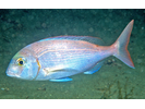
Red Snapper - Snapper
(Lutjanus campechanus)
(Lutjanus campechanus)
Red Squirrelfish - Squirrelfish
(Sargocentron hastatum)
(Sargocentron hastatum)
Redeye Mullet - Mullet
(Mugil rubrioculus)
(Mugil rubrioculus)
Resh Pikeblenny - Blenny - Pike, tube, and flag
(Chaenopsis resh)
(Chaenopsis resh)
Reticulate Moray - Moray
(Muraena retifera)
(Muraena retifera)
Rockcut Goby - Goby
(Gobiosoma grosvenori)
(Gobiosoma grosvenori)
Saddle Squirrelfish - Squirrelfish
(Sargocentron poco)
(Sargocentron poco)
Scaled Sardine - Silvery Fishes - Silversides, Herrings, and Anchovies
(Harengula jaguana)
(Harengula jaguana)
Scrawled Sole - Sole
(Trinectes inscriptus)
(Trinectes inscriptus)
Smoothhead Glass Blenny (pka Blackhead Blenny) - Blenny - Pike, tube, and flag
(Emblemariopsis bahamensis)
(Emblemariopsis bahamensis)
Southern Guitarfish - Guitarfish
(Rhinobatos percellens)
(Rhinobatos percellens)
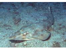
Southern Smoothhead Glass Blenny - Blenny - Pike, tube, and flag
(Emblemariopsis bottomei)
(Emblemariopsis bottomei)
Spikefin Glass Blenny (pka Caribbean Flagfin Glass Blenny) - Blenny - Pike, tube, and flag
(Emblemariopsis carib)
(Emblemariopsis carib)
Striped Burrfish - Porcupinefish
(Chilomycterus schoepfii)
(Chilomycterus schoepfii)
Surf Shy Blenny Complex - Blenny - Labrisomids
(Starksia smithvanizi complex)
(Starksia smithvanizi complex)
Unicorn Filefish - Filefish
(Aluterus monoceros)
(Aluterus monoceros)
Unidentified Mullet - Mullet
(Mugil sp.)
(Mugil sp.)
Whale Shark - Carpet Shark
(Rhincodon typus)
(Rhincodon typus)
Williams Blenny (Blackcheek Shy Blenny complex species) - Blenny - Labrisomids
(Starksia williamsi)
(Starksia williamsi)
Yellowfin Tuna - Mackerel
(Thunnus albacares)
(Thunnus albacares)