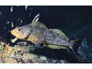
Kelp Greenling - Greenling (Hexagrammos decagrammus)
Seen in 40.09% of all REEF surveys in the PAC region.
Dates: 1/1/93 - 1/8/24
Region: PAC
Click a column header to sort by that column. Hold shift and click to sort by multiple columns
| Code | Name | N | Total | Expert | Novice | ||||||
|---|---|---|---|---|---|---|---|---|---|---|---|
| n | SF% | DEN | n | SF% | DEN | n | SF% | DEN | |||
| 1 | British Columbia | 8045 | 6491 | 80.14 | 2.31 | 3718 | 82.79 | 2.33 | 2773 | 75.98 | 2.28 |
| 11 | Queen Charlotte Strait | 991 | 901 | 90.7 | 2.67 | 524 | 93.96 | 2.68 | 377 | 86.02 | 2.65 |
| 111 | north of Cape Mudge - Chatham Point (Discovery Passage) | 203 | 180 | 88.17 | 2.99 | 123 | 93.89 | 3.07 | 57 | 74.55 | 2.76 |
| 1114 | Redonda Island incl. West and East Redonda Islands | 8 | 2 | 25 | 1.5 | 2 | 66.67 | 1.5 | 0 | 0 | 0 |
| 1116 | Quadra Island and Maurelle Island | 179 | 163 | 90.74 | 2.99 | 106 | 94.64 | 3.08 | 57 | 82 | 2.76 |
| 1117 | Sonora Island and Stuart Island | 2 | 2 | 100 | 2 | 2 | 100 | 2 | 0 | 0 | 0 |
| 1119 | North of Cape Mudge to Chatham Point - mainland | 13 | 13 | 100 | 3.46 | 13 | 100 | 3.46 | 0 | 0 | 0 |
| 112 | North of Chatham Point - Telegraph Cove (Johnstone Strait) | 62 | 57 | 91.8 | 2.64 | 39 | 95.12 | 2.56 | 18 | 85 | 2.82 |
| 1126 | Cracroft Island, East Cracroft Island, Minstrel Island | 1 | 1 | 100 | 2 | 1 | 100 | 2 | 0 | 0 | 0 |
| 113 | North of Telegraph Cove - Dillon Point | 65 | 61 | 93.22 | 2.53 | 39 | 94.74 | 2.42 | 22 | 90.48 | 2.74 |
| 1131 | Malcolm, Cormorant, Pearse Islands | 44 | 41 | 92.31 | 2.5 | 24 | 95.45 | 2.29 | 17 | 88.24 | 2.8 |
| 1132 | Swanson, Hanson and Stubbs Islands | 17 | 17 | 100 | 2.65 | 14 | 100 | 2.64 | 3 | 100 | 2.67 |
| 1134 | Lewis Point - Ledge Point (incl Port McNeill) | 4 | 3 | 66.67 | 2 | 1 | 50 | 2 | 2 | 100 | 2 |
| 114 | north of Dillon Point - Gorotisa Point | 642 | 586 | 91.23 | 2.59 | 319 | 93.71 | 2.57 | 267 | 88.15 | 2.61 |
| 1141 | Broughton Island and North Broughton Island | 1 | 1 | 100 | 3 | 1 | 100 | 3 | 0 | 0 | 0 |
| 1145 | Compton Point - Blunden Harbor | 1 | 1 | 100 | 2 | 1 | 100 | 2 | 0 | 0 | 0 |
| 1146 | north of Blunden Harbor - City Pt | 69 | 61 | 88.24 | 2.52 | 29 | 90.63 | 2.59 | 32 | 86.11 | 2.45 |
| 1147 | Bramham Island | 9 | 9 | 100 | 2.83 | 6 | 100 | 2.83 | 3 | 0 | 0 |
| 1148 | Seymour Inlet | 8 | 7 | 85.71 | 1.67 | 6 | 85.71 | 1.67 | 1 | 0 | 0 |
| 1149 | Nigei Island and Balaklava Island and Hurst Island | 526 | 481 | 91.3 | 2.61 | 268 | 93.91 | 2.58 | 213 | 88.11 | 2.66 |
| 115 | n.of Gorotisa Pt - Frederiksen Pt | 19 | 17 | 86.67 | 2.62 | 4 | 100 | 2.5 | 13 | 84.62 | 2.64 |
| 1151 | Shushartie Bay | 19 | 17 | 86.67 | 2.62 | 4 | 100 | 2.5 | 13 | 84.62 | 2.64 |
| 12 | WESTERN VANCOUVER ISLAND (Fredericksen Pt - Cape Beale) | 1279 | 1184 | 92.05 | 2.41 | 679 | 95.44 | 2.45 | 505 | 84.85 | 2.3 |
| 1205 | s. of Tatchu Pt. - Bajo Pt. (Nootka Isl) | 2 | 2 | 100 | 2.5 | 2 | 100 | 2.5 | 0 | 0 | 0 |
| 1206 | s. of Bajo Pt. - Estevan Pt. | 68 | 56 | 82.35 | 2.07 | 49 | 87.5 | 2.06 | 7 | 58.33 | 2.14 |
| 1209 | Ucluelet - Cape Beale | 1209 | 1126 | 92.72 | 2.43 | 628 | 96.12 | 2.48 | 498 | 85.85 | 2.3 |
| 13 | STRAIT OF GEORGIA | 5198 | 3892 | 74.31 | 2.19 | 2128 | 75.72 | 2.19 | 1764 | 72.32 | 2.19 |
| 131 | Upper Strait | 31 | 25 | 80.77 | 2.33 | 10 | 90.91 | 2.3 | 15 | 73.33 | 2.36 |
| 1311 | Hernando Island and Savary Island | 1 | 1 | 100 | 2 | 0 | 0 | 0 | 1 | 100 | 2 |
| 1312 | Cape Mudge - Cape Lazo | 4 | 3 | 100 | 2 | 2 | 100 | 2 | 1 | 100 | 2 |
| 1313 | Sarah Point - Greif Point | 20 | 16 | 76.47 | 2.46 | 4 | 100 | 2.5 | 12 | 69.23 | 2.44 |
| 1314 | Desolation Sound | 6 | 5 | 80 | 2.25 | 4 | 80 | 2.25 | 1 | 0 | 0 |
| 132 | S. Cape Lazo - Qualicum Beach | 785 | 633 | 80.67 | 2.32 | 287 | 94.41 | 2.54 | 346 | 71.82 | 2.14 |
| 1321 | Lasqueti Island | 8 | 6 | 33.33 | 2 | 1 | 50 | 2 | 5 | 0 | 0 |
| 1322 | Denman Island | 146 | 131 | 89.66 | 2.5 | 72 | 97.3 | 2.75 | 59 | 81.69 | 2.19 |
| 1323 | Hornby Island | 631 | 496 | 78.82 | 2.27 | 214 | 93.86 | 2.47 | 282 | 70.25 | 2.13 |
| 133 | S. Qualicum Beach - Nanaimo | 495 | 445 | 89.93 | 2.49 | 257 | 94 | 2.49 | 188 | 84.18 | 2.51 |
| 1332 | Blunden Point - Hammond Bay | 19 | 14 | 68.75 | 2.36 | 6 | 83.33 | 2.2 | 8 | 60 | 2.5 |
| 1334 | Wallis Point - Dorcas Point and islands | 207 | 201 | 96.77 | 2.46 | 135 | 98.48 | 2.43 | 66 | 92.59 | 2.54 |
| 1335 | Dorcas Point N - Madrona Point (Northwest Bay) | 159 | 156 | 98.41 | 2.78 | 82 | 100 | 2.81 | 74 | 96.61 | 2.75 |
| 134 | S. Nanaimo - Victoria | 2136 | 1440 | 67.34 | 2.04 | 1172 | 68.28 | 2.04 | 268 | 63.03 | 2.06 |
| 1341 | Gulf Islands | 473 | 394 | 82.48 | 2.28 | 264 | 84.08 | 2.25 | 130 | 78.83 | 2.38 |
| 1342 | S. Nanaimo - Coffin Point | 10 | 8 | 80 | 1.88 | 7 | 87.5 | 1.86 | 1 | 50 | 2 |
| 1343 | Ladysmith Harbor - Grave Point | 171 | 75 | 43.2 | 1.7 | 68 | 43.23 | 1.72 | 7 | 42.86 | 1.5 |
| 1344 | Sansum Narrows (incl Maple Bay) | 436 | 339 | 78.29 | 2.12 | 302 | 80.53 | 2.15 | 37 | 63.79 | 1.84 |
| 1346 | Saanich Inlet | 829 | 440 | 53.2 | 1.69 | 365 | 53.91 | 1.69 | 75 | 49.63 | 1.7 |
| 1347 | Moses Point - Cadboro Point | 216 | 184 | 85.19 | 2.36 | 166 | 89.25 | 2.39 | 18 | 60 | 2.11 |
| 135 | Malaspina Strait | 531 | 406 | 77.78 | 2.26 | 201 | 82.57 | 2.27 | 205 | 72.69 | 2.24 |
| 1351 | Texada Island | 5 | 5 | 100 | 2.67 | 2 | 100 | 3 | 3 | 100 | 2 |
| 1353 | Jervis Inlet | 38 | 37 | 96.67 | 2.24 | 15 | 100 | 2.13 | 22 | 93.33 | 2.36 |
| 1354 | Nelson Island (strait side) and Hardy Island | 2 | 2 | 0 | 0 | 0 | 0 | 0 | 2 | 0 | 0 |
| 1355 | Agamemnon Bay Area (Fearney Point - Francis Point) | 15 | 13 | 90.91 | 2.6 | 2 | 100 | 3 | 11 | 88.89 | 2.5 |
| 1356 | Agamemnon Channel (inc Captain Island) | 103 | 87 | 85 | 2.33 | 51 | 87.93 | 2.27 | 36 | 80.95 | 2.41 |
| 1359 | Sechelt Inlet - Gower Point | 367 | 262 | 73.37 | 2.22 | 131 | 78.66 | 2.26 | 131 | 67.92 | 2.16 |
| 136 | Howe Sound | 1220 | 943 | 75.59 | 2.17 | 201 | 78.54 | 2.16 | 742 | 74.53 | 2.17 |
| 1361 | Bowyer Island | 90 | 78 | 88.89 | 2.25 | 16 | 93.75 | 2.27 | 62 | 86.21 | 2.24 |
| 1362 | Gambier Island | 26 | 17 | 65.22 | 1.93 | 7 | 77.78 | 2.29 | 10 | 57.14 | 1.63 |
| 1363 | Bowen Island | 23 | 16 | 65 | 2.08 | 3 | 60 | 2 | 13 | 66.67 | 2.1 |
| 1364 | Anvil Island and nearby islands | 16 | 6 | 37.5 | 1.83 | 3 | 27.27 | 2 | 3 | 60 | 1.67 |
| 1365 | Pt Atkinson - Squamish | 1004 | 820 | 80.74 | 2.17 | 167 | 84.29 | 2.15 | 653 | 79.59 | 2.18 |
| 1367 | Keats Island | 1 | 1 | 100 | 2 | 0 | 0 | 0 | 1 | 100 | 2 |
| 1368 | Pasley Island (and associated Isls.) | 2 | 1 | 50 | 3 | 1 | 100 | 3 | 0 | 0 | 0 |
| 1369 | Burrard Inlet | 55 | 2 | 4.08 | 2.5 | 2 | 18.18 | 2.5 | 0 | 0 | 0 |
| 14 | STRAIT OF JUAN DE FUCA (VICTORIA - CAPE BEAL) | 556 | 503 | 91.45 | 2.41 | 385 | 94.36 | 2.44 | 118 | 82.31 | 2.32 |
| 1401 | West of Discovery Island and Cadboro Point - Albert Head (incl Victoria) | 471 | 424 | 90.97 | 2.36 | 335 | 93.84 | 2.39 | 89 | 80.41 | 2.24 |
| 1402 | West of Albert Head - Christopher Point | 50 | 46 | 93.88 | 2.7 | 25 | 100 | 2.84 | 21 | 87.5 | 2.52 |
| 1403 | West of Christopher Point - Possession Point | 34 | 32 | 94.12 | 2.66 | 25 | 96.15 | 2.72 | 7 | 87.5 | 2.43 |
| 1405 | Otter Point - San Juan Point | 1 | 1 | 100 | 3 | 0 | 0 | 0 | 1 | 100 | 3 |
| 19 | Chatham Sound & Browns Passage | 19 | 11 | 57.89 | 1.82 | 2 | 100 | 2 | 9 | 52.94 | 1.78 |
| 1906 | Kaien Isl (Prince Rupert) | 9 | 5 | 55.56 | 1.8 | 0 | 0 | 0 | 5 | 55.56 | 1.8 |
| 1907 | Digby Isl | 1 | 1 | 100 | 2 | 1 | 100 | 2 | 0 | 0 | 0 |
| 1909 | Chatham Sound proper | 4 | 1 | 25 | 2 | 0 | 0 | 0 | 1 | 25 | 2 |
| 1910 | Brown Passage proper | 4 | 3 | 75 | 1.67 | 0 | 0 | 0 | 3 | 75 | 1.67 |
| 1913 | Tugwell Island | 1 | 1 | 100 | 2 | 1 | 100 | 2 | 0 | 0 | 0 |
| 2 | Washington | 22447 | 8793 | 39.35 | 1.99 | 5764 | 43.05 | 2.03 | 3029 | 33.18 | 1.9 |
| 21 | BLAINE (US Border) - MT VERNON | 62 | 1 | 1.61 | 1 | 0 | 0 | 0 | 1 | 10 | 1 |
| 2111 | Chuckanut Bay | 14 | 1 | 7.14 | 1 | 0 | 0 | 0 | 1 | 25 | 1 |
| 22 | SAN JUAN ISLANDS | 2675 | 2071 | 76.91 | 2.07 | 1336 | 78.47 | 2.1 | 735 | 73.89 | 2.01 |
| 2210 | Orcas Island | 774 | 554 | 71.17 | 1.97 | 352 | 69.7 | 1.98 | 202 | 74.03 | 1.95 |
| 2211 | Shaw Island | 188 | 136 | 73.08 | 1.85 | 89 | 76.72 | 1.89 | 47 | 66.67 | 1.77 |
| 2212 | Lopez Island | 377 | 286 | 74.93 | 2.09 | 229 | 75.58 | 2.09 | 57 | 71.67 | 2.09 |
| 2213 | Blakely Island | 11 | 6 | 54.55 | 1.67 | 2 | 100 | 2 | 4 | 44.44 | 1.5 |
| 2214 | San Juan Island (including Henry) | 625 | 537 | 85.47 | 2.18 | 345 | 89.12 | 2.17 | 192 | 78.39 | 2.21 |
| 2215 | Stuart & Spieden Isls. (incl Jones and Flattop) | 123 | 100 | 81.82 | 2.01 | 75 | 83.33 | 2.03 | 25 | 77.42 | 1.96 |
| 2216 | Waldron Island | 29 | 26 | 88.46 | 2.17 | 11 | 84.62 | 2.09 | 15 | 92.31 | 2.25 |
| 2217 | Sinclair Island | 4 | 2 | 50 | 2 | 0 | 0 | 0 | 2 | 50 | 2 |
| 2219 | Cypress Island | 99 | 73 | 73.74 | 1.85 | 27 | 77.14 | 2.07 | 46 | 71.88 | 1.72 |
| 2220 | Guemes Island | 11 | 2 | 18.18 | 2 | 1 | 100 | 2 | 1 | 10 | 2 |
| 2221 | Fidalgo Island (including Allan and Burrows) | 355 | 287 | 80.18 | 2.24 | 166 | 80.88 | 2.38 | 121 | 79.1 | 2.02 |
| 2222 | Decatur | 49 | 45 | 91.84 | 2.02 | 25 | 92.59 | 2.08 | 20 | 90.91 | 1.95 |
| 2224 | Sucia and Matia Islands | 26 | 16 | 60 | 2.33 | 13 | 76.47 | 2.38 | 3 | 25 | 2 |
| 2225 | Patos Island | 2 | 1 | 50 | 3 | 1 | 100 | 3 | 0 | 0 | 0 |
| 23 | HOOD CANAL | 3539 | 534 | 15.13 | 1.51 | 345 | 16.48 | 1.49 | 189 | 13 | 1.56 |
| 2310 | Termination Point - Oak Head (Toandos Penninsula) | 14 | 5 | 33.33 | 1.67 | 3 | 33.33 | 1.67 | 2 | 0 | 0 |
| 2320 | Dabob Bay | 774 | 187 | 23.91 | 1.52 | 126 | 25.15 | 1.52 | 61 | 21.34 | 1.51 |
| 2330 | Quatsap Pt. and Misery Pt. - Potlatch State Park | 2633 | 334 | 12.89 | 1.5 | 215 | 14.17 | 1.47 | 119 | 11.01 | 1.56 |
| 2340 | Potlatch State Park - Lynch Cove (s. end of Canal) | 118 | 8 | 7.02 | 1.75 | 1 | 1.54 | 1 | 7 | 14.29 | 1.86 |
| 24 | MT VERNON-EVERETT | 2605 | 1210 | 46.63 | 2.15 | 617 | 47.03 | 2.18 | 593 | 46.21 | 2.11 |
| 2402 | Whidbey Island | 1816 | 1145 | 62.91 | 2.19 | 588 | 61 | 2.22 | 557 | 65.21 | 2.15 |
| 2404 | Port Susan and Possession Sound | 766 | 56 | 7.06 | 1.27 | 24 | 7.12 | 1.25 | 32 | 7.01 | 1.3 |
| 2405 | Minor and Smith Islands | 11 | 9 | 81.82 | 2.33 | 5 | 71.43 | 2 | 4 | 100 | 2.75 |
| 25 | EVERETT - SEATTLE | 1142 | 192 | 15.07 | 1.67 | 65 | 15.29 | 1.58 | 127 | 14.93 | 1.72 |
| 2510 | Edmonds | 1125 | 180 | 13.9 | 1.64 | 59 | 13.75 | 1.55 | 121 | 14 | 1.7 |
| 2511 | Edwards Pt. - Meadow Pt. | 17 | 12 | 75 | 1.92 | 6 | 85.71 | 1.83 | 6 | 66.67 | 2 |
| 26 | SEATTLE - OLYMPIA | 8755 | 2555 | 29.39 | 1.63 | 1661 | 32.18 | 1.62 | 894 | 24.92 | 1.64 |
| 261 | Seattle - Point Defiance | 7879 | 2444 | 31.26 | 1.64 | 1594 | 33.82 | 1.63 | 850 | 27 | 1.64 |
| 2611 | Bainbridge Island | 555 | 388 | 73.55 | 1.86 | 256 | 83.33 | 1.88 | 132 | 56.74 | 1.79 |
| 2612 | Vashon Island | 509 | 211 | 43.1 | 1.67 | 145 | 47.23 | 1.67 | 66 | 35.67 | 1.69 |
| 2613 | West Seattle Area | 2013 | 758 | 37.91 | 1.51 | 453 | 39.65 | 1.47 | 305 | 35.43 | 1.57 |
| 2614 | Burien - Tacoma Area | 4667 | 1054 | 22.79 | 1.64 | 718 | 24.75 | 1.64 | 336 | 19.22 | 1.65 |
| 2615 | King Co line (north) to S. Elliot Bay | 135 | 33 | 24.44 | 1.67 | 22 | 40 | 1.68 | 11 | 13.75 | 1.64 |
| 262 | Point Defiance - Olympia | 876 | 111 | 12.57 | 1.46 | 67 | 14.99 | 1.34 | 44 | 9.79 | 1.66 |
| 2621 | Pt. Defiance - Nisqually River | 868 | 111 | 12.7 | 1.46 | 67 | 15.16 | 1.34 | 44 | 9.87 | 1.66 |
| 27 | OLYMPIC PENINSULA | 2199 | 1829 | 82.93 | 2.5 | 1421 | 86.64 | 2.56 | 408 | 69.62 | 2.21 |
| 2701 | Hood Head - Dungeness Bay | 540 | 305 | 52.05 | 1.9 | 146 | 48.03 | 1.87 | 159 | 59.75 | 1.95 |
| 2702 | Dungeness Bay - Kydaka Point | 386 | 295 | 75.41 | 2.3 | 158 | 89.02 | 2.45 | 137 | 63.21 | 2.11 |
| 2703 | Kydaka Point - Cape Flattery | 1273 | 1229 | 96.69 | 2.66 | 1117 | 96.58 | 2.67 | 112 | 97.98 | 2.6 |
| 28 | KITSAP PENINSULA (EAST SIDE) AND SOUTH SOUND | 1370 | 306 | 22.54 | 1.64 | 228 | 24 | 1.64 | 78 | 18.9 | 1.64 |
| 2810 | Kitsap Peninsula (Port Gamble - Gig Harbor (includes Poulsbo and Bremerton)) | 992 | 284 | 28.76 | 1.65 | 213 | 30.04 | 1.65 | 71 | 25.29 | 1.64 |
| 2821 | Fox Island | 353 | 20 | 5.92 | 1.55 | 14 | 6.06 | 1.5 | 6 | 5.61 | 1.67 |
| 2831 | Case Inlet | 12 | 2 | 10 | 1 | 1 | 25 | 1 | 1 | 0 | 0 |
| 29 | CAPE FLATTERY - N COLUMBIA RIVER (Pacific Coast) | 100 | 95 | 95 | 2.62 | 91 | 95.79 | 2.63 | 4 | 80 | 2.5 |
| 2901 | Cape Flattery - Cape Alava | 99 | 94 | 94.95 | 2.63 | 90 | 95.74 | 2.63 | 4 | 80 | 2.5 |
| 2903 | Teahwhit Head - Copalis River (OCNMS boundary) | 1 | 1 | 100 | 2 | 1 | 100 | 2 | 0 | 0 | 0 |
| 3 | Oregon | 1419 | 1055 | 75.82 | 2.38 | 628 | 75.63 | 2.36 | 427 | 76.13 | 2.42 |
| 31 | S COLUMBIA RIVER - YAQUINA HEAD | 353 | 280 | 79.77 | 2.25 | 245 | 80.33 | 2.24 | 35 | 75 | 2.3 |
| 3103 | Manzanita - Tillamook Bay | 11 | 7 | 62.5 | 2.4 | 2 | 66.67 | 3 | 5 | 60 | 2 |
| 3104 | Cape Mears - Cape Lookout | 249 | 199 | 80.08 | 2.27 | 177 | 81.19 | 2.26 | 22 | 69.57 | 2.38 |
| 3105 | S. of Cape Lookout -Cascade Heads | 56 | 39 | 70.91 | 2.03 | 39 | 70.91 | 2.03 | 0 | 0 | 0 |
| 3106 | S. of Cascade Heads -Depoe Bay | 26 | 26 | 100 | 2.35 | 20 | 100 | 2.45 | 6 | 100 | 2 |
| 3107 | Cape Foulweather -Yaquina Head | 11 | 9 | 81.82 | 2.44 | 7 | 77.78 | 2.29 | 2 | 100 | 3 |
| 32 | SOUTH BEACH - NORTH BEND | 874 | 640 | 75.6 | 2.44 | 316 | 74.12 | 2.45 | 324 | 77.13 | 2.43 |
| 3201 | Newport - Waldport | 430 | 335 | 82.09 | 2.44 | 142 | 81.03 | 2.48 | 193 | 82.89 | 2.41 |
| 3202 | Waldport - Sea Lion Caves | 16 | 2 | 15.38 | 2 | 0 | 0 | 0 | 2 | 28.57 | 2 |
| 3203 | Sutton Creek - Reedsport | 255 | 178 | 70.28 | 2.4 | 101 | 73.19 | 2.41 | 77 | 66.67 | 2.39 |
| 3204 | Winchester Bay - North Bend | 173 | 125 | 72.67 | 2.51 | 73 | 68.22 | 2.47 | 52 | 80 | 2.58 |
| 33 | COOS BAY - CAPE BLANCO | 94 | 50 | 53.26 | 2.29 | 36 | 57.14 | 2.31 | 14 | 44.83 | 2.23 |
| 3301 | Empire - Bandon | 94 | 50 | 53.26 | 2.29 | 36 | 57.14 | 2.31 | 14 | 44.83 | 2.23 |
| 34 | ORFORD REEF - CALIFORNIA BORDER | 98 | 85 | 88.73 | 2.46 | 31 | 86.11 | 2.39 | 54 | 91.43 | 2.53 |
| 3401 | Orford Reef - Gold Beach | 96 | 84 | 89.86 | 2.48 | 30 | 85.71 | 2.43 | 54 | 94.12 | 2.53 |
| 3402 | Cape Sebastian - California Border | 2 | 1 | 50 | 1 | 1 | 100 | 1 | 0 | 0 | 0 |
| 4 | California | 15918 | 3082 | 11.99 | 1.62 | 1343 | 14.41 | 1.6 | 1739 | 10.17 | 1.64 |
| 41 | NORTHERN CALIFORNIA | 4713 | 2788 | 49.66 | 1.6 | 1283 | 61.18 | 1.61 | 1505 | 40 | 1.59 |
| 4101 | S Cape Ferrelo - Point St. George | 1 | 1 | 0 | 0 | 0 | 0 | 0 | 1 | 0 | 0 |
| 4104 | S Cape Mendicino - N Punta Gorda | 1 | 1 | 100 | 1 | 0 | 0 | 0 | 1 | 100 | 1 |
| 4107 | S Point Cabrillo - N Point Arena | 16 | 14 | 66.67 | 2 | 3 | 0 | 0 | 11 | 66.67 | 2 |
| 4108 | S Point Arena - Salmon Creek | 54 | 48 | 86.67 | 2.15 | 11 | 100 | 2 | 37 | 77.78 | 2.29 |
| 4111 | Farallon Islands | 8 | 8 | 0 | 0 | 6 | 0 | 0 | 2 | 0 | 0 |
| 4114 | S Davenport - Point Lobos Reserve | 4425 | 2616 | 50 | 1.59 | 1203 | 61.06 | 1.6 | 1413 | 40.57 | 1.58 |
| 4115 | S Point Lobos Reserve - N Point Sur | 131 | 83 | 60.81 | 1.67 | 48 | 63.83 | 1.67 | 35 | 55.56 | 1.67 |
| 4116 | S Point Sur - N Point Estero | 6 | 4 | 0 | 0 | 3 | 0 | 0 | 1 | 0 | 0 |
| 4117 | S Point Estero - N Point Buchon | 62 | 12 | 8.16 | 1.5 | 8 | 0 | 0 | 4 | 8.89 | 1.5 |
| 4119 | S Point Sal - N Point Conception | 3 | 1 | 50 | 1 | 1 | 50 | 1 | 0 | 0 | 0 |
| 42 | SOUTHERN CALIFORNIA | 11205 | 294 | 2.02 | 1.78 | 60 | 0.99 | 1.57 | 234 | 2.76 | 1.83 |
| 4201 | S Point Conception - N Point Heuneme | 385 | 33 | 2.13 | 1 | 25 | 3.45 | 1 | 8 | 0 | 0 |
| 4202 | Northern Channel Islands | 1915 | 91 | 3.7 | 2.05 | 12 | 3.77 | 2 | 79 | 3.65 | 2.1 |
| 4203 | Southern Channel Islands | 2069 | 39 | 2.63 | 1.93 | 3 | 0.68 | 1.67 | 36 | 4.02 | 1.96 |
| 4204 | S Port Hueneme - N Point Fermin (LA County) | 335 | 12 | 2.38 | 1.67 | 0 | 0 | 0 | 12 | 5.17 | 1.67 |
| 4205 | S Point Fermin - N Dana Point | 437 | 10 | 2.55 | 1.33 | 1 | 0 | 0 | 9 | 3.54 | 1.33 |
| 4206 | S Dana Point - N La Jolla | 4512 | 68 | 1.52 | 1.74 | 12 | 0.77 | 1.45 | 56 | 2 | 1.8 |
| 4207 | S La Jolla - Tijuana | 1552 | 41 | 2.08 | 1.71 | 7 | 0.85 | 1.17 | 34 | 3.45 | 1.86 |
| 5 | Alaska | 32 | 24 | 75 | 2.58 | 17 | 68 | 2.53 | 7 | 100 | 2.71 |
| 56 | Southeast Alaska (Yakutat Bay to Canadian Border) | 32 | 24 | 75 | 2.58 | 17 | 68 | 2.53 | 7 | 100 | 2.71 |
| 5601 | Yakutat Bay to Pt. Bishop (including Juneau) | 3 | 1 | 33.33 | 2 | 1 | 33.33 | 2 | 0 | 0 | 0 |
| 5602 | Chichagof Island | 3 | 3 | 100 | 2.33 | 3 | 100 | 2.33 | 0 | 0 | 0 |
| 5603 | Baranof Island inc. Sitka | 18 | 14 | 77.78 | 2.57 | 13 | 76.47 | 2.62 | 1 | 100 | 2 |
| 5609 | Revillagigedo and adjacent Islands (including Ketchikan) | 6 | 6 | 100 | 2.83 | 0 | 0 | 0 | 6 | 100 | 2.83 |